Maps of Great Basin

Vereinigte Staaten Von Nord-Amerika In 6 Blattern, Bl. 1.
1 : 3700000 Petermann, A.
[Die Vereinigten Staaten von Nord-Amerika, Blatt 1]
Handatlas über alle Theile der Erde und über das Weltgebäude Stieler, Adolf Justus Perthes
[Die Vereinigten Staaten von Amerika in 6 Blättern, Blatt 1]
Adolf Stieler's Handatlas über alle Theile der Erde und über das Weltgebäude Stieler, Adolf Justus Perthes
Western States road map.
1 : 1362240 Standard Oil Company of California
Map Of Oregon And Upper California.
1 : 3000000 Fremont, J.C.
Bancroft's Map Of The Pacific States.
1 : 1520640 Knight, W.H.
Soil Map of the United States, Section 4. Atlas of American Agriculture.
1 : 2500000 Marbut, Curtis F.
Oregon, Washington, California, Utah, and New Mexico.
1 : 7303000 Fisher, Richard Swainson
Map of Oregon, Washington and part of Idaho.
from New general atlas.
Map of the Gold Regions of California, Showing the Routes via Chagres and Panama, Cape Horn, &c.
Ensigns & Thayer
Rand - McNally Official Railway Map Of The Pacific Coast States Including Territory East To Denver
1 : 1393920 Rand McNally and Company
Commercial Map, Denver to Pacific Coast.
1 : 3950000 Rand McNally and Company
Sectional map indicating main automobile roads between Canada and United States
1 : 2534400 Kanada západní National Development Bureau
Oregon, and Washington Territory.
1 : 3000000 Colton, G.W.
Oregon and Washington Territory.
1 : 3000000 Colton, G.W.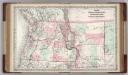
Oregon, Washington, Idaho, Montana, British Columbia.
1 : 3000000 Colton, G.W.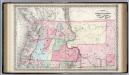
The State of Oregon and Washington Territory.
1 : 3000000 Colton, G.W.
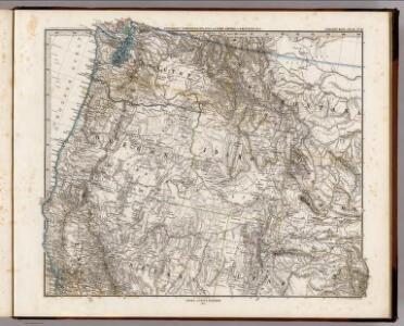
Map of an exploring expedition to the Rocky Mountains in the year 1842 and to Oregon & north California in the years 1843-44 / by Brevet Capt. J.C. Frémont of the Corps of Topographical Engineers under the orders of Col. J.J. Abert, Chief of the Topog...
From Parts
Road map Idaho, Mont., Wyo.
1 : 1774080 Texas Company
Montana, Wyoming, Colorado, Idaho, Utah, Nevada.
1 : 2246000 Rand McNally and Company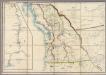
Map of the Oregon Territory
Wyld, James, 1812-1887
Californien, Oregon, Utah, Neu-Mejico.
1 : 5100000 Flemming, Carl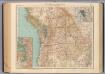
138-39. Wash., Ore., Ida.
1 : 3000000 Touring club italiano
Washington And Oregon.
1 : 3500000 Colton, G.W.
Washington and Oregon (and Idaho and Montana)
1 : 3500000 Colton, G.W.
U.S. West of Mississippi R. 1.
1 : 2000000 Freyhold, Edward; Warren, Gouverneur Kemble, 1830-1882; United States. Army. Corps of Engineers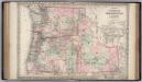
Oregon, Washington and Idaho.
1 : 2090880 Colton, G.W.
Map Of Oregon, Washington, And Part Of British Columbia.
1 : 4000000 Mitchell, Samuel Augustus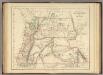
Territories Of Washington And Oregon.
1 : 3453120 Rogers, Henry Darwin