Maps of Europe

Composite: Ost-Europa, Norwegen, Schweden, Russland, Kaukasien, Turkei .
1 : 3700000 Petermann, A.
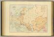
Europaeisches Russland auch Schweden u. Norwegen dabei Uebersicht des oesterreichischen u. preussischen Staats
1 : 10020000 Norsko Thiel, L. Justus Perthes

Russie d'Europe.
1 : 7800000 Lapie, M. (Pierre), 1779-1850
[Europaeisches Russland auch Schweden u. Norwegen, Dabei Uebersicht des Oesterreichischen u. Preussischen Staats]
Hand-Atlas über alle Theile der Erde nach dem neuesten Zustande und über das Weltgebäude Stieler, Adolf bei Justus Perthes
[Europaeisches Russland auch Schweden u. Norwegen]
Hand-Atlas über alle Theile der Erde nach dem neuesten Zustande und über das Weltgebäude Stieler, Adolf bei Justus Perthes
Russia cum confiniis. [Karte] Russiae Pars Amphicata [Nebenkarte], in: Atlas, sive, Cosmographicae meditationes de fabrica mundi et fabricati figura, S. 153.
1 Karte aus Atlas Mercator, Gerhard
Russia, Sweden, Norway.
1 : 15000000 Mitchell, Samuel Augustus
Russia, Sweden, Norway.
1 : 15000000 Mitchell, Samuel Augustus
Russia, Sweden, Norway.
1 : 15000000 Mitchell, Samuel Augustus Jr.
Russia, Sweden, Norway.
1 : 15000000 Mitchell, Samuel Augustus
Russia, Sweden, Norway.
1 : 15000000 Mitchell, Samuel Augustus
Russia In Europe, Sweden, And Norway.
1 : 15000000 Mitchell, Samuel Augustus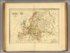
Europe.
1 : 102000000 Malte-Brun, Conrad, 1775-1826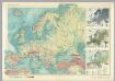
Europe - Physical. Pergamon World Atlas.
1 : 12500000 Polish Army Topography Service
Europe. Pergamon World Atlas.
1 : 25000000 Polish Army Topography Service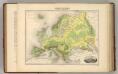
Europe. (Carte Hypsometrique).
1 : 14270000 Migeon, J.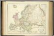
Europe.
1 : 10454400 Fullarton, A. & Co.
Europe.
1 : 14300000 Society for the Diffusion of Useful Knowledge (Great Britain)
(Europa, Asia, Africa, America)
Hubner, Johann, 1688-1731
Russland und Skandinavien
Hand-Atlas über alle Theile der Erde und über das Weltgebäude Stieler, Adolf Justus Perthes
Russland und Skandinavien
Adolf Stieler's Handatlas über alle Theile der Erde und über das Weltgebäude Stieler, Adolf Justus Perthes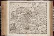
Novissima Russiæ tabula / authore Isaaco Massa
1 : 8500000 Annotatie: Rechtsboven genummerd: VI; Met opdracht van Hondius aan Isaac Bernart; Origineel is Blad 135 in atlas factice; Annotatie geografische gegevens: Met 2 schaalstokken Isaac Abrahamszoon Massa 1586-1643; Henricus Hondius 1573-1650 [Amsterdam, Londen : apud Janssonio-Waesbergios, et Mosem Pitt]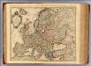
Carte d'Europe.
1 : 9000000 L'Isle, Guillaume de, 1675-1726
Volkerkarte von Russland.
1 : 13300000 Andree, Richard
Europe. Pergamon World Atlas.
1 : 25000000 Polish Army Topography Service
Russia cum confiniis. [Karte] Russiae Pars Amphlificata [Nebenkarte], in: Gerardi Mercatoris Atlas, sive, Cosmographicae meditationes de fabrica mundi et fabricati figura, S. 158.
1 Karte aus Atlas Mercator, Gerhard Montanus, Petrus
Europa.
1 : 19600000 Reichard, C. G.
Mapa slovanského světa