Maps of United States
North America (north)
1 : 5400000 Robert Laurie & James Whittle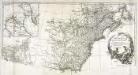
Amérique septentrionale, 2
2 Blätter : mehrfarbig ; 52 x 113 cm chez l'auteur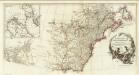
Amerique Septentrionale. (Northern section).
1 : 6300000 Anville, Jean Baptiste Bourguignon d, 1697-1782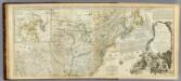
An Accurate Map Of North America. (Northern section)
1 : 5400000 Jefferys, Thomas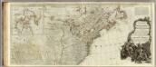
A new map of North America, with the West India Islands (northern section).
1 : 5300000 Pownall, Thomas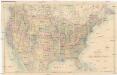
Stanford's General Map of the United States
1 : 5274720 Spojené státy americké Stanford, Edward Edward Stanford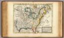
New map of ye north parts of America.
1 : 17300000 Moll, Herman, d. 1732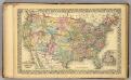
U.S., Canada.
1 : 10000000 Williams, W. (Wellington)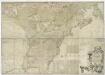
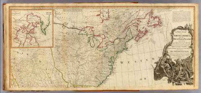
A map of the British and French dominions in North America, with the roads, distances, limits, and extent of the settlements, humbly inscribed to the Right Honourable the Earl of Halifax, and the other Right Honourable the Lords Commissioners for Trade & Plantations / by their Lordships most obliged and very humble servant, Jno. Mitchell; Tho. Kitchin, sculp.
from Parts John Mitchell; Thomas Kitchin,
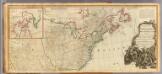
Carte generale des treize Etats Unis, de l'Amerique septentrionale
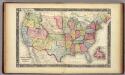
Map Of The United States, And Territories.
1 : 10137600 Mitchell, Samuel Augustus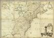
Amerique Septentrionale.
1 : 2000000 Mitchell, John
The United States of America / B. Tanner, sculpt.
from The American war, from 1775 to 1783, with plans / by Charles Smith.
The United States of America at the time of the ratification of the Constitution, from original maps in the American Geographical Society of New York
1 : 6860480 Map of the United States, with 4 maps of "Claims and cessions of western lands, 1776-1802." In upper margin: "The United States of America at the time of ratification of the Constitution, from original maps in the American Geographical Society of New York and the Library of Congress at Washington. Issued by the United States Sesquicentennial Commission". Include decorative title cartouche and historical notes. Relief shown by hachures. Prime meridian is Philadelphia. Series: "This map is one of a series of similar colored maps, depicting the 13 original states, from New Hampshire to Georgia at the time of the formati John, Mitchel, 1711-1768 Washington, D.C. : United States Constitution Sesquicentennial Commission, [Washington, D.C.] : U.S. Geological Survey
Ètats-Unis de l'Amérique septentrionale avec les Isles Royale, de Terre Neuve, de St. Jean, l'Acadie &c.
from Charts and maps Chez Delamarche, géogr.: Paris; Delamarche, Charles François,
Ètats-Unis de l'Amérique septentrionale avec les Isles Royale, de Terre Neuve, de St. Jean, l'Acadie &c.
from John H. Levine Collection Chez Delamarche, géogr.: Paris; Delamarche, Charles François,
The United States of America / W. Barker sculp., Philadelphia.
from Carey's American pocket atlas; containing nineteen maps... with a brief description of each state.
Map of the United States and Texas / engraved by C. Copley, New York.
from Whole
Etats-Unis de l'Amerique en 1855.
1 : 8300000 Garnier, F. A., 1803-1863
Map of the British and French Dominions in North America.
1 : 2000000 Mitchell, John
A map of the United States and Canada, New-Scotland, New-Brunswick and New-Foundland = Carte des Etats-Unis, avec le Canada, la Nouvelle Ecosse, le Nouveau Brunswick & Terre-Neuve
1 : 6500000 dressée par Lapie gravé par P. A. F. Tardieu ; écrit par J. J. Pachoux Paris [etc.] : P.A.F. Tardieu [etc.]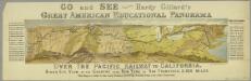
Go and see Hardy Gillard's great American educational panorama, Over the Pacific Railway to California : bird's eye view of the country from New York to San Francisco, 3,500 miles.
from Parts
U.S., Canada.
1 : 15600000 Huntington, Nathaniel G. (Nathaniel Gilbert), 1785-1848
United States of North America.
1 : 6350000 Faden, William, 1750?-1836
North America from the French of Mr. D'Anville.
1 : 6350000 Jefferys, Thomas

Vereinigte Staaten
1 : 10000000 Nové Skotsko Elfert, Paul Geogr. anstalt von Wagner & Debes
A Map of the frontier of British North America and the United States: describing the boundary line as fixed by the Treaty of 1783 which has never been respected by the American government ...
from Whole Printed for J.M. Richardson, Cornhill, by T. Davison, Whitefriars: [London],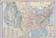
Shell Highway Map of United States.
1 : 7476480 Shell Oil Company