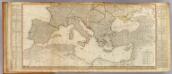
Maps of Mediterranean Sea
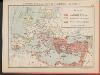
Europe (south)
1 : 4800000 Anville, Jean Baptiste Bourguignon d, 1697-1782; Kitchin, Thomas; Robert Laurie & James Whittle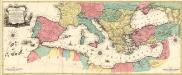
Carte Geographique representant la Mer Mediterranée ou la seconde Partie du Theatre de la Guerre entre les Russes et les Turcs
1 : 4400000 Mollova mapová sbírka Lotter, Tobias Conrad Lotter, Johann Jakob II.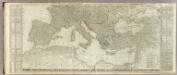
(Europe divided into its empires, kingdoms, states, republics, &c. Southern States)
1 : 4800000 Kitchin, Thomas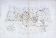
Carte des pays qu'occupe maintenant la mer Mediterranée
1 Karte : Kupferdruck ; 32 x 66 cm La Borde s.n.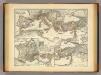
Mare internum cum populis adiacentibus a Pompeii ex Asia reditu usque ad bellum Actiacum.
1 : 12000000 Menke, Th.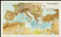
Mapa de la Conca Mediterrània: principals infrastructures de transport : regions europees riberenques de la Mediterrània
1 : 3500000 1 Mapa. Institut Cartogràfic de Catalunya ICC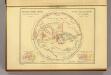
Geographie des Grecs Primitive.
Malte-Brun, Conrad, 1775-1826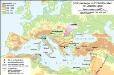
Südosteuropa im Frühmittelalter mit Jireček-Linie
Südosteuropa Sprachgeografie Zwick, J.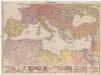
Mittelmeerländer
1 : 4000000 Afrika severní Georg Westermann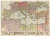
Mittelmeerländer
1 : 4000000 Afrika severní Georg Westermann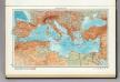
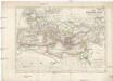
101. Mediterranean Sea. The World Atlas.
1 : 10000000 USSR (Union of Soviet Socialist Republics).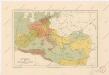
Evropa za stěhování národů
Das Römische Reich unter Traianus
starověký Řím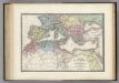
Nord de l'Afrique, Mediterranee.
1 : 9200000 Levasseur, E.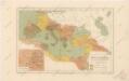
Říše římská ve své největší rozsáhlosti

[Das Mittellaendische und Schwarze Meer, Auch als General Karte des Osmanischen Reichs]
Hand-Atlas über alle Theile der Erde nach dem neuesten Zustande und über das Weltgebäude Stieler, Adolf bei Justus Perthes
Carte nouvelle de la mer Mediterranée : divisée en mer de Levant et de Ponant, subdivisés en leurs principales parties ou mers : avec les observations des Mrs. de l'Académie
1 : 4375000 Sanson, Nicolas, 1600-1667 chez Pierre Mortier
Tableau historique de Rome ancienne.
1 : 23700000 Duval, Henri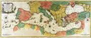
Carte geographique representant la mer Mediterranée ou la seconde partie du théatre de la guerre entre les Russes et les Turcs
1 Karte auf 3 Blättern : Kupferdruck ; 53 x 130 cm Lotter Tobias Konrad Lotter
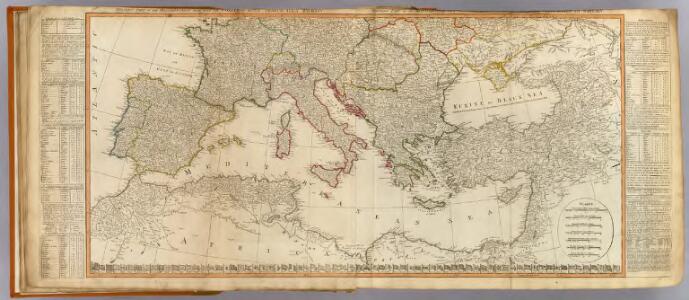
Théatre de la guerre actuelle, en Allemagne, en Pologne et en Turquie. Carte de l'Europe méridionale en 53 feuilles qui se réunissent. Tableau d'assemblage indiquant la disposition de ces feuilles, pour en faciliter la réunion
1 : 28500000 Chanlaire, Pierre Grégoire 1758-1817 Paris : chez l'auteur P. G. Chanlaire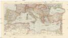
Karte der Länder des Mittelmeeres
1 : 5000000 Středozemní moře-oblast Freytag & Berndt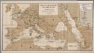
[Europa], uit: Routekaart van Nederland naar Ned. Indië en terug
1 : 8000000 Annotatie: Samengest. op uitnoodiging der Stoomvaart Maatschappij Nederland Groustra, J. Amsterdam : Seyffardt
Aelteste Geographie der Griechen, nach dem Homer und Hesiodus
Afrika severní
[Historisch-geographischer Atlas zu den allgemeinen Geschichtswerken von C. v. Rotteck, Pölitz u. Becker] : Die Küsten des Mittelländischen Meeres zur Uebersicht der ältesten Kolonisationen
von Julius Loewenberg [Freiburg im Breisgau] : [Herder]
Kriegszusammenhänge II (1672-1699)
1 : 25000000 Europa Englisch-Niederländischer Seekrieg <1672-1674>, Türkenkriege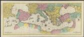
Carte géographique representant la Mer Méditerranée ou la seconde partie du Théatre de la guerre entre les russes et les turcs : c'est a dire les roiaumes, les étâts, les provinces et les diverses isles situées dans la dite Mer, avec la Mer Noire ou Pont Euxine et une partie de la province Georgie en Asia
1 : 4400000 par Tobie Conrad Lotter Augsbourg : Lotter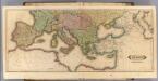
Europe (south)
1 : 6000000 Lizars, Daniel
Gemaelde des Roemischen Reichs in seiner grösten Ausdehnung
Historisch-genealogisch-geographischer Atlas von Le Sage Las Cases, Emmanuel Auguste Dieudonné Marius Joseph de Johann Velten, Kunsthändler
Das Römische Reich
Malá Asie