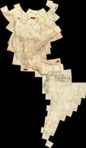
Maps of South America

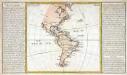
Composite: North and South America
1 : 1641836 Vandermaelen, Philippe, 1795-1869
America.
1 : 67000000 Radefeld, Carl Christian Franz, 1788-1874
America
1 : 29000000 Amerika Weiland, Karl Ferdinand Geographisches Institut
Nova Tabula Americae
Sandrart, Jakob von; Homann, Johann Baptist
America 1841 mit Benutzung der neuesten Vermessungen
1 : 37600000 Amerika Arrowsmith, David K. Geographischen Anstalt des Bibliographischen Instituts
Neueste Karte von America
Grosser Hand-Atlas über alle Theile der Erde in 170 Karten Meyer, J. Verlag des Bibliographischen Instituts
Mer des Indes.
1 : 70000000 Buache, Philippe, 1700-1773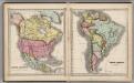
North America. South America.
1 : 27000000 Schonberg & Co.
Carte d'Amerique divisées en ses principales parties
1 Karte : Kupferdruck ; 47 x 57 cm L'Isle; Anville; Condet chez Cóvens & Mortier & Cóvens junior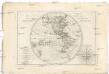
Mappe-monde sur le plan d'un méridien
Jižní Amerika André
America
1 : 27400000 Amerika Weiland, Karl Ferdinand Kratz, E. F. m Verlage des Geograph. Instituts
CHARTE von AMERICA
Amerika
Totius Americae Septentrionalis et Meridionalis novissima repraesentatio
Amerika Homann, Johann Baptist Iohannes Baptista Homann
Totius Americae Septentrionalis et Meridionalis novissima repraesentatio
Amerika Homann, Johann Baptist Iohannes Baptista Homann
Totius Americae Septentrionalis et Meridionalis novissima repraesentatio
Amerika Homann, Johann Baptist Iohannes Baptista Homann
Novissima et accuratissima totius Americae descriptio
Amerika Visscher, Nicolaus Witsen, Cornelius Jan per N. Visscher
America.
1 : 54000000 Melish, John
Západnj polokaule
Amerika Merklas, Václav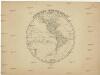
Západnj polokaule
Amerika Merklas, Václav
Západnj polokaule
Amerika Merklas, Václav
Západnj polokaule
Amerika Pluth Merklas, Václav
Carte physique de la mer des Indes
1 Karte : Kupferdruck ; 27 x 34 cm, Blattgrösse 46 x 60 cm Buache; Desbruslins Philippe Buache
AMERICAE Aucta DELINEATIO
Amerika
The World on Mercator's projection, western part.
1 : 40000000 Pinkerton, John, 1758-1826
Isles, caps et ports de mer de l'Amerique
1 Karte : Kupferdruck ; 30 x 33 cm, Blattgrösse 32 x 55 cm Clouet Mondhare
Recentissima novi orbis, sive Americæ septentrionalis et meridionalis tabula
1 Karte : Kupferdruck ; 48 x 57 cm Allard; Gouwen; Tideman ex officina Caroli Allard
Homannův atlas světa
1 : 11500000
W. Hemisphere.
1 : 100000000 Tanner, Henry S.