Maps of La Pampa
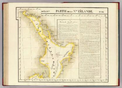
Partie, Nle. Zelande. Oceanque. no. 59.
1 : 1641836 Vandermaelen, Philippe, 1795-1869
New Zealand
1 : 1415000 Auckland (Nový Zéland) Bacon, George Washington G.W. Bacon
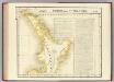
CARTE de l'Ille D'IKA NA MAUWI
Severní ostrov (Nový Zéland) Blosseville, Jules de Eyries, Jean-Baptiste Benoît J.B. Eyries
Victoria.
1 : 1900800 Stanford, Edward
Victoria Or Port Phillip.
1 : 2977920 Tallis, J. & F.
Gobernacion de La Pampa.
1 : 2470000 Paz Soldan, Mariano Felipe, 1821-1886
Afteekening van het incomen van Rio de La Plata met alle desselfs gronden en banken tot voor Boinos Airos
Argentina Gerard van Keulen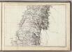
(Mapa de la Republica de Chile 6)
1 : 11000000 Pissis, Aime, 1812-1889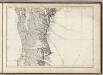
(Mapa de la Republica de Chile 7)
1 : 11000000 Pissis, Aime, 1812-1889
Departamento de tierras y colonizacion
1 : 1000000 (Chili) Servicio de Mensura y Clasificacion de Tierras Santiago du Chili : Taller del Servicio de Mensura y Clasificacion de Tierras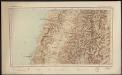
Republica de Chile [35°-37° S]
1 : 500000 (Chili) Oficina de Mensura de Tierras Santiago du Chili : Oficina de Mensura de Tierras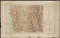
Republica de Chile [37°-39° S]
1 : 500000 (Chili) Oficina de Mensura de Tierras Santiago du Chili : Oficina de Mensura de Tierras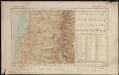
Republica de Chile [39°-41° S]
1 : 500000 (Chili) Oficina de Mensura de Tierras Santiago du Chili : Oficina de Mensura de Tierras
Demarcacion de limites con Chile. Plano general de la sub-comision n°3
1 : 500000 Argentine. Oficina de Límites Internacionales [Buenos Aires ?] :
Demarcacion de limites con Chile. Plano general de la sub-comision n°5
1 : 500000 Argentine. Oficina de Límites Internacionales [Buenos Aires ?] :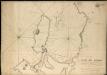
Plano del Puerto de la Concepcion de Chile, citu[a]da la Poblacion de Talcaguano en la latitud S. de 36o,42',28" y en longitud al O' de cadiz de 67o,2',53"
1 : 48000
Victoria.
1 : 2150000 Hughes, William
Topographical map of Hills district between Adelaide & the Bremer Ranges
1 : 130000 Surveyor General's Office
Ramon M. Castro
1 : 200000 Argentine. Dirección general de minas y geología [Buenos Aires] : Direccion general de minas, geologia e hidrologia
Adjie and portion of Welumla
Austrálie Geological survey of Victoria
Campo de Mayo
1 : 100000 (Argentine) Estado Mayor del Ejercito 3a Division [Buenos Aires] : Estado Mayor del Ejercito 3a Division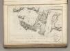
Plan of the Bay of Conception in Chili.
La Perouse, Jean-Francois de Galaup, comte de, 1741-1788
Binginwarri
Austrálie Geological survey of Victoria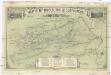
Map of M.t Kosciusko & surrounding districts
1 : 60000 Vernon, Walter Liberty David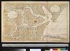
Nieuwe afteekening van de rivier van Baldivia is geleegen in de Zuijt Zee aen de kust van Chili
Chile Gerard van Keulen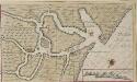
Afteekeningh en de opdoeninge van de rivier van Baldivia
Chile Gerard van Keulen
Maryvale
Austrálie Geological survey of Victoria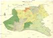
Waratah North
Austrálie Geological survey of Victoria
Tarwin South
Austrálie Geological survey of Victoria