Maps of Geraldton
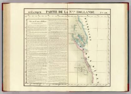
Partie, Nlle. Hollande. Oceanique no. 50.
1 : 1641836 Vandermaelen, Philippe, 1795-1869
Western Australia.
1 : 4088064 Stanford, Edward
Map of Western Australia, 1904
1 : 4680000 Západní Austrálie H.J. Petcher
West-Australien. Tasmania. Neu-Seeland. Der Isthmus Von Auckland.
1 : 5000000 Petermann, A.
Neu-Seeland
Adolf Stieler's Handatlas über alle Theile der Erde und über das Weltgebäude Stieler, Adolf Justus Perthes
[West-Australien, Tasmania früher genannt Van Diemen's Land, Neu-Seeland]
Hand-Atlas über alle Theile der Erde und über das Weltgebäude Stieler, Adolf Justus Perthes
Western Australia, Swan River.
1 : 2750000 Tallis, J. & F.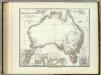
Austral-Continent.
1 : 10000000 Weiland, C. F. (Carl Ferdinand), d. 1847
Carte générale de l'Australie
Austrálie King
Australia with the British Settlements. (insets) Swan River. New South Wales. Van Diemans Land.
1 : 14600000 Lothian, John
Karte von Neu Holland
Austrálie Lindner, Friedrich Ludwig
Australie.
1 : 10000000 Vivien St Martin, L.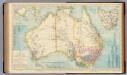
Australia.
1 : 8236800 Letts, Son & Co.
Das Austral-Continent oder Neu Holland : nach Krusenstern, King, Freycinet, Oxley, Sturt, Mitchell
1 : 10000000 in Mercators Projection entworfen von C. F. Weiland Weimar : Im Verlage des Geograph. Instituts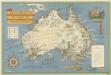
Australia

Karte vom Austral-Continent
1 : 6500000 Austrálie Handtke, Friedrich C. Flemming
Australia.
1 : 19900000 Higgins, W.M.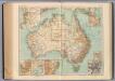
166-67. Australia.
1 : 10000000 Touring club italiano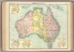
Australia - political.
1 : 10000000 John Bartholomew & Co.
A draught of the coast of NEW HOLLAND and parts Adjacent
from The sea-atlas : containing an hydrographical description of most of the sea-coasts of the known parts of the world.
Australia.
1 : 40000000 Fenner, Rest.
Das Austral-Continent, oder, Neu Holland
1 : 10000000 Austrálie Weiland, Karl Ferdinand Geographisches Institut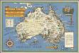
Australia: her natural and industrial resources
1 : 8944941 Gill, Leslie MacDonald, 1884-1947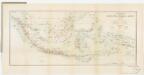
[Kaart], uit: Overzichtskaart van den Nederlandsch-Indischen Archipel / uitgave van de Afdeeling Handel van het Departement van Landbouw, Nijverheid en Handel
1 : 10000000 titelvariant: Nederlandsch-Indië; Annotatie: Omslagtitel: Nederlandsch-Indië; Annotatie geografische gegevens: Legenda Departement van Landbouw, Nijverheid en Handel, Buitenzorg. Afdeeling Handel Buitenzorg : Departement van Landbouw, Nijverheid en Handel / (Weltevreden (Batavia) : Reproductiebedrijf Topografische Dienst)
Australien
Handatlas über alle Theile der Erde und über das Weltgebäude Stieler, Adolf Justus Perthes
Australia and New Zealand.
1 : 16600000 Sharpe, J.
Uebersichts-Karte der ethnographischen Verhältnisse von Asien und von den angrenzenden Theilen Europa'sbearbeitet und herausgegeben mit Unterstützung der kaiserlichen Akademie der Wissenschaften in Wien von Vinzenz v. Haardt
Hartenthurn, Vincenz
Australia and East Indies.
1 : 15000000 Johnson, A.J.
Australia and East Indies.
1 : 15000000 Johnson, A.J.