Maps of Mariana Isands
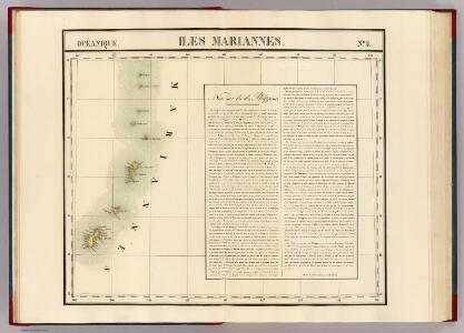
Iles Mariannes. Oceanique no. 5.
1 : 1641836 Vandermaelen, Philippe, 1795-1869
Commonwealth of the Northern Mariana Islands Sheet 3 of 3
1 : 25000
Island Of Tinian
1 : 25000
Island Of Tinian
1 : 25000
Island Of Saipan
1 : 25000
Island Of Saipan
1 : 25000
Island Of Saipan
1 : 25000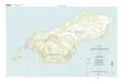
Island Of Rota (Luta)
1 : 25000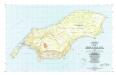
Island Of Rota (Luta)
1 : 25000
Inarajan
1 : 24000
Merizo
1 : 24000
Talofofo
1 : 24000
Agat
1 : 24000
Apra Harbor
1 : 24000
Hagatna
1 : 24000
Dededo
1 : 24000
Pati Point
1 : 24000
Ritidian Point
1 : 24000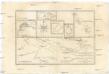
Carte des découvertes du capit. Carteret dans la N. Bretagne, avec une partie du passage du capit. Cook par le Détroit de l'Endéavour et les découvertes du capt. Dampierre dans ces parages
1 : 6360000 Celebes (Indonésie) Bonne, Rigobert André
Marianen, Carolinen en Marshall eilanden
1 : 20000000 Annotatie: Vrijgegeven door W.B.N. 29-3 '44 Den Haag : Kompas
[Die Niederlaendischen u. Spanischen Südsee Inseln]
[Allgemeiner Atlas über alle Theile der Erde in 29 Blättern] Ziegler, Jakob Melchior Top. Anstalt v. J. Wurster u. Comp.
Japanese aerodromes in Southwest Pacific Area, 20th November, 1944 / comp. by Allied Air Force SWPA
Allied Air Force SWPA [S.l.] : Allied Air Force SWPA
Malay Archipelago, Or East India Islands.
1 : 21500000 Tallis, J. & F.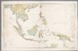
Nederlandsch-Indië en omgeving / Topografische Dienst
1 : 5000000 Topographische Dienst in Nederlandsch-Indië Batavia : Topografische Dienst
China Veteribus Sinarum Regio nunc Incolis Tame dicta. [Karte], in: Theatrum orbis terrarum, sive, Atlas novus, Bd. 2, S. 259.
1 Karte aus Atlas Blaeu, Joan Blaeu, Willem Janszoon

Suite de l'Ocean oriental contenant les isles de la Sonde les costes de Tunquin et de la Chine les isles du Japon les Philippines Moluques
1 : 7400000 Filipíny Bellin, Jacques-Nicolas
China Veteribus Sinarum Regio nunc Incolis Tame dicta. [Karte], in: Gerardi Mercatoris et I. Hondii Newer Atlas, oder, Grosses Weltbuch, Bd. 2, S. 356.
1 Karte aus Atlas Mercator, Gerhard und Hondius, Jodocus Jansson, Jan
Asie Orientale.
1 : 15000000 Garnier, F. A., 1803-1863