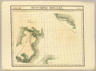
Maps of Melville Peninsula
Decouvertes Boreales. Amer. Sep. 9.
1 : 1641836 Vandermaelen, Philippe, 1795-1869
[142][145] Septemtrionaliora Americae à Groenlandia, ..., uit: Atlas sive Descriptio terrarum orbis
Annotatie: Gedigitaliseerde versie. Amsterdam. Heiloo : Picturae (vervaardiger), 2015. tiff-bestand. Gedigitaliseerd: 07-01-2015; Origineel: Universiteitsbibliotheek Vrije Universiteit (XL.05127.-) ; Netherlands; Titelpagina ontbreekt Wit, Frederik de Amsterdam : Frederick de Wit
The north west part of America / by Robt. Morden.; Geography rectified, or, A description of the world: in all its kingdoms, provinces, countries, islands, cities, towns, seas, rivers, bayes, capes, ports: their antient and present names, inhabitants, situations, histories, customs, governments, &c.: as also their commodities, coins, weights, and measures, compared with those at London: illustrated with above sixty new maps: the whole work performed according to the more accurate discoveries of modern authors / by Robert Morden.
from Geography rectified, or, A description of the world : in all its kingdoms, provinces, countries, islands, cities, towns, seas, rivers, bayes, capes, ports : their antient and present names, inhabitants, situations, histories, customs, governments, &c. : as also their commodities, coins, weights, and measures, compared with those at London : illustrated with above sixty new maps : the whole work performed according to the more accurate discoveries of modern authors / by Robert Morden. Morden, Robert; Cockerill, Thomas,
Carta delle Terre polari Artiche dalla Baja di Baffin all'Isola Baring
1 : 2800000 arktická oblast Miniscalchi-Erizzo, Francesco
Sir John Franklin's arctic discoveries, between Baffin Bay & Cape Bathurst
1 : 2900000 Arktida Arrowsmith, John John Arrowsmith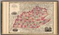
Kentucky And Tennessee.
1 : 1520640 Johnson, A.J.
Discoveries in the Arctic Sea between Baffin Bay & Melville Island
1 : 2600000 Arktida Arrowsmith, John John Arrowsmith
Road from Limestone to Frankfort in the state of Kentucky.
1 : 253440 Tardieu, P.F.
New York City.
1 : 36000 Bien, Joseph Rudolf
Cumberland Isle from the observations of Captain Penny
Cumberland Isle from the observations of Captain Penny, and from the ínformation of Enoolooapeck, an intelligent Esquimaux, 1839. [Admiralty Chart] [London]
Greenland, Labrador.
1 : 15000000 Peterson, Augusts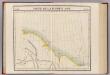
Partie, Russie d'Asie. Asie 11.
1 : 1641836 Vandermaelen, Philippe, 1795-1869
Septemtrionaliora Americæ à Groenlandia, per freta Davidis et Hudson, ad Terram Novam
1 Karte : Kupferdruck ; 48 x 55 cm Renard Louis Renard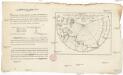
Vorstellung des Meers in Norden von Asien und America, nebst der Berechnung von dessen Grösse und Ausdehnung
Asie severní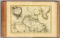
L'Amerique Septentrionale 1.
1 : 10050000 Bonne, Rigobert, 1727-1794
Carte marine, de la B. de Baffin, et une partie d'Hudson, d'Island et Groenland
1 Karte : Kupferdruck ; 42 x 48 cm Königliche Akademie der Wissenschaften
A General Chart ... Davis Straits & Baffin Islands Bay.
1 : 19000000 Melish, John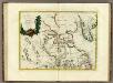
La Baja D'Hudson Terra di Labrador e Groenlandia.
1 : 9750000 Zatta, Antonio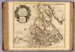
Canada, Nouvelle France.
1 : 9000000 L'Isle, Guillaume de, 1675-1726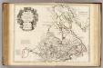
Canada, Nouvelle France.
1 : 9000000 L'Isle, Guillaume de, 1675-1726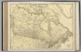
Canada.
1 : 8554000 Rand McNally and Company
Groenland und die angraenzenden Laender nach den Charten und Berichten von Cranz, Egede, Gieseke, Graah, Olavsen, Parry, Ross, Scoresby, Thorhallesen u.a.
1 : 5000000 entworfen und gezeichnet von Theodor Gliemann Weimar : Verlag des Geograph. Instituts
Partie orientale du Canada ou de la Nouvelle France : ou sont les provinces, ou pays de Sagvenay, Canada, Acadie etc., les peuples, ou nations des Etechemins, Iroquois, Attiquameches etc., auec la Nouvelle Angleterre, la Nouvelle Ecosse, la Nouvelle Yorc
from Charts and maps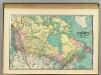
British America.
1 : 11500000 Rand McNally and Company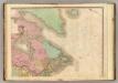
North America, N.E.. Sheet.
1 : 7600000 Tanner, Henry S.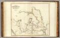
Arctic Regions.
1 : 19000000 Thomson, John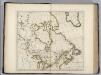
British Possessions in North America.
1 : 9100000 Carey, Mathew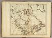
British Possessions in North America.
1 : 9000000 Carey, Mathew
British Possessions in North America.
1 : 6969600 Carey, Mathew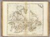
British Possessions in North America.
1 : 7603200 Carey, Mathew
British Possessions in North America.
1 : 7286400 Lewis, Samuel