Maps of Muchinga Mountains

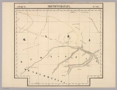
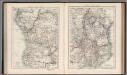
Mononomatapa. Afrique 46.
1 : 1641836 Vandermaelen, Philippe, 1795-1869
Podrobná mapa plavby Dr. Holuba po středním toku Zambesijském od zátoky Makubské až ku slapu Nambveskému v jižní zemi Barocké
1 : 185200 Zambezi J. Otta
Lusaka and environs, EAF 546
Lusaka and environs, EAF 546. Cadastral map. Great Britain. Army. East Africa Command. East African Survey Group. [Nairobi] : [Survey Directorate, East Africa Command]
Jesuit mission of northern Rhodesia
1 : 1500000 Zambie Dittrich, Reinhold
172. Central Africa Mining Region. The World Atlas.
1 : 2500000 USSR (Union of Soviet Socialist Republics).
Special Map of South-East Africa to Dr. David and Charles Livingstone's new mission travels
Central Africa (West). Central Africa (East).
1 : 10383000 W. & A.K. Johnston Limited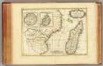
Afrique, cote orientale.
1 : 7000000 Bonne, Rigobert, 1727-1794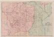
A map of Rhodesia divided into provinces and districts under the administration of the British South Africa Company
1 : 1000000 Edward Stanford Ltd Edward Stanford
Central Africa - eastern section.
1 : 5000000 John Bartholomew and Son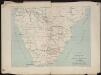
Itinéraire de Mr et Mme Coillard du Pays des Bassoutos au Zambèze
1 : 12100000 [Paris] : Société de géographie
Charte von Nieder Guinea und den angrenzenden ländern Sud Afrika's : nach den neuesten und besten Hülfsmitteln
1 : 6750000 Reinecke, J. C. M. (Johann Christoph Matthias), 1770-1818 Im Verlage des Industrie Comptoirs
La Basse Guinée, contenant les royaumes de Loango, de Congo, d'Angola et de Benguela, avec la Cafrérie occidentale et la méridionale, ou le pays des Hotentots
1 : 9600000 Angola Bonne, Rigobert André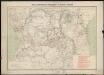
Carte des missions catholiques du centre africain
1 : 4000000 Vuillot, Paul 18..-19.. [Lyon : Oeuvre de la propagation de la foi]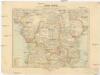
Inner-Afrika
Afrika střední Riemer, C. Geographisches Institut
Die Ostküste Süd-Africa's nebst der Insel Madagascar, den Comoren, Sechellen, Amiranten und Mascarenischen Inseln
1 : 5480000 entworfen von C.F. Weiland gestochen von Mädel med. Weimar : Geographisches Institut
Mozambique. Afrique 47.
1 : 1641836 Vandermaelen, Philippe, 1795-1869
Mapa Afriky střední
1 : 12500000 Afrika střední
Spezial - karte von AfricaSektion Seengebiet (8)
1 : 4000000 1 full d'1 mapa en 10 fulls i estoig Hermann Habenicht; Justus Perthes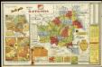
Etat du Katanga

Übersichtskarte von Ost-Central-Afrika

Fletcher & Espin's map of Matabeleland
1 : 506880 Fletcher & Espin E. Stanford
Map of Portuguese East Africa
1 : 3000000 Afrika východní Mining and Industrial Publications of Africa
Spezial-Karte von Afrika
1 : 4000000 Blatt 8 Habenicht, Hermann Perthes
Přehledná mapa k dílu "Sedm let v Jižní Africe" od Dra. Em. Holuba
1 : 7200000 Afrika jižní Holub, Emil J. Otta
Deutsch-Ostafrika
1 : 2000000 Afrika východní Moisel, Max Dietrich Reimer
Paris Evangelical Missionary Society. Zambesi Mission.

Podrobná mapa cest D.ra Holuba (čís. 1.) po střední části země východních Bamankvatův a západních Matabelův
1 : 500000 Botswana Holub, Emil nákladem J. Otty
Versuch einer geologischen Karte des Njassagebietes
1 : 1000000 Annotatie: Bijlage (Krt. 1) bij: Mitteilungen aus den deutschen Schutzgebieten, Erganzungheft Nr. 10 (1914) Berlin : Mittler