Maps of West Bahr-al-Ghazal

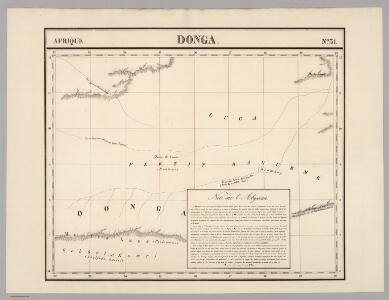
Donga. Afrique 31.
1 : 1641836 Vandermaelen, Philippe, 1795-1869
Anglo-Egyptian Sudan 1:250,000, Lake Keilak
Anglo-Egyptian Sudan / compiled and zincograhed at the Survey Office Khartoum. Sudan. Maṣlaḥat al-Misāḥah. Khartoum : Survey Office
Sudan [Anglo-Egyptian] 1:250,000, Lake No
Anglo-Egyptian Sudan / Survey Office. Sudan. Maṣlaḥat al-Misāḥah. [Southampton] : For D. Survey (WO & AM) by Ordnance Survey
Sudan. Maṣlaḥat al-Misāḥah (1955)
[Sudan]. Sudan. Maṣlaḥat al-Misāḥah. Khartoum : Sudan Survey Department
Southern Sudan (1951) Distribution of Population During Wet Season
Southern Sudan. Distribution of population during wet season. Corrected Nov. 1951. Topo. No. S. 918. Khartoum : Sudan Survey Dept.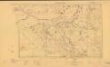
Sudan. Maṣlaḥat al-Misāḥah (1954)
Tribes [Sudan]. Sudan. Maṣlaḥat al-Misāḥah. Khartoum : Sudan Survey Department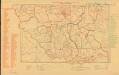
Parliamentary constituencies ― 1957 [Sudan]
Parliamentary constituencies ― 1957 [Sudan]. Sudan. Maṣlaḥat al-Misāḥah. Khartoum : Sudan Survey Department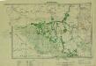
Southern Sudan (1951) Seasonal Cattle Movements
Southern Sudan. Seasonal cattle movements. Corrected Nov. 1951. Topo. No. S919. Khartoum : Sudan Survey Dept.
Soudan égyptien & Abyssinie d'après divers documents
1 : 4000000 Amend, H Genève : imp. Noverraz & fils
Map of the egyptian Sudan
1 : 2253080 Súdán Intelligence branch, War Office
The Anglo-Egyptian Sudan
1 : 3000000 Súdán Ordnance survey office
The Anglo-Egyptian Sudan
1 : 3000000 Súdán War Office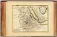
Nubie, Abissinie.
1 : 7000000 Bonne, Rigobert, 1727-1794
Afrique Orientale.
1 : 7000000 Montemont, A.
Composite: NO Afrika.
1 : 5450000 Flemming, Carl
Nillander.
1 : 5000000 Weiland, C. F. (Carl Ferdinand), d. 1847
Das nordoestliche Africa oder Aegypten, Nubien, Habesch, Kordofan und Dar-Fur
1 : 5000000 Alexandrie (Egypt) Weiland, Karl Ferdinand Jungmann, C. im Verlage des geograph. Instituts
Egypt et Abyssinie.
1 : 8560000 Migeon, J.
Das Nordoestliche Africa oder Aegypten, Nubien, Habesch, Kordofan und Darfur
1 : 5160000 entw. von C. F. Weiland C. Metzeroth sc. Weimar : Verlag des Geographischen Instituts
Nubia, Abyssinia.
1 : 5100000 Hall, S. (Sidney)
Phyto-geographische Karte des Nilgebietes und der Uferländer des Rothen Meeres
1 : 10000000 Nil (řeka : oblast) Schweinfurth, Georg Justus Perthes
Spezial - karte von AfricaSektion Abessinien (6)
1 : 4000000 1 full d'1 mapa en 10 fulls i estoig Hermann Habenicht; Justus Perthes
A map of Rhodesia divided into provinces and districts under the administration of the British South Africa Company
1 : 1000000 Edward Stanford Ltd Edward Stanford
Countries In The Northern Tropical Regions of Africa.
Fullarton, A. & Co.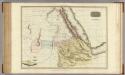
Abyssinia, Nubia &c.
1 : 4000000 Pinkerton, John, 1758-1826
Cours du Nil.
1 : 5900000 Andriveau-Goujon, J.
Abessinien - Somaliländer
1 : 7500000 Etiopie Barich, Carl Justus Perthes
Sudan and Ethiopia, Plate 87, V. IV
1 : 5000000 Bartholomew, John
Evangelische Mission im Kwango, Rep ZaireUebersichtsplan der Gemeinden und Aussenposten im Bezug zur Siedlungsdichte