Maps of Tamil Nadu
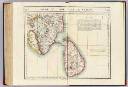
Partie, l'Inde et Ceylan. Asie 108.
1 : 1641836 Vandermaelen, Philippe, 1795-1869
India I and Ceylon. Published under the Superintendence of the Society for the Diffusion of Useful Knowledge.

Tabula Asiae XII. [Karte], in: Geographia universalis vetus et nova complectens Claudii Ptolemaei Alexandrini enarrationis libros VIII, S. 299.
1 Karte aus Atlas Münster, Sebastian [und Ptolemaeus, Claudius]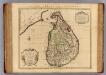
l'Isle de Ceylan.
1 : 1250000 L'Isle, Guillaume de, 1675-1726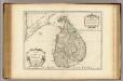
l'Isle de Ceylan.
1 : 1250000 L'Isle, Guillaume de, 1675-1726
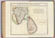
India 1.
1 : 2217600 Letts, Son & Co.
India I and Ceylon.
1 : 2200000 Society for the Diffusion of Useful Knowledge (Great Britain)
Tabula Asiae XII. [Karte], in: Claud. Ptolemaeus. Geographia lat. cum mappis [...], S. 329.
1 Karte aus Atlas Münster, Sebastian [und Ptolemaeus, Claudius]
Het eiland Ceilon : volgens de nieuwste waarneminge opgesteld
1 : 5000000 Te Amsterdam : bij de Wed. van Esveldt en Holtrop
Insula Ceilon et Madura
1 : 1000000 exactissime delineata et nuperrime edita per R. & J. Ottens [Amsterdam] : [Ottens]
Insula Ceilan : olim frapobana nunc incolis tenarisin / Joan van Essen
1 : 1000000 Annotatie: Met opgeplakte cartouche en windroos; Annotatie geografische gegevens: Oost boven Essen, J. F. van [Antwerpen : Joan van Essen]
Insula Ceilon et Madura
1 : 930000 Cejlon Ram, Johannes de apud Ioannem de Ram
't Eylandt Ceylon, Voordesen Taprobana, Byde Inwoonders genaemt Lankawn. [Karte], in: De Nieuwe Groote Vermeerderde Zee-Atlas ofte Water-Werelt, S. 57.
1 Karte aus Atlas Doncker, Hendrick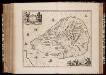
Insvla Zeilan, olim Taprobana, nunc incolis Tenarisim
1 : 1000000 Annotatie: Zeekaart; Met toel. op krt. in het Portugees of Nederlands; Origineel is Blad 189 in atlas factice; Annotatie geografische gegevens: Schaalstokken op kaart: 6 Milliaria Germanica communia (=4,2 cm), en: 7 Milliaria Hispanica communia (=4,2 cm); Oost boven Johannes Janssonius 1588-1664 [Amstelodami] : [Apud Ioannem Ianssonium]
Insula Zeilan, olim Taprobana, nunc incolis Tenarisim. [Karte], in: Het vijfde Deel Des Grooten Atlas : Vervatende De Water-Weereld, S. 89.
1 Karte aus Atlas Jansson, Jan Jansson, Jan
Insula Zeilan, olim Taprobana nunc incolis Tenarisim. [Karte], in: Novus atlas absolutissimus, Bd. 9, S. 112.
1 Karte aus Atlas Janssonius Offizin
Ceylon olim Taprobana incolis Tenarisin et Lekawn dicta maxima et simul ditissima Maris Indici insula
1 : 900000 accuratissime aeri incisa et excusa cura et sumtibus Tobiae Conradi Lotteri chalc. et geographi Augustano [Augusta Videlicorum] : Tobias Conrad Lotter
Ceylon.
1 : 696960 Stanford, Edward
Ceylon

Map of the island of Ceylon
1 : 506880 Srí Lanka Surveyor general's office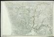
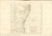
[Indian Atlas] Sheet 62

Ceylon.
1 : 1647360 Tallis, J. & F.
Map of the island of Ceylon
1 : 760000 Srí Lanka A.M. & J. Ferguson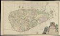
Caart van het Eyland Ceylon
1 : 550000 rondsom gemeeten op ordre van Ryhlof van Goens, en nu tot algemeenen dienst door David Mill, overgegeven, en in't ligt gebragt door Joannes Van Keulen Amsterdam : Van Keulen
Ins. Ceilan quae incolis Tenarisin dicitur [Karte], in: Gerardi Mercatoris Atlas, sive, Cosmographicae meditationes de fabrica mundi et fabricati figura, S. 544.
1 Karte aus Atlas Mercator, Gerhard Montanus, Petrus
Ceylon

Ceylon olim Taprobana incolis Tenarisin et Lekawn dicta maxima et simul ditissima Maris Indici insula
1 : 880000 Cejlon Lotter, Tobias Conrad sumtibus Tobiae Conradi Lotteri
Ceylon olim Taprobana incolis Tenarisin et Lekawn dicta maxima et simul ditissima Maris Indici insula
1 : 865000 Indický oceán Seutter, Matthäus sumtibus Matthaei Seutteri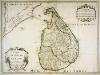
Carte de l'isle de Ceylan
1 Karte : Kupferdruck ; 41 x 55 cm L'Isle; Berey chez l'auteur sur le quay de l'Horloge