Maps of Chhattisgarh
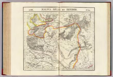
Malwa, Berar et Beeder. Asie 94.
1 : 1641836 Vandermaelen, Philippe, 1795-1869
Pachmari Sanitarium
1 : 15500 Indie Surveyor general's office
Nos. 8-10. Palamow Fort, Agowry Fort, Ancient Hindoo Temples at Marra in Singrowla. From a series of plans of forts and passes on the W. border of Bihar, copied from the original by Lieut Robert Smith
Pen-and-ink and water-colour plans of the forts at Agori and Palamau and of Hindu Temples at Marra after Robert Smith (1787-1873), c.1813. This is one of six plans of forts and passes on the west border of Bihar. Inscribed on the front of the folder in ink is: 'Plans of Forts & Passes on the South West Frontier of Bengal. Copied from the Original by Lieut. Robt. Smith of the Engineers.' There are two large forts at Palamau said to have been built by the Adivasi kings of the Chero dynasty. Construction of the forts was begun by Raja Medhni Raj, the ruler of Chotanagpur, however they were completed by his son Pratap Raj while Medhni Raj was engaged with repelling invaders. The main fort has three main defences, the largest of which is named Singh Dwar or Lion Gate. The Nagpuri Gate bears two inscriptions in Sanskrit and Persian. Smith, Robert (1787-1873), Artist
Central division of Hindoostan
1 : 7000000 Cary, John, ca. 1754-1835 J. Cary
Central India.
1 : 3380000 Sharpe, J.
India 7.
1 : 2217600 Letts, Son & Co.
India VII.
1 : 2200000 Society for the Diffusion of Useful Knowledge (Great Britain)
India 4.
1 : 2217600 Letts, Son & Co.
India IV.
1 : 2200000 Society for the Diffusion of Useful Knowledge (Great Britain)
India 6.
1 : 2217600 Letts, Son & Co.
India VI.
1 : 2200000 Society for the Diffusion of Useful Knowledge (Great Britain)
Gold, copper and lead in Chota Nagpore
This is the map contained within the 176-page volume Gold, copper and lead in Chota Nagpore and the adjacent country, compiled by W. King and T.A. Pope and published in Calcutta. King, W., F.G.S. (William) Calcutta : Thacker, Spink
Map of the East Indian Railway

India - southern section.
1 : 4000000 John Bartholomew & Co.
140-141. South India, Ceylon, Burma. The World Atlas.
1 : 5000000 USSR (Union of Soviet Socialist Republics).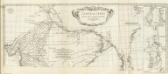
Carte de l'Inde. (Northern section).
1 : 3100000 Anville, Jean Baptiste Bourguignon d, 1697-1782
Northern India Including The Presidency of Calcutta.
1 : 9000000 Tallis, J. & F.
Southern India Including The Presidencies Of Bombay & Madras.
1 : 9000000 Tallis, J. & F.
Inde Medionale.
1 : 5000000 Vivien St Martin, L.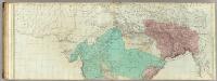
The East Indies, with the roads (northern section).
1 : 2600000 Jefferys, Thomas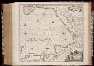
Sinus Gangeticus; vulgo Golfo de Bengala nova descriptio
1 : 4500000 Annotatie: Zeekaart; Kaart uitg. in de periode vanaf ca. 1650 tot ca. 1680; Origineel is Blad 190 in atlas factice; Annotatie geografische gegevens: Schaalstokken op de kaart: 45 Milliaria Germanica communia (=7,5 cm), en: 60 Milliaria Gallica communia (=7,5 cm); Westen boven Johannes Janssonius 1588-1664 [Amstelodami] : [Apud Ioannem Ianssonium]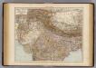
India North.
1 : 6000000 Andree, Richard; Times (London, England)
Sinus Gangeticus; Vulgo Golfo De Bengala Nova descriptio. [Karte], in: Het vijfde Deel Des Grooten Atlas : Vervatende De Water-Weereld, S. 92.
1 Karte aus Atlas Jansson, Jan Jansson, Jan
General Karte von VORDERINDIEN
1 : 4000000 Indie Berghaus, Heinrich Karl Wilhelm Rennell, James Justus Perthes
Imperia antiqua
1 : 13530000 Indie Bonne, Rigobert André
Charte von Ost Indien
Indie Sotzmann, Daniel Friedrich Rennell, James Haude u. Spener
Carte de l'Indostan servant à indiquer les possessions françaises en Asie
1 : 10000000 par A.M. Perrot gravé par les frères Malo Paris : Duprat-Duverger
[Indien]
Bangladéš
Vorderindien.
1 : 8700000 Flemming, Carl