Maps of Urup
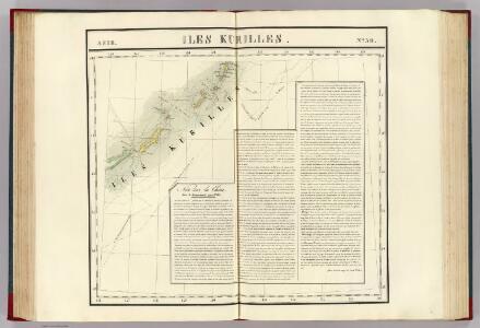
Iles Kurilles. Asie 50.
1 : 1641836 Vandermaelen, Philippe, 1795-1869
Plan of the Kurile Islands.
La Perouse, Jean-Francois de Galaup, comte de, 1741-1788
45. Kuril Islands. The World Atlas.
1 : 3000000 USSR (Union of Soviet Socialist Republics).
Iles Kuriles, Aleutiennes.
1 : 1900000 La Perouse, Jean-Francois de Galaup, comte de, 1741-1788
Chart of Discoveries, Made in 1787, in the Seas of China and Tartary, Sheet II.
1 : 6050000 La Perouse, Jean-Francois de Galaup, comte de, 1741-1788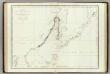
Mers, Chine, Tartarie. 2.
1 : 6250000 La Perouse, Jean-Francois de Galaup, comte de, 1741-1788
Ice Chart, Okhotsk Sea Region, August.
U.S. Navy
Ice Chart, Okhotsk Sea Region, June.
U.S. Navy
Ice Chart, Okhotsk Sea Region, March.
U.S. Navy
Ice Chart, Okhotsk Sea Region, January.
U.S. Navy
Ice Chart, Okhotsk Sea Region, November.
U.S. Navy
Ice Chart, Okhotsk Sea Region, April
U.S. Navy
Ice Chart, Okhotsk Sea Region, October.
U.S. Navy
Ice Chart, Okhotsk Sea Region, February.
U.S. Navy
Ice Chart, Okhotsk Sea Region, December.
U.S. Navy
Ice Chart, Okhotsk Sea Region, May.
U.S. Navy
Karte von Jesso und Sagalien
Hokkaidó (Japonsko)
Map of the Japan Islands
1 : 7000000 Maury, William L J. Ackerman
[Kaart], uit: Ezo kōkyō yochi zenzu
1 : 1200000 Edo : Harimaya Katsugorō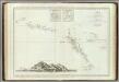
Decouvertes nord du Japon.
1 : 2800000 Vries, Maarten Gerritszoon
Ice Chart, Okhotsk Sea Region, July.
U.S. Navy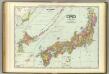
Japan.
1 : 2600000 Rand McNally and Company
Discoveries made in 1787 In the Seas of China and Tartary between Manilla and Avateha.
1 : 12850000 La Perouse, Jean-Francois de Galaup, comte de, 1741-1788
Mers, Chine, Tartarie.
1 : 11400000 La Perouse, Jean-Francois de Galaup, comte de, 1741-1788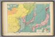
Chinese, Japanese ports.
1 : 10000000 Philip, George
Teatr voennych dějstvīj v 1904 - 1905 godach
China Russisch-Japanischer Krieg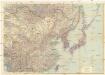
Ostasien
1 : 5000000 Asie východní Justus Perthes
[Východní Asie].
Asie východní Berghaus, Heinrich Karl Wilhelm Horsburgh, James