Maps of Aleutian Islands
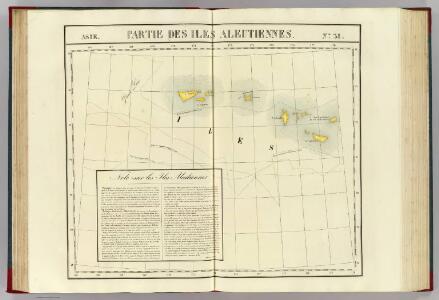
Partie, Iles Aleutiennes. Asie 38.
1 : 1641836 Vandermaelen, Philippe, 1795-1869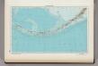
184. Aleutian Islands. The World Atlas.
1 : 5000000 USSR (Union of Soviet Socialist Republics).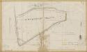
Vereenigde Grote en Kleine Vettenoordsche-, West- en Oosten Zevenmanspolders, gemeente Vlaardinger-Ambacht en Vlaardingen.

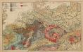
Kleine geologische Karte von Deutschland / bearb. von W. Schriel ; hrsg. von der Preussischen Geologischen Landesanstalt
1 : 2000000 Annotatie: Bijbehorend materiaal (Erläuterungen. - Ibid., 1930. - 28 p. : ill. ; 21 cm + krt) apart opgeborgen in legendakast Schriel, Walter; Preussische Geologische Landesanstalt Berlin : Preussische Geologische Landesanstalt
Germaniae Antiqvae Popvli
1 : 10750000 Mollova mapová sbírka Clüver, Philipp Fuhrmann, Mathias
Carte routiere, historique et statistique des états de l'ancienne Pologne indiquantses limites avant sen premiér démembrement er 1772 et son état actuel depuis son dernier partage en 1815
1 : 2970000 Polsko Dufour, A. H. Chodzko, Leonard chez Ch.les Simonneau
Polen im Herzogthum Warschau und unter Oestreich und Russland getheilt
1 : 2050000 Prusko Müller, Franz T. Mollo
Polen im Herzogthum Warschau und unter Oestreich und Russland getheilt
1 : 2050000 Prusko Müller, Franz Rizzi Zannoni, Giovanni Antonio T. Mollo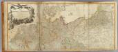
Germany (north)
1 : 1250000 Robert Laurie & James Whittle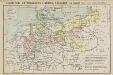
Geschichtl. Entwicklung d. Königr. Preussen vom Frieden von Tilsit (1807) bis jetzt
Deutschland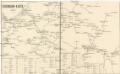
Eisenbahn-Karte
Evropa střední
Eger 102, uit: Special-Karte von Mittel-Europa / nach amtlichen Quellen bearbeitet von W. Liebenow
1 : 300000 titelvariant: W. Liebenow's Mittel-Europa; Annotatie: Titel boven de bladen: W. Liebenow's Mittel-Europa Johannes Wilhelm Liebenow 1822-1897 Frankfurt a. M. : Ludwig Ravenstein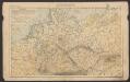
Deutsches Reich
Volksschul-Atlas über alle Teile der Erde Lange, Henry Druck und Verlag von Georg Westermann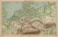
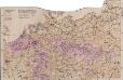
Mitteleuropa. Bodengestalt
1 : 4000000 Mitteleuropa Physische Geografie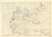
Karte der deutschen Wasser Wasserstrassen

Geschäfts- und Reise-Tableau für Deutschland und die angränzenden Länder
1 : 3620000 Německo Seitz, Johan Baptista Ioh. Bapt. Seitz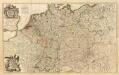
Composite: L'Alemagne.
1 : 1800000 Rizzi Zannoni, Giovanni Antonio Bartolomeo, 1736-1814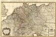
L'Empire d'Allemagne distingué suivant l'étendüe de tous les Estats, Principautés et Souverainetés qui passent ou qui ont passé jusque a present sous le nom d'Allemagne
1 : 2100000 Mollova mapová sbírka Sanson, Guillaume Covens, Johannes I
Nova Germaniae Descriptio
1 : 3100000 Mollova mapová sbírka Janssonius, Johannes Janssonius, Johannes I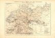
Atlas für Industrie- und Handelsgeographie: Für commercielle und technische Lehranstalten, für Kaufleute und Industrielle
Mitteleuropa Volksdichte
1 : 6000000 Mitteleuropa Bevölkerungsdichte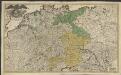
Imperii romano-germanici in suos status et circulos divisi tabula generalis
1 : 1750000 Ultraject : edita per Cornelium Kribber
Shell British Columbia - Alberta.
1 : 2471040 Shell Oil Company
Die Ältesten Karten von Deutschland
Map of Germany and the adjoining countries / by Ignatius Heymann
1 : 970000 Heymann, Ignatius London : John Stockdale
Post Karte von Deutschland in zwey Blättern
1 : 1920000 Německo Schindelmeyer, Karl Robert Ludwig Mairisch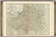
A new map of the Kingdom of Poland with its dismembered provinces.
1 : 2450000 Kitchin, Thomas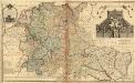
A New Map of Germany. Hungary Transilvania & the Suisse Cantons
1 : 1900000 Mollova mapová sbírka Moll, Herman Bowles, Thomas I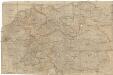
Neueste und vollstaendigste Post Karte von ganz Deutschland Niederlanden Schweiz Pohlen Ungarn und den angränzenden Theilen Frankreichs u Italien
Evropa střední Cappi, Jean Jean Cappi