Maps of Tyumen'
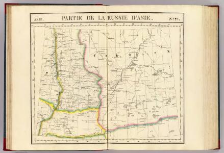
Partie, Russie d'Asie. Asie 21.
1 : 1641836 Vandermaelen, Philippe, 1795-1869
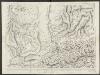
Map showing the country traversed by Yermak
Russland Sibirien Eroberung Ermak, Timofeevič
Geologische Karte des Hüttenbezirks Katharinenburg
1 : 210000 Hofmann, E. Kartographische Anstalt A. Ilgin
Geologische Karte des Hüttenbezirks Goroblagodatsk
1 : 210000 Hofmann, E. Kartographische Anstalt A. Ilgin
Geologische Karte des Hüttenbezirks Slatoust
1 : 210000 Hofmann, E. Kartographische Anstalt A. Ilgin
Feuille 14 (G II), uit: Carte géologique internationale de l'Europe : la carte, votée au congrès géologique international de Bologne en 1881, est exécutée conformément aux décisions d'une commission internationale, avec le concours des gouvernements, sous le dir. de M.M. Beyrich et Hauchecorne
Annotatie: Blad 48 gamme des couleurs; blad 49: bladwijzer en titelblad Heinrich Ernst Beyrich 1815-1896; Wi. Hauchecorne Berlin : Reimer / (Berlin: Institut lithographique)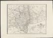
Karte vom Ural Gebirge, gegründet auf die astronomischen Beobachtungen von Wischnewsky, Schubert, A. v. Humboldt, Ad. Erman, und auf handschriftliche Specialkarten
1 : 2000000 [S.l.] : [s.n.]
[V], uit: Geognostische Karte des Oesterreichischen Kaiserstaates mit einem grossen Theile Deutschland's u. Italien / hauptsachlich nach ... Haidinger's geognostischer Karte dieses Staates bearb. von Josef Scheda
1 : 3000000 titelvariant: General-Karte von Europa in 25 Blättern; Annotatie: Bijlage bij: General-Karte von Europa in 25 Blättern. - 1:2.592.000. - 1845-1847 Scheda, Joseph Wien : K.K. Militär. Geografisch. Institut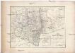
Karte vom URAL GEBIRGE
1 : 2000000 Ural (Rusko : oblast) Berghaus, Heinrich Karl Wilhelm Erman, Ad. Justus Perthes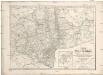
Karte vom Ural Gebirge
1 : 2000000 Ural-oblast (Rusko) Erman, Ad. bei Justus Perthes
24. Urals. The World Atlas.
1 : 3000000 USSR (Union of Soviet Socialist Republics).
Karte der stroganowschen Erbländer
1 : 850000 Leipzig : Wilhelmi
Geologische Karte des Hüttenbezirks Bogoslowsk
1 : 210000 Hofmann, E. Kartographische Anstalt A. Ilgin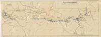
Schema historických momentů československ. vojenských operací na Sibiři 1918-1919
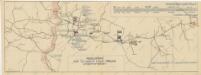
Schema historických momentů československ. vojenských operací na Sibiři 1918-1919
Schema historických momentů československ. vojenských operací na Sibiři 1918-1919
Schema historických momentů československ. vojenských operací na Sibiři 1918-1919

Administrativnaja Karta Evropejskoj časti C.C.C.P.

31-32. Siberia, West. The World Atlas.
1 : 5000000 USSR (Union of Soviet Socialist Republics).
Postkarte von Nord-Russland
Rusko severozápadní Benedict, Anton im von Reillyschen Landkarten und Kunstwerke Verschleiss Komptoir
RVSSIÆ, | vulgo MOSCOVIA dictæ, | Partes Septentrionalis | et Orientalis
Auctore Isaaco Maßa. Apud Ioannem et | Cornelium Blaeu.
Russiae, vulgo Moscovia dictae, Partes Septentrionalis et Orientalis. [Karte], in: Novus atlas absolutissimus, Bd. 1, S. 78.
1 Karte aus Atlas Janssonius Offizin
A mapp of the estates of the Great Duke of Russia, Blanch, or Moscovia / designed by Mouner Sanson,
1 : 10000000 1 Karte : Kupferdruck ; 26 x 39 cm Lamb, Francis Printed for Ric: Blome
Moscoviae imperium
1 : 18500000 1 Karte : Kupferdruck ; 12 x 17 cm Ptolemaeus, Claudius [Giovanni B. u. Georgio Galignani]
Sarmatia utraque Europaea et Asiatica / autore Nicolao Sanson Filio, Christianissimi Galliarum Regis
1 : 6500000 1 Karte : Kupferdruck ; 40 x 46 cm Sanson, Nicolas Sanson
Rvssiae, vulgo Moscovia dictae, partes septentrionalis et orientalis
1 : 5017000 Moskva-oblast (Rusko) Massa, Isaac Blaeu, Cornelius apud Ioannem et Cornelium Blaeu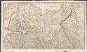
Russian Dominions
A new general atlas of modern geography, consisting of a complete collection of maps of the four quarters of the globe Wyld, James James Wyld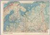
U.S.S.R. In Europe - North. Pergamon World Atlas.
1 : 5000000 Polish Army Topography Service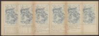
Russiae, vulo Moscovia dictae, Partes Septentrionalis et Orientalis. [Karte], in: Le théâtre du monde, ou, Nouvel atlas contenant les chartes et descriptions de tous les païs de la terre, Bd. 1, S. 70.
1 Karte aus Atlas Blaeu, Willem Janszoon und Blaeu, Joan Blaeu, Willem Janszoon