Maps of Taymyr Peninsula
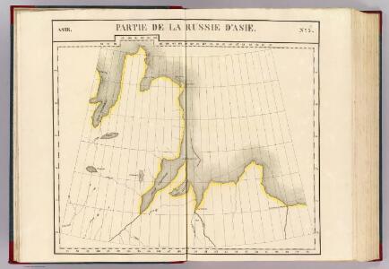
Partie, Russie d'Asie. Asie 3.
1 : 1641836 Vandermaelen, Philippe, 1795-1869
Předběžná mapa cesty Framu podél severního pobřeží starého světa
1 : 5000000 Tajmyrský poloostrov (Rusko) nákladem J. Otty
Carte marine de la mer glaciale, et la Siberie septentrional
1 Karte : Kupferdruck ; 42 x 48 cm Königliche Akademie der Wissenschaften
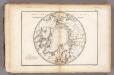
Die nördliche und südliche Halbkugel der Erde
1 : 30000000 entworfen von C. F. Weiland Carl Metzeroth sc. Weimar : Verlag des Geograph. Instituts
34-35. Siberia, Middle. The World Atlas.
1 : 5000000 USSR (Union of Soviet Socialist Republics).
[Východní Asie].
Asie východní Berghaus, Heinrich Karl Wilhelm Horsburgh, James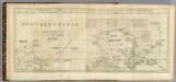
Chart containing part of the Icy Sea ... Greenland ... Islands about Baffins Bay and part of Hudsons Bay.
1 : 21000000 Jefferys, Thomas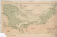
Cesta norské výpravy na severní točnu 1893-1896
1 : 12000000 Arktida nákladem J. Otty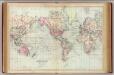
World, Mercator's projection.
1 : 68000000 Asher & Adams

Charte von America
Amerika Kitschin, Thomas Berra, Marco
Carte de la Sibérie et des pays voisins / par le Sr. Bellin Ing. de la Marine
1 : 14500000 1 Karte : Kupferdruck ; 27 x 44 cm Bellin, Jacques Nicolas [Bellin]
Carte de la Sibérie et des pays voisins / par le Sr. Bellin Ing. de la Marine
1 : 14500000 1 Karte : Kupferdruck ; 27 x 44 cm Bellin, Jacques Nicolas [Bellin]
Carte de la Sibérie et des pays voisins / par le Sr. Bellin Ing. de la Marine
1 : 14500000 1 Karte : Kupferdruck ; 27 x 44 cm Bellin, Jacques Nicolas [Bellin]
CHARTE vom ASIATISCHEN RUSSLAND
Rusko východní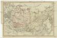
Charte vom Asiatischen Russland
Rusko východní
General'naja karta azijatskoj časti Rossijskoj imperii
1 : 26000000 Rusko východní Korsakov, P.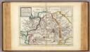
Great Tartary.
1 : 26000000 Moll, Herman, d. 1732
Charte von America
1 Karte : Kupferdruck ; 58 x 48 cm Walch bey Johannes Walch
Uebersichts-Karte der ethnographischen Verhältnisse von Asien und von den angrenzenden Theilen Europa'sbearbeitet und herausgegeben mit Unterstützung der kaiserlichen Akademie der Wissenschaften in Wien von Vinzenz v. Haardt
Hartenthurn, Vincenz
Atlas für Industrie- und Handelsgeographie: Für commercielle und technische Lehranstalten, für Kaufleute und Industrielle

Arctic Regions.
Fullarton, A. & Co.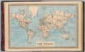
Map of the world on Mercator's projection.
1 : 70000000 H.W. Burgett and Company
Generali totius imperii Russorum novissima tabula
1 : 11940000 Japonské moře Homann, Johann Baptist ex conatibus Iohannis Baptistae Homanni
Carte marine de la mer glaciale avec une partie de la province de Jrkucki
1 Karte : Kupferdruck ; 42 x 48 cm Academie roÿale des sciences
Imperium Russicum
1 : 7600000 Rusko Doetsch, Johann Anton Hartl, Sebastian apud Sebastianum Hartl
Sovětský svaz v mapách

Carte des glaces boreales.
1 : 34000000 Vincent