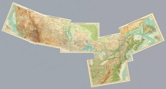
Maps of Central Lowland

Composite: Canada 1:2,500,000.
1 : 2500000 John Bartholomew and Son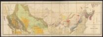
Map of the Dominion of Canada
1 : 2700000 Geological and Natural History Survey (Canada) Geological and Natural History Survey of Canada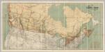
Map Shewing the Railways of Canada.
1 : 2660000 Canada Government Railways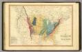
Geol. map US.
1 : 15000000 Simpkin & Marshall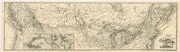
Map of the Canadian Pacific Railway and its connections
Carte générale des États-Unis de l'Amérique avec les plans des principales villes
1 : 7500000
United States.
1 : 21000000 Grigg, John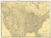
Rand McNally new official railroad map of the United States and southern Canada
1 : 5258880 Kanada Rand McNally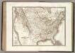
Etats-Unis d'Amerique.
1 : 9300000 Lapie, M. (Pierre), 1779-1850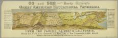
Go and see Hardy Gillard's great American educational panorama, Over the Pacific Railway to California : bird's eye view of the country from New York to San Francisco, 3,500 miles.
from Parts
Canadian national railways
1 : 4730000 Kanada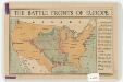
The battle fronts of Europe
1 : 2500000 Map of battle fronts drawn to scale upon a map of the United States showing relative distances of fronts. Roberts & Leete. London : Stanford's Geographical Establishment
Pulp & paper map of Canada
1 : 6270000 Kanada Department of the Interior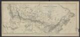
Carte de la puissance du Canada dressée et publiée par l'ordre du Ministre des Chemins de fer et des Canaux (1882)
1 : 8300000 [Lieu de publication inconnu] : éditeur inconnu]
Etats-Unis de l'Amerique en 1860.
1 : 12000000 Garnier, F. A., 1803-1863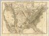
Die Vereinigten Staaten von Nord-America.
1 : 8000000 Bromme, Traugott
[Vereinigte Staaten von Nord-America und Canada]
Schul-Atlas über alle Theile der Erde nach dem neuesten Zustande, und über das Weltgebäude Stieler, Adolf bei Justus Perthes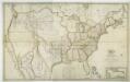
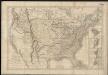
Map of the United States with the contiguous British & Spanish possessions / compiled from the latest & best authorities by John Melish; engraved by J. Vallance & H.S. Tanner.
from Whole John Melish; J. Vallance; Henry S. Tanner,
[Neuer Atlas der ganzen Erde nach den neuesten Bestimmungen ... : XXIV.] Charte von dem Nordamericanischen Staatenbunde
Entworfen und gezeichnet von F.W. Streit H. Leutemann sc. Leipzig : J.C. Hinrichs'sche Buchhandlung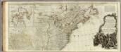
A new map of North America, with the West India Islands (northern section).
1 : 5300000 Pownall, Thomas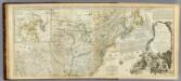
An Accurate Map Of North America. (Northern section)
1 : 5400000 Jefferys, Thomas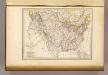
Etats-Unis d'Amerique, 1835.
1 : 16200000 Malte-Brun, Conrad, 1775-1826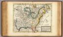
New map of ye north parts of America.
1 : 17300000 Moll, Herman, d. 1732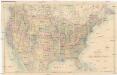
Stanford's General Map of the United States
1 : 5274720 Spojené státy americké Stanford, Edward Edward Stanford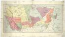
Map of the Dominion of Canada
1 : 6210000 Kanada Department of the Interior, Surveys Branch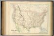
United States.
1 : 9504000 Fullarton, A. & Co.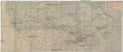
Canada's Grand Trunk Eisenbahnsystem
1 : 7500000 Kanada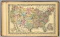
U.S., Canada.
1 : 10000000 Williams, W. (Wellington)
Canada
Kanada Dathe, C. Gleditsch