Maps of Nevada

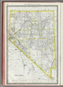
Nevada.
1 : 1800000 Rand McNally and Company
Nevada.
1 : 1711000 Rand McNally and Company
Nevada.
1 : 1204000 Rand McNally and Company
Shell Highway Map of Nevada.
1 : 1584000 Shell Oil Company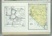
Nevada. Yellowstone National Park.
1 : 2926000 Hammond, C.S.
Nevada.
1 : 1140480 U.S. General Land Office
Nevada.
1 : 1750000 Rand McNally and Company
State Of Nevada.
1 : 1013760 U.S. General Land Office
Nevada.
1 : 1330560 Cram Atlas Company
Nevada.
1 : 2200000 Cram, George Franklin; Davis, Ellis Arthur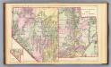
Utah, Nevada.
1 : 1750000 Mitchell, Samuel Augustus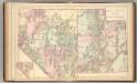
Utah, Nevada.
1 : 1750000 Mitchell, Samuel Augustus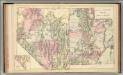
Utah, Nevada.
1 : 1750000 Mitchell, Samuel Augustus Jr.
Nevada.
1 : 3100000 Holdredge, Sterling M.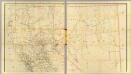
California, Nevada (upper)
1 : 696960 Von Haake, A.
Publicity map
1 : 1750000 Shows routes for "present Los Angeles Aqueduct," "present Los Angeles power line," Metropolitan Aqueduct, under construction," "All American Canal." Also shows location of "Mono Basin Project, under construction," and "Owens River Project, future." "Drawn A.E.A." Blueline print. "Drawing number L-287." Los Angeles (Calif.). Bureau of Power and Light. Los Angeles : Bureau of Power and Light, Department of Water & Power.
Topography Of Southern & Southeastern Nevada.
1 : 760320 Wheeler, G.M.
DeGroot's Map Of Nevada Territory.
1 : 776160 Holt, Warren
From the Humboldt Mountains to the Mud Lakes.
1 : 760320 Beckwith, E.G.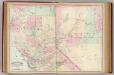
Calif., Nev. north.
1 : 1267200 Asher & Adams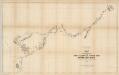
Map of the Western Division of the Fort Kearney South Pass and Honey Lake Road.
1 : 760320 Campbell, Albert
Topographic Map of the Los Angeles Aqueduct and Adjacent Territory
1 : 1316800 [California? : s.n.]
58. Parts Of Eastern & Southern Nevada And Southwestern Utah.
1 : 506880 Wheeler, G.M.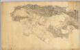
Los Angeles & San Bernardino topography.
1 : 126720 Hall, Wm. Ham. (William Hammond)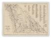
Map of Inyo County, California : showing locations of principal mines
1 : 135000 Includes indexes of mines and mineral monuments. "Accompanying State Mineralogist's Report XXXIV. October 1938." Tucker W.B., Sampson R.J. [Sacramento] : Division of Mines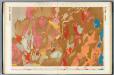
Nevada Basin. (Geological)
1 : 253440 King, Clarence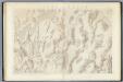
Nevada Basin. (Topographical)
1 : 253440 King, Clarence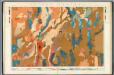
Nevada Plateau. (Geological)
1 : 253440 King, Clarence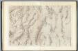
Nevada Plateau. (Topographical)
1 : 253440 King, Clarence