Maps of Great Lakes
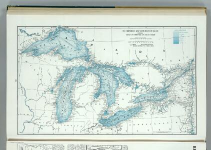
Great Lakes including Canals and Tributary Navigable Streams.
1 : 3353000 Hammond, C.S.
Canada West (Upper).
1 : 2000000 Tanner, Henry S.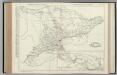
Ontario.
Rand McNally and Company
PARTIE OCCIDENTALE de la NOUVELLE FRANCE ou du CANADA
1 : 3600000 Velká kanadská jezera (Kanada a Spojené státy americké) Bellin, Jacques-Nicolas par le Heritiers de Homan
PARTIE OCCIDENTALE de la NOUVELLE FRANCE ou du CANADA
1 : 3600000 Velká kanadská jezera (Kanada a Spojené státy americké) Bellin, Jacques-Nicolas par les Heritiers de Homan
PARTIE OCCIDENTALE de la NOUVELLE FRANCE ou du CANADA
1 : 3600000 Velká kanadská jezera (Kanada a Spojené státy americké) Bellin, Jacques-Nicolas par les Heritiers de Homan
Karten - Skizzen für die Schul - Praxis

Map of the Vermont Central Rail Road and its connections from Smith's map of the United States.
from Parts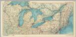
United States of America - Great Lakes. Pergamon World Atlas.
1 : 2500000 Polish Army Topography Service
Lay's map of the United States / compiled from the latest and best authorities and actual surveys by Amos Lay, geographer and map publisher ; engraved by O.H. & D.S. Throop & Wm. Chapin.
From Whole
Brooklyn V. 2, Double Page Plate No. 54 [Map bounded by Ryerson St., Myrtle Ave., Vanderbilt Ave., Flushing Ave.]
From Atlas 66. Vol. 2, 1887.
Canada, Louisiane et Terres Angloises. (Northwest section)
1 : 2900000 Anville, Jean Baptiste Bourguignon d, 1697-1782
Northern Steamship Co. (map)
1 : 4752000 Northern Steamship Company
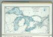
A Chart exhibiting the Light Houses, on the Lake Coasts of the United States of America
A Chart exhibiting the Light Houses, on the Lake Coasts of the United States of America.
Central Canada.
1 : 2065500 Johnston, W. & A.K.
County map of Michigan, and Wisconsin.
from Mitchell's new general atlas, containing maps of the various countries of the world, plans of cities, etc., embraced in fifty-three quarto maps., forming a series of eighty four maps and plans, together with valuable statistical tables.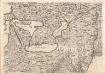
A Map of the British Empire in America. (Sheet 6).
1 : 2000000 Popple, Henry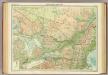
Ontario & Quebec.
1 : 2500000 John Bartholomew and Son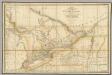
A Map of the Province of Upper Canada.
1 : 1420000 Wyld, James, 1812-1887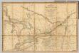
A Map of the Province of Upper Canada.
1 : 1420000 Smyth, David William
A Map of the Province of Upper Canada.
1 : 1420000 Smyth, David William
Ontario, Quebec.
1 : 2217600 Stanford, Edward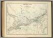
Central Canada.
1 : 2065500 Johnston, Alexander Keith
Upper Canada &c.
1 : 2154240 Arrowsmith, John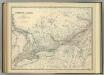
Central Canada.
1 : 2065500 Johnston, Alexander Keith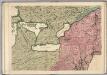
A Map of the British Empire in America. (Sheet 6).
1 : 2000000 Popple, Henry
Upper Canada.
1 : 2200000 Arrowsmith, John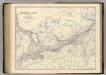
Canada W.
1 : 2065500 Johnston, Alexander Keith, 1804-1871
North Western and MichiganTerritories.
1 : 4400000 Lucas, Fielding Jr.