Maps of South Africa

South Africa.
1 : 10080000 Peterson, Augusts
Das Capland nebst den süd-afrikanischen Freistaaten un dem Gebiet der Hottentotten & Kaffern.
South Africa.
1 : 3817440 Johnston, W. & A.K.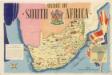
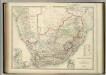
Union of South Afrika
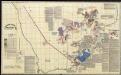
A land divided against itself.A map of South Africa showing the African Homelands and some of the mass removals of people which have taken place,..
Sud. v. Africa.
1 : 3000000 Weiland, C. F. (Carl Ferdinand), d. 1847
Süd-Afrika
Hand-Atlas über alle Theile der Erde nach dem neuesten Zustande und über das Weltgebäude Stieler, Adolf bei Justus Perthes
[Süd-Afrika]
Hand-Atlas über alle Theile der Erde nach dem neuesten Zustande und über das Weltgebäude Stieler, Adolf bei Justus Perthes
South Africa 40
1 : 4200000 Appleton, D. & Co.
South Africa.
1 : 3817440 Johnston, Alexander Keith
Das Capland nebst den Süd-Afrikanischen Freistaaten und dem Gebiet der Hottentotten & Kaffern
Handatlas über alle Theile der Erde und über das Weltgebäude Stieler, Adolf Justus Perthes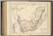
South Africa.
1 : 4118400 Fullarton, A. & Co.
Topographical map of the Union of South Africa = Topografiese kaart van die Unie van Suid-Afrika / A.D. Lewis ; comp. in the Office of the Director of Irrigation
1 : 1500000 titelvariant: Topografiese kaart van die Unie van Suid-Afrika Lewis, A. D.; Office of the Director of Irrigation, Zuid-Afrika Pretoria : Government Printer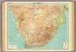
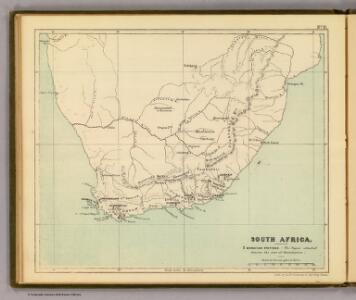
South Africa.
1 : 5000000 John Bartholomew and Son
Kaart van Zuid-Afrika / naar de laatste en beste bronnen bewerkt voor 'De worstelstrijd der Transvalers' door F. Lion Cachet, derde herziene druk ; A.J. Wendel grav
1 : 3000000 Annotatie geografische gegevens: Met schaalstok; Legenda Abraham Jacobus Wendel 1826-1915 Pretoria [etc.] : Boekhandel voorheen Höveker & Wormser / ([Leiden : P.W.M. Trap])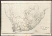
South Africa
A new general atlas of modern geography, consisting of a complete collection of maps of the four quarters of the globe Wyld, James James Wyld
Mission map of South Africa according to the map in Stieler's Atlas

Politisch - militärische Karte von Süd-Afrika

Das Capland Nebst Den Sud-Afrikanischen Freistaaten.
1 : 5000000 Petermann, A.
Zuid-Afrika
1 : 10000000 steendruk van P.W.M. Trap [Amsterdam] : [s.n.]
Karte des Afrikander-Aufstandes im Kaplande und des Angriffskrieges der Buren
1 : 4000000 Langhans, Paul Perthes
Karte von Transvaal und der angrenzenden Gebiete
1 : 5000000 Afrika jižní Dietrich Reimer (Ernst Vohsen)
Das Capland nebst den Süd-Afrikanischen Freistaaten und dem Gebiet der Hottentotten & Kaffern
Hand-Atlas über alle Theile der Erde und über das Weltgebäude Stieler, Adolf Justus Perthes
[LL.04752gk: 591/od/1899] [Recto], uit: Kaart van Zuid-Afrika : (Zuid-Afrikaansche Republiek, Oranje-Vrijstaat en aangrenzend gebied)
1 : 5600000 Amsterdam [etc.] : J.H. de Bussy
South Africa.
1 : 6000000 Andree, Richard; Times (London, England)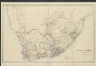
South Africa
1 : 2565000 by James Wyld London : Wyld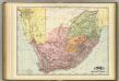
South Africa.
1 : 3200000 Rand McNally and Company
[LL.04716gk: 591/od/1899], uit: Kaart van Zuid-Afrika : (Zuid-Afrikaansche Republiek, Oranje-Vrijstaat en aangrenzend gebied)
1 : 5600000 Amsterdam [etc.] : J.H. de Bussy
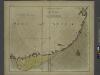
Die Südspitze von Africa mit der Colonie am Vorgebirge der guten Hoffnung und dem Kaffernlande oder Südrand von Africa mit dessen Stufen-laender
1 : 3000000 entworfen und gezeichnet von C. F. Weiland C. Jungmann sc. Weimar : Verlag des Geograph. Instituts