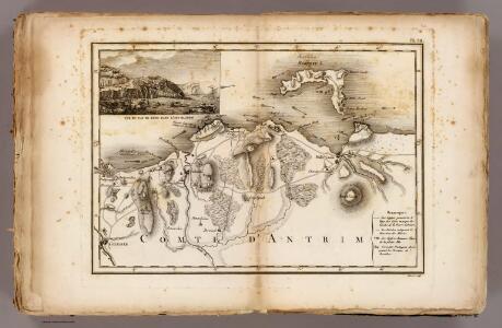
Maps of Moyle
Antrim, Raghery.
1 : 106000 Vincent
Sheet 1 North Derry, uit: [Northern Ireland] : one-inch popular edition
1 : 63360 titelvariant: One-inch popular edition; One-inch popular series; Annotatie: Serietitel op omslag: One-inch popular series; Voor aanwezige bladen zie bladoverzicht; Sommige bladen met gaas verstevigd; Annotatie geografische gegevens: Met twee maatstokken (miles/yards en kilometres); Met indexkaartje op elk blad Belfast : Ordnance Survey of Northern Ireland
Bartholomew's Quarter-inch to mile" map of Ireland
1 : 253440 Belfast (Severní Irsko) Geographical Institute
Scotland / J. Ainslie, 7
1 Blatt : 67 x 58 cm Ainslie, Faden
Nieuwe Caart van de Rivier van Glasgow in 't Groot.
Keulen, Johannes van, 1654-1715
Belfast
1 : 250000 Belfast (Severní Irsko) War Office
Ulster
This is a map of the six ‘escheated’ counties of Ulster. It dates from 1609 and may be by John Norden, though likely to be based on the barony maps of Josias Bodley and William Parsons. It seems to be intended as a guide to planned plantings. In 1607 the earls of Ulster fled and the counties of Armagh, Cavan, Coleraine, Donegal, Fermanagh and Tyrone were confiscated by the English and the Scots. In 1608-9 the Commons had drafted plans for English and Scottish planting and lands that were to be retained by the Irish. Norden, John
Provincia Ultoniae = The province of Ulster
1 : 690000 Amstelodami : apud Joannem Janssonium
VLTONIA; | Hibernis CUI-GUILLY; | Anglis VLSTER.
[Amsterdam : Joan Blaeu]
Provincia Ultoniae The Province of Ulster [Karte], in: Gerardi Mercatoris et I. Hondii Newer Atlas, oder, Grosses Weltbuch, Bd. 1, S. 63.
1 Karte aus Atlas Mercator, Gerhard und Hondius, Jodocus Jansson, Jan
Provincia Ultoniae The Province of Ulster [Karte], in: Novus atlas absolutissimus, Bd. 8, S. 201.
1 Karte aus Atlas Janssonius Offizin
Vltonia; hibernis Cvi-Gvilly; anglis Vlster
1 Karte : Kupferdruck ; 40 x 48 cm Blaeu Joan Blaeu
Carte particuliere de la cote occidentale d'Escosse, depuis la Pointe d'Ardnamurchan jusqu'au Mull de Galloway.
Depot Generale de la Marine, Paris
Lorna, Knapdalia, Cantire, Iura, Ila, Glota, et Buthe Insulae. [Karte], in: Novus atlas absolutissimus, Bd. 8, S. 175.
1 Karte aus Atlas Janssonius Offizin
Scotland SW.
1 : 500000 Cary, John, ca. 1754-1835
Ireland NE.
1 : 486830 Stanford, Edward
Scotland SW.
1 : 486830 Stanford, Edward
A general map of Scotland and islands thereto belonging, 3
2 Blätter : 91 x 76 cm s.n.
Ireland 2.
1 : 760320 Letts, Son & Co.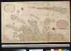
Nieuwe afteekening van de West kust van Schotlant en de Lewijs Eijlanden met alle de tussen leggende eijlanden
Scotland Gerard van Keulen
Ireland (north)
1 : 380000 Rocque, John
Ireland (northern)
1 : 700000 Lizars, Daniel
Scotland S.
1 : 633600 Johnston, Alexander Keith, 1804-1871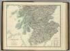
Scotland (southern sheet).
1 : 633600 Johnston, Alexander Keith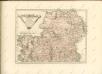

Parte del regno d'Irlandia, cioè le provincie d'Ulster, e Leinster
1 Karte : Kupferdruck ; 40 x 30 cm Zatta; Zuliani; Pitteri presso Antonio Zatta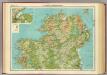
Ireland - northern section.
1 : 633600 John Bartholomew & Co.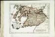
Des Königreichs Scotland südlicher Theil
1 Karte : Kupferdruck ; 19 x 25 cm Reilly F. J. J. von Reilly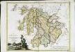
La Scozia meridionale
1 Karte : Kupferdruck ; 30 x 39 cm Zatta; Zuliani; Pitteri presso Antonio Zatta