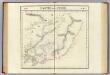
Maps of Sikhote-Alin Range

43-44. Far East, South. The World Atlas.
1 : 3000000 USSR (Union of Soviet Socialist Republics).
Partie, l'Empire Chinois. Asie 35.
1 : 1641836 Vandermaelen, Philippe, 1795-1869
[Nebenkarte : Sachalin]
Partie, la Chine. Asie 48.
1 : 1641836 Vandermaelen, Philippe, 1795-1869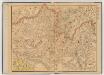
中俄交界詳圖 (第五幅)
1 : 14400000 中俄交界詳圖 宣统元年至二年[1909-1910],武昌:武昌亞新地學社出版 该图集以1幅总图15幅详图(分图)的形式,详细绘制了清末中俄边界线以及清代中俄边界的变化,空间上东起乌苏里江、图们江,向西延黑龙江、蒙古、新疆直到帕米尔地区。详图中详细标注了边界上各界牌所在位置及名称。 该图未标注成图时间,根据图上内容推测应为宣统元年至二年。详图第十幅中,吉林宁古塔标注了绥芬府,而绥芬府是宣统元年[1909]四月升绥芬厅而置,次年四月又改为宁安府,因此该图应成图于宣统元年或二年。图上其他标注也符合这一时间限定,如总图中已绘制了京张铁路,而京张铁路通车时间是1909年,表明该图应在1909年或之后;北京处则标注为“順天京師”,而顺天府于民国二年被废,京师改为京兆地方,表明该图应在1913年之前。因此,该图成图时间应在宣统元年至二年之间,其中,又以宣统二年上半年的可能性最大。 1集16图,彩印,中文,图幅为36.5 x 47.6 cm,总图比例尺1:14400000,详图比例尺1:1500000,以穿过北京的116°经线为中央经线,总图经纬度范围约为E50°-145°; N40°-60°。 Harvard-Yenching | Offsite Storage C (HD) | G2306.F2 H93 1930Z;Hollis Number:012092643 武昌:武昌亞新地學社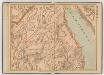
中俄交界詳圖 (第六幅)
1 : 14400000 中俄交界詳圖 宣统元年至二年[1909-1910],武昌:武昌亞新地學社出版 该图集以1幅总图15幅详图(分图)的形式,详细绘制了清末中俄边界线以及清代中俄边界的变化,空间上东起乌苏里江、图们江,向西延黑龙江、蒙古、新疆直到帕米尔地区。详图中详细标注了边界上各界牌所在位置及名称。 该图未标注成图时间,根据图上内容推测应为宣统元年至二年。详图第十幅中,吉林宁古塔标注了绥芬府,而绥芬府是宣统元年[1909]四月升绥芬厅而置,次年四月又改为宁安府,因此该图应成图于宣统元年或二年。图上其他标注也符合这一时间限定,如总图中已绘制了京张铁路,而京张铁路通车时间是1909年,表明该图应在1909年或之后;北京处则标注为“順天京師”,而顺天府于民国二年被废,京师改为京兆地方,表明该图应在1913年之前。因此,该图成图时间应在宣统元年至二年之间,其中,又以宣统二年上半年的可能性最大。 1集16图,彩印,中文,图幅为36.5 x 47.6 cm,总图比例尺1:14400000,详图比例尺1:1500000,以穿过北京的116°经线为中央经线,总图经纬度范围约为E50°-145°; N40°-60°。 Harvard-Yenching | Offsite Storage C (HD) | G2306.F2 H93 1930Z;Hollis Number:012092643 武昌:武昌亞新地學社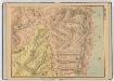
中俄交界詳圖 (第九幅)
1 : 14400000 中俄交界詳圖 宣统元年至二年[1909-1910],武昌:武昌亞新地學社出版 该图集以1幅总图15幅详图(分图)的形式,详细绘制了清末中俄边界线以及清代中俄边界的变化,空间上东起乌苏里江、图们江,向西延黑龙江、蒙古、新疆直到帕米尔地区。详图中详细标注了边界上各界牌所在位置及名称。 该图未标注成图时间,根据图上内容推测应为宣统元年至二年。详图第十幅中,吉林宁古塔标注了绥芬府,而绥芬府是宣统元年[1909]四月升绥芬厅而置,次年四月又改为宁安府,因此该图应成图于宣统元年或二年。图上其他标注也符合这一时间限定,如总图中已绘制了京张铁路,而京张铁路通车时间是1909年,表明该图应在1909年或之后;北京处则标注为“順天京師”,而顺天府于民国二年被废,京师改为京兆地方,表明该图应在1913年之前。因此,该图成图时间应在宣统元年至二年之间,其中,又以宣统二年上半年的可能性最大。 1集16图,彩印,中文,图幅为36.5 x 47.6 cm,总图比例尺1:14400000,详图比例尺1:1500000,以穿过北京的116°经线为中央经线,总图经纬度范围约为E50°-145°; N40°-60°。 Harvard-Yenching | Offsite Storage C (HD) | G2306.F2 H93 1930Z;Hollis Number:012092643 武昌:武昌亞新地學社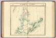
Partie du Japon. Asie 49.
1 : 1641836 Vandermaelen, Philippe, 1795-1869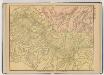
中俄交界詳圖 (第八幅)
1 : 14400000 中俄交界詳圖 宣统元年至二年[1909-1910],武昌:武昌亞新地學社出版 该图集以1幅总图15幅详图(分图)的形式,详细绘制了清末中俄边界线以及清代中俄边界的变化,空间上东起乌苏里江、图们江,向西延黑龙江、蒙古、新疆直到帕米尔地区。详图中详细标注了边界上各界牌所在位置及名称。 该图未标注成图时间,根据图上内容推测应为宣统元年至二年。详图第十幅中,吉林宁古塔标注了绥芬府,而绥芬府是宣统元年[1909]四月升绥芬厅而置,次年四月又改为宁安府,因此该图应成图于宣统元年或二年。图上其他标注也符合这一时间限定,如总图中已绘制了京张铁路,而京张铁路通车时间是1909年,表明该图应在1909年或之后;北京处则标注为“順天京師”,而顺天府于民国二年被废,京师改为京兆地方,表明该图应在1913年之前。因此,该图成图时间应在宣统元年至二年之间,其中,又以宣统二年上半年的可能性最大。 1集16图,彩印,中文,图幅为36.5 x 47.6 cm,总图比例尺1:14400000,详图比例尺1:1500000,以穿过北京的116°经线为中央经线,总图经纬度范围约为E50°-145°; N40°-60°。 Harvard-Yenching | Offsite Storage C (HD) | G2306.F2 H93 1930Z;Hollis Number:012092643 武昌:武昌亞新地學社
Plan of La Baie Destaing on the Eastern Coast of Tchoka ....
La Perouse, Jean-Francois de Galaup, comte de, 1741-1788
Plan of La Baie de Langle.
La Perouse, Jean-Francois de Galaup, comte de, 1741-1788
Iwaonobori-Naganuma
1 : 3000 Hokkaidó (Japonsko : ostrov)
Lake Kuttyaro
1 : 50000 Hokkaidó (Japonsko : ostrov)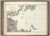
Plan of the Baie de Castries.
La Perouse, Jean-Francois de Galaup, comte de, 1741-1788
Plan of Baie de Ternai.
La Perouse, Jean-Francois de Galaup, comte de, 1741-1788
Lake Masyu
1 : 50000 Hokkaidó (Japonsko : ostrov)
Lake Sikaribetu
1 : 15000 Hokkaidó (Japonsko : ostrov)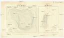
Iwaonobori-Ônuma
1 : 2000 Hokkaidó (Japonsko : ostrov)
Karta Amurského a Přímorského kraje
Amur-oblast (Čína a Rusko) H. Seifert
Mandschukuo
1 : 4000000 Mandžusko (Čína) OKH
Karte von Jesso und Sagalien
Hokkaidó (Japonsko)
Charte von der Nordwestküste Americas nach Vancouver
Vancouver-oblast (Britská Kolumbie) Martius, C. von Schwarzmann, I.
Manchuria
1 : 4000000 Mandžusko (Čína) War Office
Manchuria
1 : 4000000 Mandžusko (Čína) Royal Geographical Society
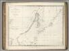
et des Rojaumes de COREE ET IAPAN
Carte de la Tartarie orientale
1 : 8000000 1 Karte : Kupferdruck ; 19 x 30 cm [Didot]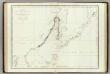
Mers, Chine, Tartarie. 2.
1 : 6250000 La Perouse, Jean-Francois de Galaup, comte de, 1741-1788
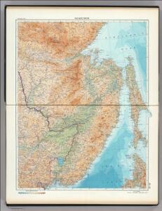
U.S.S.R. - Far East, Korea, Japan. Pergamon World Atlas.
1 : 5000000 Polish Army Topography Service
Japan, Mandshuria (showing the course of the Amur river), the Kurile Isles &c. : according to the British & Russian Admiralty surveys, Krusenstern, Siebold &c. / by J. Bartholomew Jun.r ; engraved by J. Bartholomew
1 : 9000000 titelvariant: Islands of Japan; Annotatie: Uit: The Royal illustrated atlas of modern geography. - London [etc.] : A. Fullarton & Co., 1860; Lit: A list of geographical atlases, I, no. 838; Titel boven de kaart: Islands of Japan Bartholomew, John (1831-1893) Edinburgh [etc.] : A. Fullarton & Co.