Maps of Sonoma County

Sonoma, Marin, Lake, and Napa Counties.
1 : 443529 Blum, George W.
Santa Rosa
1 : 250000
Santa Rosa
1 : 250000
Santa Rosa
1 : 250000
Santa Rosa
1 : 250000
Santa Rosa
1 : 250000
Santa Rosa
1 : 250000
Santa Rosa
1 : 250000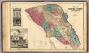
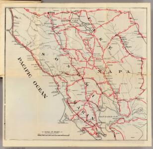
Map of Sonoma County California.
1 : 205920 Thompson, Thos. H.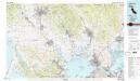
Napa
1 : 100000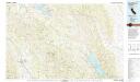
Healdsburg
1 : 100000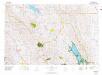
Healdsburg
1 : 100000
Coast of California showing San Andreas Rift.
1 : 140000 California. State Earthquake Investigation Commission
Marin County.
1 : 63360 Whitney, F.
Official Map Of Marin County, California.
1 : 48000 Dodge, George M.
Napa
1 : 125000
Napa
1 : 125000
Napa
1 : 125000
Napa
1 : 125000
Napa
1 : 125000
Napa
1 : 125000
Mare Island Straits, California from a trigonometrical survey under the direction of A.D. Bache, Superintendent of the Survey of the Coast of the United States.
1 : 130000 Relief shown by hachures. Depths shown by soundings. Shows drainage, buildings, wharves, etc. Facsimile. "Reproduced from the annual reports by permission of United States Coast & Geodetic Survey." Oriented with north toward upper left. Includes text and table of abbreviations. "No. 61." United States Coast Survey., P. Witzel (Peter), Rose Research Austin, Tex. : Rose Research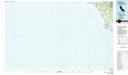
Bodega Bay
1 : 100000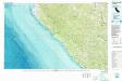
Point Arena
1 : 100000
Port de St. Francois.
1 : 420000 La Perouse, Jean-Francois de Galaup, comte de, 1741-1788
Port de St. Francois.
1 : 420000 La Perouse, Jean-Francois de Galaup, comte de, 1741-1788
San Pablo Bay, Carquines Straits.
1 : 455000 Stuart, F. D. (Fred. D.)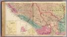
Salt Point, Ocean, Mendocino, Redwood, Bodega, and Analy Townships.
1 : 63360 Thompson, Thos. H.
Carte Detaillee Du Mouillage Du Fort Ross.
1 : 79200 Duflot de Mofras, Eugene