Maps of Seven Seas (Open Ocean)

No. 1. Pacifico.
1 : 46000000 U.S. Coast and Geodetic Survey
Composite: Pacific Ocean.
1 : 25000000 John Bartholomew and Son
Isothermal chart.
1 : 95000000 Woodbridge, William C.
Animals - World.
Woodbridge, William C.
Inhabited World.
1 : 93000000 Woodbridge, William C.
Isothermal chart, productions.
1 : 80000000 Woodbridge, William C.
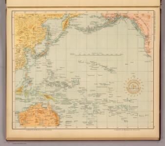
Pacific Ocean : compiled from Admiralty surveys & other official sources
1 : 15000000 India-Rubber, Gutta-Percha & Telegraph Works Co J.D. Potter
Afrique : d'après les documents les plus récents et les derniers traitès
1 : 18000000 Giffault, E Le Temps Bureaux
Atlas über die Entwicklung von Industrie und Handel der Schweiz in dem Zeitraume vom Jahr 1770 bis zum Jahr 1870
1 : 45000000 1 Atlas ([3], VIII Bl.) im Auftrage der schweizerischen Commission für die additionellen Ausstellungen in Wien, bearbeitet von Dr. Hermann Wartmann Wurster Randegger & Co., Winterthur
[Islas filipinas - pacifico]
Atlas de Filipinas Algué, P. José Government Printing Office
Kompas van het Verre Oosten : bevattende: Aziatisch Rusland, China, Japan, Philippijnen, Nederl. Indië, Molukken, Fransch Indo-China, Noord-Australië en Westelijk Noord-Amerika
1 : 20000000 Den Haag : Kompas
Objevy zemí na hranici středního a nového věku
Le monde ou panorama géographique du globe terrestre, représentant les terres et les mers du globe, ses accidents physiques, les phénomènes, les règnes de la nature [...]
1 : 177600000 réd. d'après Mr. De Humbold et les savans les plus distingués par E. Hocquart [S.l.] : [s.n.]
Longueurs du pendule.
1 : 75000000 L'Isle, Guillaume de, 1675-1726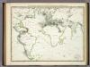
Die Vulkanischen Erscheinungen Der Atlen Welt.
1 : 65000000 Berghaus, Heinrich
The River systems of Asia & Europe
The physical atlas Johnston, Alexander Keith William Blackwood & Sons
Asien
Plastischer Schul-Atlas über alle Theile der Erde : in 24 Karten Woldermann, G Verlag von P. Eckerlein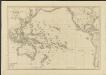
Océanie ou cinquième partie du monde
1 : 29450000 carte encyprotype réduite de celle sur 4 feuilles du même auteur par A. Brué [...] Paris : chez Ch. Picquet
A chart of the discoveries made by the late Capt. Cook, & other European navigators, in the great Pacific Ocean between Asia and America
Kitchin, Thomas Baldwin, Richard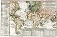
Carte des lieux où les differentes longueurs du pendule à secondes ont été observées
1 Karte : Kupferdruck ; 24 x 37 cm, Blattgrösse 46 x 61 cm Buache Philippe Buache
Ocean Atlantique et Ocean Indien.
1 : 50000000 Vivien St Martin, L.
Atlantic Ocean.
1 : 95000000 Huntington, Hezekiah, 1795-1865
Geographische Verbreitung.
1 : 108000000 Berghaus, Heinrich
Asia
A new general atlas of modern geography, consisting of a complete collection of maps of the four quarters of the globe Wyld, James James Wyld
War map Atlantic, Eurasia, Africa, Pacific Ocean.
Sun Oil Company
Calculus Eclipsis Solis Observatae die 19. Novemberis 1816

Australien
Austrálie Mollo, Tranquillo bey Tranquillo Mollo
Map Of Oceanica.
1 : 100000000 Mitchell, Samuel Augustus