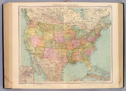
Maps of United States
127-28. Stati Uniti.
1 : 10000000 Touring club italiano
194-195. United States of America. The World Atlas.
1 : 10000000 USSR (Union of Soviet Socialist Republics).
Composite: Vereinigte Staaten v. Nordamerika.
1 : 8000000 Berghaus, Heinrich; Flemming, Carl; Sohr, Karl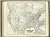
Vereinigten Staaten von N. America.
1 : 8000000 Kiepert, Heinrich, 1818-1899
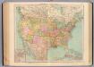
United States of America.
1 : 22000000 Colton, G.W.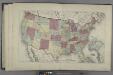
Map of the United States
from Atlas of Madison County, New York : from actual surveys / by and under the direction of D. G. Beers.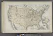
Map of the United States
from County atlas of Cayuga, New York. From recent and actual surveys and records under the superintendence of F. W. Beers.
Continental Map Of North America.
1 : 3041280 Monk, Jacob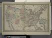
Map of The United States
from Atlas of Franklin County, New York. : From actual surveys and official records.
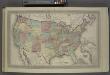
Map of the United States, constructed from the latest authorities / J.H. Young, sc.
from Whole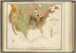
Geol. map U.S.
1 : 10000000 Rogers, Henry Darwin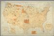
Map showing the location of the Indian reservations within the limits of the United States and territories / compiled from official and other authentic sources, under the direction of the Hon. John D.C. Atkins, Commissioner of Indian Affairs ; Paul Brodi
from Whole
[Vereinigte Staaten von Nord-America und Canada]
Schul-Atlas über alle Theile der Erde nach dem neuesten Zustande, und über das Weltgebäude Stieler, Adolf bei Justus Perthes
Map of the United States, British & Central America : from state documents & unpublished materials
1 : 3540000
A new map of the United States of America
1 : 8750000 Facsimile. "The United States in 1856 as reproduced by Rand McNally & Company to commemorate its one hundredth anniversary in 1956." Relief shown by hachures. Shows railroad routes proposed to the Pacific Ocean. Includes insets: Gold region of California and District of Columbia. Longitude on top of map "West from Greenwich;" on bottom "East/West from Washington." Printed with ornamental border. "Entered according to Act of Congress in the year 1856 by Charles Desilver, in the Clerks office of the District court of the Eastern District of Pennsylvania." Screen reader support enabled. Young, J. H. (James Hamilton) Philadelphia : Published by Charles Desilver, 1856. ([Chicago] : Rand Mcnally 1956)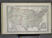
Map of The United States, and Territories. Together with Canada & c. ; Island of Newfoundland
from Atlas of Schuyler County, New York : from actual surveys by and under the direction of Beach Nichols.
Special -Karte der Vereinigten Staaten von Nord - America No 16.
Map of The United States
from Atlas of Wayne County, New York : from actual surveys and official records / compiled & published by D. G. Beers & Co.
North part of America, 1625.
1 : 40000000 Briggs, Henry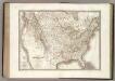
Etats-Unis d'Amerique.
1 : 9300000 Lapie, M. (Pierre), 1779-1850
Map of the United States of America with its territories & districts : including also a part of upper & lower Canada and Mexico.
from Whole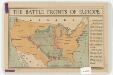
The battle fronts of Europe
1 : 2500000 Map of battle fronts drawn to scale upon a map of the United States showing relative distances of fronts. Roberts & Leete. London : Stanford's Geographical Establishment
Standard American Map.
1 : 3168000 Monk, Jacob
Vereinigte Staaten Von Nordamerika

United States with the contiguous British & Spanish Possessions.
1 : 3801600 Melish, John
Composite: United States with the contiguous British & Spanish Possessions.
1 : 3801600 Melish, John
Map of the United States: with the contiguous British & Spanish possessions / compiled from the latest & best authorities by John Melish; engraved by J. Vallance & H.S. Tanner.
from Whole John Melish; J. Vallance; Henry S. Tanner,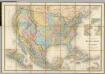
Carte Generale Des Etats.
1 : 7285000 Andriveau-Goujon, E.
United States / Geo. Boynton, sc., Boston.
from Whole