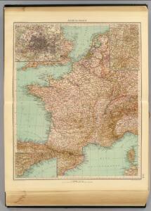
Maps of Metropolitan France

30-31. Francia, France.
1 : 3000000 Touring club italiano
Der Sieg im Westen [Victory in the West]

Carte aéronautique de France
Service Géographique de l'Armée

Gallia IIII. Nova Tabula [Karte], in: Geographia universalis vetus et nova complectens Claudii Ptolemaei Alexandrini enarrationis libros VIII, S. 311.
1 Karte aus Atlas Münster, Sebastian [und Ptolemaeus, Claudius]
Demembrement de l'Empre. de Charlemagne.
1 : 5800000 Houze, Antoine Philippe
Nouvelle carte de poste de tout l'empire Français, de l'Angleterre, de l'Italie, d'une partie de l'Espagne et de l'Allemagne, etc. = Neueste Post Karte vom ganzen Französischen Reiche, England, Italien, und einem Theile von Spanien und Deutschland uzw. / hrsg. und verlegt von J.C. Hinrichs
1 : 2800000 Hinrichs, J. C. Leipzig : Hinrichs
[Historisch-geographischer Atlas zu den allgemeinen Geschichtswerken von C. v. Rotteck, Pölitz u. Becker] : Das Reich Karls des Grossen nach der Theilung seiner Enkel zu Verdun 843
von Julius Loewenberg Lithographie von B. Herder in Freiburg im Breisgau [Freiburg im Breisgau] : [Herder]
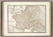
LA FRANCE en 1812
Francie Las Cases, Emmanuel-Auguste-Dieudonné Didot, Pierre Jules Didot Ainé
Nouvelle carte de poste de tout l'empire Français, de l'Anglettere, de l'Italie, d'une partie de l'Espagne et de l'Allemagne etc
Anglie Hinrichs, Johann Conrad J.C. Hinrichs
Carte de la France : divisée en 133 départements et en arrondissements communaux ... / par J.B. Poirson
1 : 1750000 titelvariant: Carte de l'empire Français; Annotatie: Omslagtitel: Carte de l'empire Français Poirson, J. B. Paris : Jean
Gallia IIII. Nova Tabula [Karte], in: Claud. Ptolemaeus. Geographia lat. cum mappis [...], S. 341.
1 Karte aus Atlas Münster, Sebastian [und Ptolemaeus, Claudius]

Frankreich nach der alten und neuen Eintheilung
1 Karte : Kupferdruck ; 28 x 24 cm Sotzmann; Jättnig s.n.
Le royaume de France
1 Karte : Kupferdruck ; 46 x 55 cm Seutter Matthäus Seutter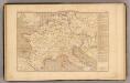
L'Empre. de Charlemagne de 768 a 814.
1 : 5800000 Houze, Antoine Philippe
Jak vzniká mapa

Die Republik und das Kaiserthum Frankreich mit seinen Bundes-Staaten.
1 : 5200000 Spruner von Merz, Karl
Jak vzniká mapa

Francie, Belgie, Nizozemí, Lucembursko
France 1789, 1813.
1 : 3700000 Lapie, M. (Pierre), 1779-1850
Neue Orientierungkarte [von] Frankreich u[nd] Mittelmeerlä[nder]
Francie
Le Royaume De France. [Karte], in: Novus Atlas, das ist, Weltbeschreibung, Bd. 2, S. 18.
1 Karte aus Atlas Blaeu, Joan Blaeu, Willem Janszoon
Tableau l'historie de France.
1 : 8250000 Duval, Henri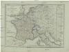
Karte von Frankreich
1 : 4500000 Belgie Mollo, Tranquillo Tranquillo Mollo
Sprachkarte von Frankreich.
1 : 3700000 Berghaus, Heinrich
Jak vzniká mapa
Gallia Transalpina e le sue successive divisioni.
1 : 3030000 Picquet, C.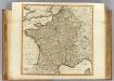
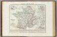
France, departments.
1 : 2300000 Robert Laurie & James Whittle