Maps of New Guinea
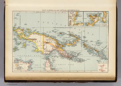
New Guinea, Papuan Archipelago.
1 : 10000000 Andree, Richard; Times (London, England)
335. New Guinea, Solomon Islands. The World Atlas.
1 : 7500000 USSR (Union of Soviet Socialist Republics).
Kaiser-Wilhelmsland, Bismarck-Archipel, Salomon- und Marshall-Inseln
1 : 6000000 Bismarckovo souostroví F.A. Brockhaus' geogr.-artist. Anstalt
Nieuw Guinea en omgeving
1 : 8000000 Annotatie: Vrijgegeven door W.B.N. 29-3 '44 Den Haag : Kompas
Nieuw Guinea / Topografische Dienst
Topografische Dienst Batavia Batavia : Reproductiebedrijf Topografische Dienst
Schetskaart van Nieuw Guinea / Topografische Dienst
Topografische Dienst Batavia Batavia : Reproductiebedrijf Topografische Dienst
Elf kaarten van Nieuw-Guinea / Directie Ned[erlands] Nieuw Guinea, Ministerie van Binnenlandse Zaken
Ministerie van Binnenlandse Zaken 's-Gravenhage . Directie Nederlands Nieuw Guinea ['s-Gravenhage : Staatsdrukkerij]
Vegetatiekaart van Nieuw-Guinea
Topografische Dienst Delft Delft : Topografische Dienst
Schetskaart van Nieuw-Guinea / Topografische Dienst
Topografische Dienst Batavia Batavia : Reproductiebedrijf Topografische Dienst
[Nieuw Guinea] / Topografische Dienst
Topografische Dienst Batavia Batavia : Reproductiebedrijf Topografische Dienst
[Schetskaart van Nieuw-Guinea] / Topografische Dienst
Topografische Dienst Batavia Batavia : Reproductiebedrijf Topografische Dienst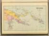
New Guinea & Solomon Islands.
1 : 5105520 Stanford, Edward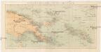
Kolonien (Schutzgebiete) des Deutschen Reichs
1 : 6000000 Marshallovy ostrovy F.A. Brockhaus Geogr.-artist. Anstalt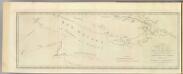
New Britain discoveries.
1 : 4500000 Hawkesworth, John, 1715?-1773
Die deutschen Besitzungen im Stillen Ozean
1 : 3000000 Kiepert, Richard Geographische Verlagshandlung Dietrich Reimer
Západní Irian

Nederlands Nieuw-Guinea / [Netherlands Topographic Service]
Netherlands Topographic Service Delft [Delft : Netherlands Topographic Service]
Kaart van Nederlandsch Nieuw-Guinea en omliggende eilanden / Topographisch Bureau
Topographisch Bureau Batavia Batavia : Topographisch Bureau
Nederlandsch-Nieuw-Guinee
Topographische Inrichting Batavia Batavia : Top[ographische] Inr[ichting]
Kaiser-Wilhelmsland

Kaart van een gedeelte der zuid en zuidwest kust van Nieuw-Guinea : volgens de opnemingen gedaan door Zr. Ms. schepen Dourga, Triton, Sireen en Postillon tusschen de jaren 1826 en 1835 / zamengesteld door Salomon Müller
[S.l. : s.n.]
Kaart van Nederlandsch Nieuw Guinea en de Papoesche Eilanden
[S.l. : s.n.]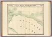
Partie, Nouvelle Guinee. Oceanique no. 23.
1 : 1641836 Vandermaelen, Philippe, 1795-1869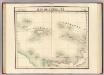
Iles de l'Amiraute. Oceanique no. 24.
1 : 1641836 Vandermaelen, Philippe, 1795-1869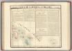
Partie, Nlle. Irlande. Oceanique no. 25.
1 : 1641836 Vandermaelen, Philippe, 1795-1869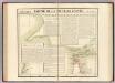
Partie, Nouvelle Guinee. Oceanique no. 30.
1 : 1641836 Vandermaelen, Philippe, 1795-1869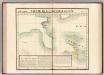
Partie, Nouvelle Guinee. Oceanique no. 31.
1 : 1641836 Vandermaelen, Philippe, 1795-1869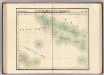
Partie, Iles Salomon. Oceanique no. 32.
1 : 1641836 Vandermaelen, Philippe, 1795-1869
Overzichtskaart van de Residentie Amboina en de Afdeeling Noord-Nieuw Guinea / samengesteld door het Encyclopaedisch Bureau [in] 1915
Encyclopaedisch Bureau Batavia Batavia : G. Kolff & Co.