Maps of Bavaria
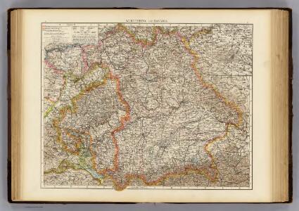
Wurtemberg, Bavaria.
1 : 1000000 Andree, Richard; Times (London, England)
Postkarte von Bayern, Würtemberg und Baden nebst Theilen der angrenzenden Laender
Bavorsko (Německo) Loehle, Franz Franz Loehle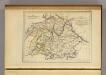
La Baviere, le Wurtemberg, et le Gr. Duche de Bade
1 : 2000000 Malte-Brun, Conrad, 1775-1826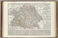
Regni di Baviera, Wurttemberg, Baden, Principati Prussiani.
1 : 2200000 Wieland, C. F.
Chur-Bayern im Jahr 1802
1 Karte : Kupferdruck ; 39 x 43 cm Rheinwald; Herdegen; Leizel s.n.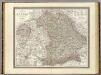
Bayern.
1 : 850000 Weiland, C. F. (Carl Ferdinand), d. 1847
Bayern, Wurtemberg, Baden, Hohenzollern.
1 : 1800000 Reichard, C. G.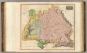
Germany S. of Mayne.
1 : 860000 Thomson, John
Chur-Bayern im Jahr 1804
1 : 1083000 Bavorsko (Německo) Herdegen, J. C. F. Leizel, Balthasar Friedrich J.L.C. Rheinwald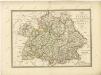

Bayern.
1 : 1390000 Flemming, Carl
Königreich Bayern Bezirksämter 1862
Bayern Bezirksamt Kunz, Andreas ; Johnen, Bettina ; Moeschl, Joachim
Germany Southern.
1 : 1000000 Hall, S. (Sidney)
Königreich Bayern Kreisunmittelbare Städte 1862
Bayern Kreisfreie Stadt Kunz, Andreas ; Johnen, Bettina ; Moeschl, Joachim
Germany.
1 : 1500000 Colton, G.W.
Das Königreich Bayern
1 : 860000 Bavorsko (Německo) Weiland, Karl Ferdinand Gräf, A. Geographisches Institut
Neueste Karte von Bayern Würtemberg, Baden und Hohenzollern
Grosser Hand-Atlas über alle Theile der Erde in 170 Karten Meyer, J. Verlag des Bibliographischen Instituts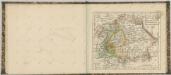

Das Konigreich Bayern
1 : 850000 Weiland, C.F.
Baiern, Wurtemberg, Baden u. Hohenzollern.
1 : 980000 Streit, F. W.

[Koenigreich Baiern, Würtemberg u. Baden]
Neuester Schul-Atlas Walch, Johann im Verlag bei Joh. Walch
Germany No. 3.
1 : 1457280 Colton, G.W.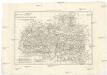
Les cercles de Souabe et de Baviere
1 : 1740000 Bavorsko (Německo) Bonne, Rigobert André
Germany.
1 : 1500000 Colton, G.W.
[Neuer Atlas der ganzen Erde nach den neuesten Bestimmungen ... : XVII.] Die Königreiche Baiern u. Würtemberg, das Grossherzogthum Baden und die Fürstl. Hohenzollernschen Laender
Entworfen und gezeichnet von Dr. F.W. Streit H. Leutemann sc. Leipzig : J.C. Hinrichssche Buchhandlung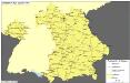
Straßen im Königreich Bayern 1848
Bayern Straßennetz Kunz, Andreas ; Treiling, Thomas
Südwestliches Deutschland
Neuer Handatlas über alle Theile der Erde Kiepert, Heinrich Verlag von Dietrich Reimer
Haupt-Dreiecknetz für das Königreich Bayern
1 : 1000000 Stiglmayer Contur Obernetter Schrift [gravirt] [S.l.] : [s.n.]
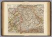
Southern Germany.
1 : 1710720 Fullarton, A. & Co.