Maps of Austria

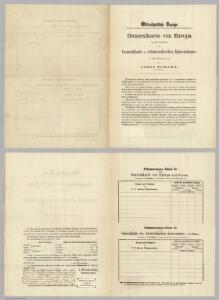
(Order form for) Generalkarte von Europe.
Scheda, Josef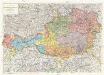
Republik Österreich
1 : 600000 Rakousko Freytag & Berndt A. G.
Karte der Republik Österreich
1 : 1500000 Rakousko Rothaug, Johann Georg Kartogr. Anstalt G. Freytag & Berndt
Übersichtskarte der Republik Österreich
1 : 750000 Rakousko
Oestereichischer Kreis
Allgemeiner Atlas [Walch, Johannes] im Verlag bei Johannes Walch
Karte der Mineralquellen und Kurorte von Österreich
1 : 750000 Rakousko Diem, Karl Knett, Josef Kartographisches, früher Militärgeographisches Institut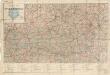
Automobil-Karte der Republik Österreich: Österreichischen Touring-Buch
Austria.
1 : 1220000 Cary, John, ca. 1754-1835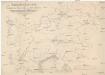
Übersichtskarte der evangelischen Kirche Augsb. und Helv. Confession
1 : 864000 Chorvatsko Strehl, Anton k. k. evangel. Oberkirchenrathe

Autriche
1 : 1000000 Rakousko Čs. voj. zeměp. ústav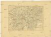
Charte von Oestreich Steyermark, Illyrien und Tyrol
1 : 1600000 Ilýrie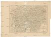
Charte von Oestreich Steyermark Illyrien und Tyrol
1 : 1550000 Ilýrie
[Oesterreich]
Neuester Schul-Atlas Walch, Johann im Verlag bei Joh. Walch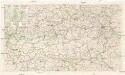
Automobil Übersichtskarte von Österreich
1 : 750000 Rakousko Steyr
[Süd-Östliches Deutschland, Erzherzogth. Oesterreich, Tirol, Illyrien, Steyermark]
Hand-Atlas über alle Theile der Erde nach dem neuesten Zustande und über das Weltgebäude Stieler, Adolf bei Justus Perthes
Nejnovější cestovní mapa zemí aplských

Géographie. croquis n4, Entre Pô et Danube
1 : 1000000 Molard, Jules, Commandant [Paris] : Service Géographique de l'Armée
Kronlander Oesterreich.
1 : 1040000 Flemming, Carl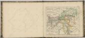
81. Austria. The World Atlas.
1 : 1500000 USSR (Union of Soviet Socialist Republics).
[Süd-Östliches Deutschland]
Hand-Atlas über alle Theile der Erde nach dem neuesten Zustande und über das Weltgebäude Stieler, Adolf bei Justus Perthes
Teutschlandes Oesterreichischer Creiss
1 : 3700000 Mollova mapová sbírka Weigel, Johann Christoph Weigel, Johann Christoph
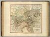
Generalcharte von Oesterreich, Tyrol, Steyermark und Illyrien
1 : 1600000 Horní Rakousko (Rakousko) Schönberg, Johann bey Johann Schönberg
[Süd-Östliches Deutschland nebst einem Theile des nördlichen Italien]
Hand-Atlas über alle Theile der Erde und über das Weltgebäude Stieler, Adolf Justus Perthes
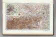
Süd-Östliches Deutschland
Stieler's Hand-Atlas Stieler, Adolf bei Justus Perthes
Die Ostalpenländer
1 : 2750000 Alpenländer Skizzenbuch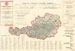
Plan von Wien

Cercle D'Autriche divisé en toutes ses Provinces, tant Civiles qu'Ecclésiastiques
Brion de la Tour, Louis Desnos