Maps of Appennini

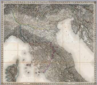
Composite XI, XII, XVI, XVII: Karte Des Oesterreichischen Kaiserstaates.
1 : 576000 Scheda, Josef
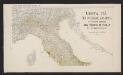
Italy, North Part.
1 : 2500000 Tanner, Henry S.
Karte des Oesterreichisch - ungarischen Reiches

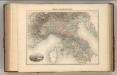
Italie Septentrionale.
1 : 1500000 Vivien St Martin, L.
Italy. North Part.
1 : 2500000 Mitchell, Samuel Augustus
Florenz
1 : 1500000 Itálie severní K. u. k. Militärgeograph. Institute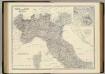
Italy N., central.
1 : 1500000 Johnston, Alexander Keith, 1804-1871
X, uit: General-Karte von Mittel-Europa in 12 Blättern, im Masse 1:1.200.000 / entworfen, bearb. und hrsg. von Josef Schlacher
1 : 1200000 Annotatie: Blad 6 ontbreekt; Annotatie geografische gegevens: 21 maatstokken op blad 9; Legenda op blad 9 Wien : K.K. Militär Geografisches Institut
Italien. Nördliche Hälfte
Italie Septentriole.
1 : 1940000 Migeon, J.
Northern Italy.
1 : 2400000 Colton, G.W.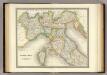
North Italy.
1 : 1950000 Teesdale, Henry
Gallia Cisalpina et Italia Propria
1 : 2200000 Mollova mapová sbírka Weigel, Christoph Weigel, Christoph I.
Italia Superior et Corsica
Schul-Atlas der alten Welt bei Justus Perthes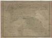
Nördliches Italien
1 : 1480000 Benátky-oblast (Itálie) Weiland, Karl Ferdinand im Verlage des Geograph. Instituts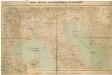
Ober- und Mittel-Italien, Istrien und Dalmatien
1 : 1296000 Bosna a Hercegovina Hartinger, A. Verlag der Wallishausser'schen Buchhandlung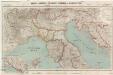
Ober- und Mittel-Italien, Istrien und Dalmatien
1 : 1296000 Bosna a Hercegovina Hartinger, A. Verlag der Wallishausser'schen Buchhandlung
Northern Italy.
1 : 2400000 Colton, G.W.
Northern Italy.
1 : 3168000 Tallis, J. & F.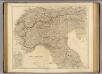
N. Italy, Alps, Apennines.
1 : 1250000 Arrowsmith, John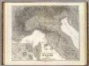
Ober, Mittel-Italien.
1 : 1200000 Kiepert, Heinrich, 1818-1899
Italy. North Part.
1 : 2450000 Tanner, Henry S.
Italy North Part.
1 : 2450000 Tanner, Henry S.
Ober und Mittel Italien
Mortalità per infezione malarica in ciascun comune del Regno d'Italia nei tre anni 1890-91-92
1 : 1000000 Nordblatt R. Stab. Carto-Lit. C. Virano e C
[Historisch-geographischer Atlas zu den allgemeinen Geschichtswerken von C. v. Rotteck, Pölitz u. Becker] : Italien und Spanien zur Uebersicht der Napoleonischen Feldzüge
von Julius Loewenberg [Freiburg im Breisgau] : [Herder]
Carte itinéraire indiquant la marche des armées Françaises en Allemagne et en Italie : faisant suite à la carte en 8 feuilles de L. Capitaine ... / par P.C. Chanlaire
1 : 850000 Annotatie: Overige bl. niet aanwezig Chanlaire, P. C Paris : Dépot de Géographie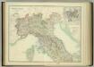
North & Central Italy and Corsica.
1 : 1500000 Johnston, W. & A.K.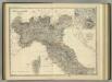
North & Central Italy and Corsica.
1 : 1500000 Johnston, Alexander Keith