Maps of Polynesia
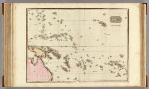
Polynesia.
1 : 15500000 Pinkerton, John, 1758-1826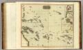
Pacific islands.
1 : 16000000 Thomson, John
(World, gnomonic proj. III. Polynesia)
1 : 5000000 Society for the Diffusion of Useful Knowledge (Great Britain)
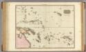
Polynesia.
1 : 50000000 Arrowsmith, Aaron; Lewis, Samuel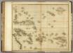
Islands in the Pacific Ocean.
1 : 17500000 Playfair, Principal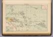
Polynesia.
1 : 30000000 Andree, Richard; Times (London, England)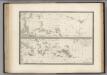
La Polynesie.
1 : 4500000 Levasseur, E.
Polynesia, Or Islands In The Pacific Ocean.
1 : 42000000 Tallis, J. & F.
[West-Polynesien]
Hand-Atlas über alle Theile der Erde nach dem neuesten Zustande und über das Weltgebäude Stieler, Adolf bei Justus Perthes
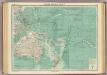
Australien
Schul-Atlas in 36 Karten Völter, Daniel Verlag der J.M. Dannheimer'schen Buchhandlung
3. Atlas des ganzen Erdkreises.
1 : 61000000 Reichard, C. G.
Bez titulu: Mapy kontinentů
South Pacific Ocean.
1 : 25000000 John Bartholomew and Son
Australien (Südland) auch Polynesien oder Inselwelt, insgemein fünfte Welttheil genannt
1 : 22300000 Austrálie Walch, Johann J. Walch
Kompas van het Verre Oosten : bevattende: Aziatisch Rusland, China, Japan, Philippijnen, Nederl. Indië, Molukken, Fransch Indo-China, Noord-Australië en Westelijk Noord-Amerika
1 : 20000000 Den Haag : Kompas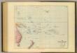
Pacific Islands.
1 : 20000000 Stanford, Edward
Oceanien
Atlas der Geologie Zittel, K.v. ; Berghaus, Hermann Justus Perthes
Australien.
1 : 69000000 Reichard, C. G.
Polynesia.
1 : 95000000 Fenner, Rest.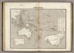
Oceanie.
1 : 28000000 Montemont, A.
Oceanie
1 : 34000000 Malte-Brun, Conrad, 1775-1826
Karte von Australien oder Polynesien
Austrálie in der Weigel und Schneiderschen Handlung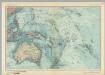
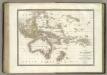
Australia and Oceania. Pergamon World Atlas.
1 : 25000000 Polish Army Topography Service
Distribution of French and German Islands in the Pacific Ocean.
First world war map showing distribution of French and German Islands in the Pacific Ocean. Admiralty War Staff. I.D.
L'Oceanie, divers archipels.
1 : 15700000 Garnier, F. A., 1803-1863
Pacific Ocean : compiled from Admiralty surveys & other official sources
1 : 15000000 India-Rubber, Gutta-Percha & Telegraph Works Co J.D. Potter
No. 1. Pacifico.
1 : 46000000 U.S. Coast and Geodetic Survey
Neuer Atlas der ganzen Erde nach den neuesten Bestimmungen für Zeitungsleser
L'Oceanie.
1 : 29500000 Lapie, M. (Pierre), 1779-1850