Maps of United States

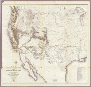
Map Of The Territory Of The United States From The Mississippi To The Pacific.
1 : 3000000 Warren, Gouverneur Kemble, 1830-1882
Map Of The Territory Of The United States From The Mississippi To The Pacific Ocean.
1 : 3000000 Warren, Gouverneur Kemble, 1830-1882
Reduced section, general map, North America, 1795.
1 : 18000000 Winterbotham, W.
Map Of The Territory Of The United States From The Mississippi To The Pacific Ocean.
1 : 3000000 Warren, Gouverneur Kemble, 1830-1882
Map Of The United States.
1 : 6000000 Emory, William H.
Reduced section, map of North America, 1826.
1 : 18000000 Warren, Gouverneur Kemble, 1830-1882
North America, 1710.
1 : 13500000 Senex, John
Reduced section, territory west of Rocky Mountains, 1837.
1 : 18000000 Warren, Gouverneur Kemble, 1830-1882
Composite: U.S. West of Mississippi R.
1 : 2000000 Freyhold, Edward; Warren, Gouverneur Kemble, 1830-1882; United States. Army. Corps of Engineers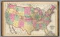
Map of the United States and territories.
1 : 7500000 Lloyd, H.H.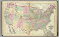
United States.
1 : 7500000 Gray, Ormando Willis; Walling, H. F.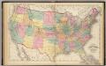
Map of the United States and territories.
1 : 7500000 Walling, H. F.
Map Of The United States.
1 : 13168000 U.S. War Department, Topographical Engineers
Westliches-Nordamerica
Neuer Handatlas über alle Theile der Erde Kiepert, Heinrich Verlag von Dietrich Reimer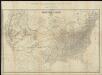
Map of the United States of America = Specialkarte der Vereinigten Staaten von Nord-America
1 : 5000000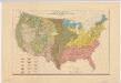
Distribution of the great soil groups (soil provinces)
1 : 8000000 Relief shown by spot heights. Appears in Washington: U.S. Dept. of Agriculture. Atlas of American agriculture, 1936. Soils, plate 2. Marbut, Curtis Fletcher, 1863-1935. Washington, D.C. : Bureau of Chemistry and Soils
Maris Pacifici, America.
Schoner, Johann
Composite: Map of Louisiana and Mexico.
1 : 4300000 Tardieu, P.F.
National Map Of The Territory Of The United States.
1 : 3801600 Keeler, William J.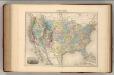
Etats-Unis.
1 : 11700000 Migeon, J.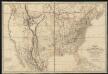
Fredonia or the United States of North-America : including also Cabotia, or the Canadian provinces; the Western Territory to the Pacific Ocean; and the northern part of the Mexican States
1 : 5700000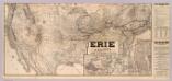
Erie Railway and connections.
1 : 8826000 New York, Lake Erie, and Western Railroad Company
Military map of the United States
1 : 5000000 Freyhold, Edward United States. War Dept.
United States and Contiguous Territories: Federal Reserve Districts, Commercial Airways, Highways, and Railroads.
1 : 17398000 Hammond, C.S.
Railroad map of the United States to accompany the "Commercial travellers guide book".
From Whole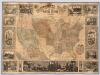
Pictorial Map Of The United States.
1 : 6336000 Ensigns & Thayer
United States Of North America.
1 : 6336000 Stanford, Edward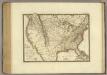
Etats-Unis, Canada.
1 : 9600000 Brue, Adrien Hubert, 1786-1832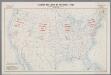
Standard time zones of the United States and adjacent parts of Canada and Mexico as of April 1, 1930
1 : 7000000 [Washington, D.C.] : U.S. Department of Commerce [etc.]