Maps of Mediterranean Sea
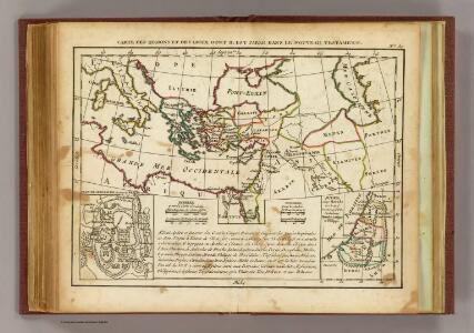
Regions, lieux dans le Nouveau Testament.
1 : 18000000 Delamarche, Charles Francois
Nouveau Testament, regions, lieux.
1 : 10200000 Bonne, Rigobert, 1727-1794
I. Osmanisches Reich bis 1683
1 : 28000000 Osmanisches Reich Expansion
Zuid-oostelijk oorlogsterrein
1 : 6000000 Annotatie geografische gegevens: Op de kaart zijn vestingen en forten aangegeven 's-Gravenhage : Smulders
Uebersichts-Karte des Russisch - Türkischen Kriegsschauplatzes
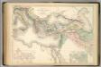
Principal Countries of the Ancient World.
1 : 7100000 Hughes, William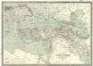
Carte générale de l'Empire Ottoman en Europe et en Asie
1 : 3000000 osmanská říše Kiepert, Heinrich D. Reimer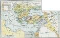
Osmanisches Reich bis 1683
1 : 18000000 Osmanisches Reich Expansion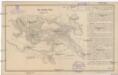
Das türkische Reich
Afrika severní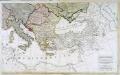
Carte generale de toute l'Europe, 3
2 Blätter : 56 x 90 cm J.M. Will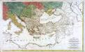
Carte générale de toute l'Europe, 2
2 Blätter : 57 x 93 cm T.C. Lotter
Osmanisches Reichs.
1 : 11800000 Radefeld, Carl Christian Franz, 1788-1874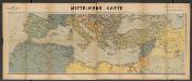
Metzer karten der Mittelmeer Raum
1 : 5950000 Metzer Verlagsanstalt Metz : Metzer Verlagsanstalt
L’Europe Nord-Orientale au 5e siècle avant notre ère, d’après Hérodote
Europa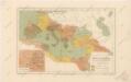
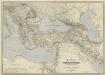
Říše římská ve své největší rozsáhlosti
General-Karte des Türkischen Reiches in Europa und Asien nebst Ungarn, Südrussland, den kaukasischen Ländern und West-Persien
1 : 3000000 entworfen und bearb. von Heinrich Kiepert Stich und Druck der lithographischen Anstalt von L. Kraatz Berlin : Reimer
A map of the eastern part of the Roman empire
1 Karte : Kupferdruck ; 39 x 42 cm s.n.
Carte de l’Empire des Goths, au 4e siècle de notre ère, à l’époque de l’arrivée des Huns et de leurs établissements entre l’Oural et le Don
Russland Ural Don Gotenreich Völkerwanderungszeit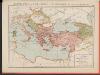
L'Empire Grec à la mort de Basile le Bulgarochtone et sous ses Héritiers
Byzantinisches Reich Basileios II.
Übersichts - Karte des Türkischen Reichs in Europa und Asien
II. Rückgang des Osmanischen Reichs (Orientalische Frage) seit 1683
1 : 28000000 Osmanisches Reich
Mediterranean Sea E.
1 : 9000000 Andree, Richard; Times (London, England)
Mittelmeerlander ostliche.
1 : 9000000 Andree, Richard
Osmanisches Reich und seine Schutzstaaten im XVIIten Jahrhundert
1 : 9000000 Osmanisches Reich Protektorat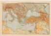
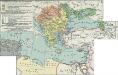
Východní Středomoří
Kuchař, Karel
Turquia asiàtica / Ramon Alabern lo grabó
1 mapa. Datat al 1850 aproximadament. Alaber, Ramon
Das osmannische Reich, XVIIten Jahrhundert.
1 : 9200000 Spruner von Merz, Karl
Asia occidental I
1 mapa. Datat al s.XIX. 0 Gras y compañia, editores. Madrid
Regna succesorum Alexandri Magni
1 : 9400000 Asie jihozápadní Spruner, Karl von Alt, Wilhelm Justus Perthes