Maps of United States Minor Outlying Islands
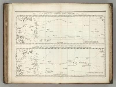
Pacific Ocean between California and the Philippine Islands.
1 : 25400000 La Perouse, Jean-Francois de Galaup, comte de, 1741-1788
Mer du Sud, entres les Philippines, Californie.
1 : 20000000 La Perouse, Jean-Francois de Galaup, comte de, 1741-1788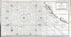
Carte de la mer du Sud ou mer Pacifique
1 Karte : Kupferdruck ; 27 x 54 cm Lattré Nyon
Goffstown, Hillsborough Co.
1 : 26000 D.H. Hurd & Co.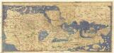
Charta rogeriana
Afrika Al-Idrísí Miller, Konrad Konrad Miller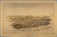
Birds eye view of the city of San Francisco.
From California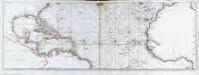
Océan atlantique et mers adjacentes, 2
2 Blätter : 47 x 135 cm Le Rouge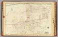
Scarsdale.
1 : 3600 Bromley, George Washington; Bromley, Walter Scott; G.W. Bromley & Co.
Hillsborough Bridge P.O.
D.H. Hurd & Co.
Lisbon, Littleton.
1 : 4800 D.H. Hurd & Co.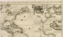
Carte tres curieuse de la mer du Sud, contenant des remarques nouvelles et tres utiles non seulement...
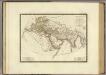
Monde connu des anciens.
1 : 25000000 Brue, Adrien Hubert, 1786-1832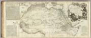
Africa, with all its states, kingdoms, republics, regions, islands, &ca. (northern section)
1 : 8400000 Boulton, S.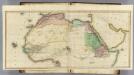
(Africa N sheets)
1 : 11200000 Lizars, Daniel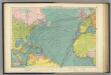
North Atlantic Ocean.
1 : 20000000 Philip, George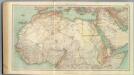
109-11. Africa nord.
1 : 10000000 Touring club italiano
Province of Nova Scotia (Island of Cape Breton). Sheet no. 20.
1 : 63360 Geological Survey of Canada
N. Africa, S. Africa.
Thomson, John
Mauritania, Morocco, Algeria, Tunisia, Libya, United Arab Republic, Chad, Sudan. Pergamon World Atlas.
Polish Army Topography Service
The unique map of California.
From California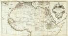
Afrique nord.
1 : 8300000 Anville, Jean Baptiste Bourguignon d, 1697-1782
Karte von Africa
Afrika Robert de Vaugondy, Didier Alberti, Ignaz F.A. Schraembl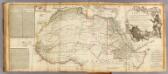
Africa (north)
1 : 8300000 Robert Laurie & James Whittle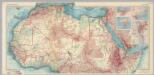
Africa - North. Pergamon World Atlas.
1 : 10000000 Polish Army Topography Service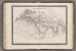
Monde Connu des Anciens.
1 : 34000000 Monin, C.V.
Monatskarte für den Nordatlantischen Ozean
1 : 10700000 Atlantský oceán (oblast) Eckardt & Messtorff
Chart shewing the tracks across the north Atlantic ocean of don Christopher Columbus
Atlantský oceán Toquet, H. Raban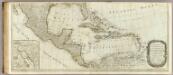
(A new map of North America, with the West India Islands. Southern section)
1 : 5300000 Pownall, Thomas
Empire de la Porte ottomane en Europe, en Asie et en Afrique avec les pays qui lui sont tributaires
1 : 9000000 Lotter Family (Augsburg, Germany) Frères Lotter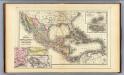
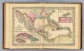
Mexico, Central America, West Indies.
1 : 12000000 Mitchell, Samuel Augustus
Cuba.
1 : 3300000 Mitchell, Samuel Augustus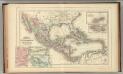
Mexico, Central America, West Indies.
1 : 12000000 Mitchell, Samuel Augustus Jr.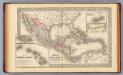
Mexico, Central America, West Indies.
1 : 12000000 Mitchell, Samuel Augustus