Maps of United States
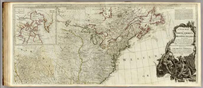
A new map of North America, with the West India Islands (northern section).
1 : 5300000 Pownall, Thomas
New map of ye north parts of America.
1 : 17300000 Moll, Herman, d. 1732
An Accurate Map Of North America. (Northern section)
1 : 5400000 Jefferys, Thomas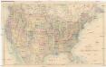
Stanford's General Map of the United States
1 : 5274720 Spojené státy americké Stanford, Edward Edward Stanford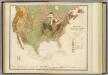
Geol. map U.S.
1 : 10000000 Rogers, Henry Darwin
The traveller's guide : a new and correct map of the United States, including great portions of Missouri Territory, Upper & Lower Canada, Nova Scotia, New Brunswick, the Floridas, Spanish provinces &c. / collected and compiled from the most undoubted aut
from Whole
Carte générale des États-Unis de l'Amérique avec les plans des principales villes
1 : 7500000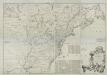
A map of the British and French dominions in North America : with the roads, distances, limits, and extent of the settlements, humbly inscribed to the Right Honourable the Earl of Halifax, and the other Right Honourable the Lords Commissioners for Trade
from Parts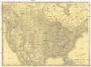
Rand McNally new official railroad map of the United States and southern Canada
1 : 5258880 Kanada Rand McNally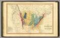
Geol. map US.
1 : 15000000 Simpkin & Marshall
Map Of The United States, British & Central America.
1 : 3540000 Rogers, Henry Darwin
The United States of America at the time of the ratification of the Constitution, from original maps in the American Geographical Society of New York
1 : 6860480 Map of the United States, with 4 maps of "Claims and cessions of western lands, 1776-1802." In upper margin: "The United States of America at the time of ratification of the Constitution, from original maps in the American Geographical Society of New York and the Library of Congress at Washington. Issued by the United States Sesquicentennial Commission". Include decorative title cartouche and historical notes. Relief shown by hachures. Prime meridian is Philadelphia. Series: "This map is one of a series of similar colored maps, depicting the 13 original states, from New Hampshire to Georgia at the time of the formati John, Mitchel, 1711-1768 Washington, D.C. : United States Constitution Sesquicentennial Commission, [Washington, D.C.] : U.S. Geological Survey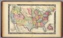
Map Of The United States, And Territories.
1 : 10137600 Mitchell, Samuel Augustus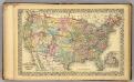
U.S., Canada.
1 : 10000000 Williams, W. (Wellington)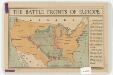
The battle fronts of Europe
1 : 2500000 Map of battle fronts drawn to scale upon a map of the United States showing relative distances of fronts. Roberts & Leete. London : Stanford's Geographical Establishment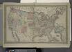
Map of The United States
from Atlas of Franklin County, New York. : From actual surveys and official records.
Composite: Amerique Septentrionale.
1 : 6300000 Anville, Jean Baptiste Bourguignon d, 1697-1782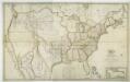
Map of the United States with the contiguous British & Spanish possessions / compiled from the latest & best authorities by John Melish; engraved by J. Vallance & H.S. Tanner.
from Whole John Melish; J. Vallance; Henry S. Tanner,
Map of the United States and Texas / engraved by C. Copley, New York.
from Whole
Ètats-Unis de l'Amérique septentrionale avec les Isles Royale, de Terre Neuve, de St. Jean, l'Acadie &c.
from Charts and maps Chez Delamarche, géogr.: Paris; Delamarche, Charles François,
Ètats-Unis de l'Amérique septentrionale avec les Isles Royale, de Terre Neuve, de St. Jean, l'Acadie &c.
from John H. Levine Collection Chez Delamarche, géogr.: Paris; Delamarche, Charles François,
Vereinigte Staaten
1 : 10000000 Nové Skotsko Elfert, Paul Geogr. anstalt von Wagner & Debes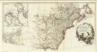
Amerique Septentrionale. (Northern section).
1 : 6300000 Anville, Jean Baptiste Bourguignon d, 1697-1782
Map of the United States, British & Central America : from state documents & unpublished materials
1 : 3540000
A new map of the north parts of America claimed by France under ye names of Louisiana, Mississipi, Canada and New France, with ye adjoyning territories of England and Spain ... / by H. Moll, geographer, 1720.
from Charts and maps Herman Moll,
A new map of the north parts of America claimed by France under ye names of Louisiana, Mississipi, Canada and New France, with ye adjoyning territories of England and Spain ... / by H. Moll, geographer, 1720.
from Charts and maps Herman Moll,
Die Vereinigten Staaten von Nord-America.
1 : 8000000 Bromme, Traugott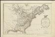
A map of the United States and Canada, New-Scotland, New-Brunswick and New-Foundland = Carte des Etats-Unis, avec le Canada, la Nouvelle Ecosse, le Nouveau Brunswick & Terre-Neuve
1 : 6500000 dressée par Lapie gravé par P. A. F. Tardieu ; écrit par J. J. Pachoux Paris [etc.] : P.A.F. Tardieu [etc.]
Etats-Unis de l'Amerique en 1860.
1 : 12000000 Garnier, F. A., 1803-1863