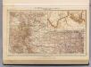
Maps of Oklahoma

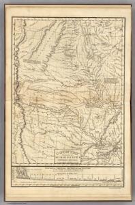
Country drained by the Mississippi Western Section.
1 : 4752000 Long, Stephen H.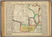
Map Of Arkansas Territory.
1 : 4752000 Lea, I.
State of Kansas, and Nebraska and Indian Territories.
1 : 3000000 Colton, G.W.
Nebraska And Kansas.
1 : 3850000 Colton, J. H.
Nebraska and Kansas.
1 : 3850000 Colton, J. H.
Map of an exploring expedition to the Rocky Mountains in the year 1842 and to Oregon & north California in the years 1843-44 / by Brevet Capt. J.C. Frémont of the Corps of Topographical Engineers under the orders of Col. J.J. Abert, Chief of the Topog...
From Parts
Kansas, and Nebraska and Indian Territories.
1 : 3000000 Colton, G.W.
Map of Kansas, Nebraska, and Colorado. Showing also the eastern portion of Idaho.
from New general atlas.
Map showing the lands assigned to emigrant Indians west of Arkansas & Missouri / prepared at the Topographical Bureau Feby. 23d, 1836, [by] R. Jones, Adj. Gene.
from Parts
Nebraska and Kansas.
1 : 3850000 Colton, J. H.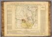
Arkansas.
1 : 4700000 Buchon, J. A. C.; Carey, H. C.; Lea, I.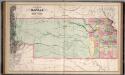
A New Map of Kansas.
1 : 1457280 Mitchell, Samuel Augustus
Nebraska, Kansas, New Mexico, and Indian Territories
1 : 6600000 Mitchell, Samuel Augustus
Nebraska, Kansas, New Mexico, and Indian Territories
1 : 6600000 Mitchell, Samuel Augustus
Indian Territory, Northern Texas and New Mexico.
1 : 3600000 Gregg, Josiah, 1806-1850
Nebraska And Kanzas.
1 : 4800000 Colton, G.W.
Map Of The States Of Kansas And Texas And Indian Territory.
1 : 1500000 U.S. War Department
Nebraska And Kansas.
1 : 4942080 Johnson, A.J.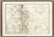
Carte Generale Du Royaume De La Nouvelle Espagne.
1 : 3000000 Humboldt, Alexander von, 1769-1859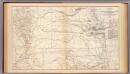
Kansas, Texas, Indian Territory.
1 : 1900000 United States. War Department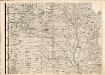
A Map of the British Empire in America. (Sheet 5).
1 : 2000000 Popple, Henry
Indian Terr., N. Texas, N.M.
1 : 3500000 Morse, Sidney E. (Sidney Edwards), 1794-1871
Nebraska and Kansas.
1 : 3850000 Colton, J. H.
U.S.A. Great Plains South, Plate 109, Vol. V
1 : 2500000 Bartholomew, John
Kan., Neb., Colo.
1 : 4000000 Mitchell, Samuel Augustus
Post route map of the states of Kansas and Nebraska : showing post offices with the intermediate distances and mail routes in operation on the 1st of December, 1900 / published by order of Postmaster General Charles Emory Smith under the direction of A.
from Parts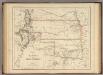
Territory of Kansas And Indian Territory.
1 : 3453120 Rogers, Henry Darwin
Nebraska. Oklahoma.
1 : 1665000 Hammond, C.S.
Indian Territory (Oklahoma). Nebraska.
1 : 1497000 Gray, Ormando Willis