Maps of Peloponnese, West Greece and Ionian Sea

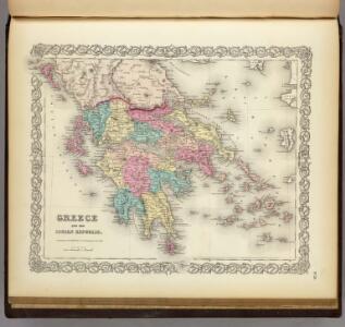
Greece And The Ionian Republic.
1 : 1584000 Colton, G.W.
Greece and the Ionian Republic.
1 : 2000000 Colton, G.W.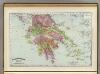
Greece.
1 : 1470000 Rand McNally and Company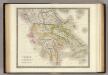
Greece.
1 : 1425000 Teesdale, Henry
Griechenland und die Jonischen Inseln
Schul-Atlas in 36 Karten Völter, Daniel Verlag der J.M. Dannheimer'schen Buchhandlung
Greece and the Ionian Republic.
1 : 2000000 Colton, G.W.
Greece and the Ionian Republic.
1 : 1500000 Colton, G.W.
[Griechenland]
1 : 1000000 Athény (Řecko : oblast)
Das Königreich Hellas
1 : 1000000 Řecko Bosse, P. Debes, E. Geograph. Anstalt von Wagner & Debes
Greece and the Ionian Republic.
1 : 1500000 Colton, G.W.
Griechenland und die Jonischen Inseln mit Beachtung der Klassischen Zeit
Hand-Atlas über alle Theile der Erde nach dem neuesten Zustande und über das Weltgebäude Stieler, Adolf bei Justus Perthes
Griechenland.
1 : 1400000 Flemming, Carl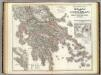
Hellas, Ionischen Inseln.
1 : 800000 Kiepert, Heinrich, 1818-1899
Griechenland und die Jonischen Inseln mit Beachtung der Klassischen Zeit
Hand-Atlas über alle Theile der Erde nach dem neuesten Zustande und über das Weltgebäude Stieler, Adolf bei Justus Perthes
Königreich Hellas oder Griechenland
1 : 1000000 Athény (Řecko : oblast) Kiepert, Heinrich Dietrich Reimer
Griechenland
1 : 2300000 Řecko F. A. Brouckaus' Geogr.-artist. Anstalt
Griechenland
1 : 3000000 Foiníkie Eduard Hölzel
Das Königreich Hellas oder Griechenland und die Republik der Seiben Ionischen Inseln (Ephtánisos)
Řecko Kiepert, Heinrich Herzberg, H. Verlag des Geographischen Instituts
Königreich Griechenland
1 : 1600000 nach den neuesten und besten Hülfsmitteln entworfen und gezeichnet von C.F. Weiland. Weimar : im Verlage des Geograph. Instituts
Grece Ancienne.
1 : 1800000 Migeon, J.
Griechenland mit Beachtung der Klassischen Zeit
Stieler's Hand-Atlas Stieler, Adolf bei Justus Perthes
Greece.
1 : 1800000 Migeon, J.
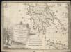
Graeciae antiquae et adjacentis partim Asiae Minoris tabula geographica
1 : 2810000 Malá Asie Berra, Marco Marco Berra
Greece. (with) inset maps of Corfu and Stampalia.
1 : 1647360 Tallis, J. & F.

Griechenland
1 : 3000000 Libanon Kocen, Blaž Eduard Hölzel
Griechenland und der Griechisch-Türkische Archipel
Handatlas über alle Theile der Erde und über das Weltgebäude Stieler, Adolf Justus Perthes
Graecia Antiqua
1 : 2900000 Mellish, John
Graeciae Antiquae specimen geographicum.
1 : 1020000 Anville, Jean Baptiste Bourguignon d, 1697-1782