Maps of Northern European Plain
Sheets 79,81. (Cary's England, Wales, and Scotland).
1 : 360000 Cary, John, ca. 1754-1835
Nieuwe pascaert van de Oost cust van Schotlandt : beginnende van Barwyck tot aen de Orcades Ylanden
1 : 700000 Annotatie: Uit (krt. 24): Nieuwe groote lichtende zee-fakkel ... - Amsterdam : Gerard Hulst van Keulen, 1782 Amsterdam : Iohannes van Ceulen
Charte von England und Wallis, 2
1 Blatt : 62 x 53 cm Walch
Karte von England und Wallis, 2
1 Blatt : 63 x 54 cm Schrämbl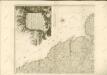

England & Wales NE.
1 : 633600 Stanford, Edward
England I.
1 : 765000 Society for the Diffusion of Useful Knowledge (Great Britain)
Sheets 77-78. (Cary's England, Wales, and Scotland).
1 : 360000 Cary, John, ca. 1754-1835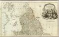
England and Wales (Northern section)
1 : 675000 Rocque, John
Carte des iles britanniques ou Royaume-Uni de la Grande Bretagne et d'Irlande, 2
2 Blätter : je 50 x 39 cm
L'Angleterre, Galles.
1 : 1460000 Andriveau-Goujon, J.
Composite: England, Wales.
1 : 675000 Rocque, John
Grossbritannien. Nordliches Blatt: Schottland U. Der Nordlichste Theil England's.
1 : 1500000 Petermann, A.
delineation of the strata of England and Wales, with part of Scotland
Übersichtskarte Smith, William Cary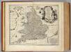
South Britain, or England and Wales.
1 : 2170000 Bowen, Emanuel
Palaeontological Map of the British Islands
The physical atlas Johnston, Alexander Keith William Blackwood & Sons
England.
1 : 1200000 Kiepert, Heinrich, 1818-1899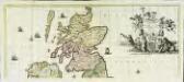
Nova totius Angliæ, Scotiæ, et Hiberniæ, tabula, 1
2 Blätter : 43 x 103 cm Danckerts
England and Wales.
1 : 2860000 Higgins, W.M.
Anglia II. Nova Tabula [Karte], in: Geographia universalis vetus et nova complectens Claudii Ptolemaei Alexandrini enarrationis libros VIII, S. 305.
1 Karte aus Atlas Münster, Sebastian [und Ptolemaeus, Claudius]
Angliae Regni Florentissimi Nova Descriptio [...] [Karte], in: Theatrum orbis terrarum, S. 36.
1 Karte aus Atlas Ortelius, Abraham
Partie, l'Angleterre. Europe 7.
1 : 1641836 Vandermaelen, Philippe, 1795-1869
[Schotland mit der Nördlichen Spitze von England]
Hand-Atlas über alle Theile der Erde nach dem neuesten Zustande und über das Weltgebäude Stieler, Adolf bei Justus Perthes
[Schotland mit der Nördlichen Spitze von England]
Stieler's Hand-Atlas Stieler, Adolf bei Justus Perthes
Paskaert van een gedeelte vande Noort Zee Streckende Van Harwitz en Egmon tot Stavanger [...] [Karte], in: De Nieuwe Groote Vermeerderde Zee-Atlas ofte Water-Werelt, S. 17.
1 Karte aus Atlas Doncker, Hendrick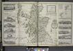
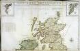
The north part of Great Britain called Scotland.
from The world described, or, A new and correct sett of maps : shewing the kingdoms and states in all the known parts of the earth, with the principal cities, and most considerable towns in the world ... / ... by Herman Moll, geographer ...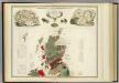
Geological, palaeontological map British Islands.
1 : 1550000 Johnston, Alexander Keith, 1804-1871
RAF map of Danger Areas in the United Kingdom (Permanent sites)
Great Britain War Office General Staff Geographical Section Ordnance Survey
BRITANNIA | prout divisa suit temporibus | ANGLO-SAXONVM [...].
[Amsterdam : Joan Blaeu]