Maps of Denmark

Denmark.
1 : 840000 Arrowsmith, John
Post Karte von Daenemark nach Meilen
Dánsko Hallberg, von Santjohanser, N.
Daenemark, Island.
1 : 875000 Weiland, C. F. (Carl Ferdinand), d. 1847
[Neuer Atlas der ganzen Erde nach den neuesten Bestimmungen ... : XIII.] Der Daenische Staat und die Gebiete der freien Städte Hamburg und Lübeck
Entworfen und gezeichnet von Dr. F.W. Streit H. Leutemann sc. Leipzig : J.C. Hinrichs'sche Buchhandlung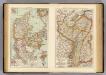
Denmark, Alsace-Lorraine, Palatinate.
1 : 1500000 Andree, Richard; Times (London, England)
Daenemark, Schleswig-Holstein u. Lauenburg.
1 : 1000000 Stein, Christ. Gottfr. Dan.
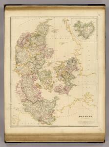
Denmark.
1 : 1800000 Darton, William
Denmark, Sleswig, Holstein.
1 : 823680 Stanford, Edward
Danemark.
1 : 1290000 Migeon, J.
Danemark, Schleswig, Holstein, Lauenburg.
1 : 1500000 Flemming, Carl
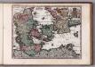
[DANIA REGNUM in quo sunt ducatus HOLSATIA et SLESVICUM INSULAE DANICAE et PROVINCIAE IUTIA, SCANIA, BLEKINGIA ET HALLANDIA]
1 : 1050000 Dánsko Wit, Frederick de F. de Wit
Regni Daniae in quo sunt ducatus Holsatia et Slesvicum, insulæ Danicæ provinciæ Iutia Scania Blekingia nova tabula
1 Karte : Kupferdruck ; 47 x 55 cm Homann Johann Baptist Homann
Regni Daniae in quo sunt ducatus Holsatia et Slesvicum, insulæ Danicæ provinciæ Iutia Scania Blekingia nova tabula
1 Karte : Kupferdruck ; 47 x 56 cm Homann; Hübner Johann Baptist Homann
Regni Daniae in quo sunt ducatus Holsatia et Slesvicum insulæ Danicæ provinciæ Iutia Scania Blekingia nova tabula
1 Karte : Kupferdruck ; 47 x 56 cm Homann; Hübner Johann Baptist Homann
Daniae regnum cum ducatu Holsatiae et Slesvici nec non insulae Danicae et Iutia cum parte Scaniae
1 : 941000 Dánsko Lotter, Tobias Conrad studio Tobiae Conradi Lotteri
Charte des Königreichs Daenemark, nach Murdochischer Projection und nach den trigonometrischen Charten der König
1 : 919000
Karte von dem Koenigreiche Daenemark
1 : 1000000 Dánsko Reilly, Franz Johann Josef von Franz Ioh. Ios. von Reilly
Daenemark
Schul-Atlas in 36 Karten Völter, Daniel Verlag der J.M. Dannheimer'schen Buchhandlung
Regni Daniae in quo sunt ducatus Holsatia et Slesvicum insulae Danicae provinciae Iutia Scania Blekingia nova tabula
1 : 1100000 Dánsko Homann, Johann Baptist
Regni Daniae, in quo sunt ducatus Holsatia et Slesvicum, insulae Danicae, provinciae Iutia Scania Blekingia etc. nova tabula
1 : 1100000 Dánsko Homann, Johann Baptist â Io. Baptista Homanno
Regni Daniae, in quo sunt ducatus Holsatia et Slesvicum, insulae Danicae, provinciae Iutia Scania Blekingia etc. nova tabula
1 : 1100000 Dánsko Homann, Johann Baptist â Io. Baptista Homanno
REGNI DANIAE, in quo sunt DUCATUS HOLSATIA ET SLESVICUM, INSULAE DANICAE, PROVINCIA IUTIA SCANIA BLEKINGIA &c. Nova Tabula
1 : 1100000 Dánsko Homann, Johann Baptist a Io. Baptista Homanno
Denmark.
1 : 1400000 Hughes, William
Dänemark mit Schleswig, Holstein
Dánsko
Regni Daniae
1 : 1129000 Dánsko Visscher, Nicolaus per Nicolaum Visscher
REGNI DANIAE, Novißima et accuratißima TABULA
1 : 1130000 Dánsko Visscher, Nicolaus per Nicolaum Visscher
Pas-Caarte van't Schager-Rack, De Sondt en de Belt. [Karte], in: De Nieuwe Groote Vermeerderde Zee-Atlas ofte Water-Werelt, S. 21.
1 Karte aus Atlas Doncker, Hendrick
Dänemark, Schleswig, Holstein u. Lauenburg, nebst den Dänischen Colonien
Hand-Atlas über alle Theile der Erde und über das Weltgebäude Stieler, Adolf Justus Perthes