Maps of Sweden

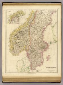
Sweden, Norway.
1 : 2200000 Arrowsmith, John
Schweden und Norwegen
1 : 3340000 Norsko Weiland, Karl Ferdinand Bürck Geograph. Institut
Shweden und Norwegen
Švédsko Seutter, Matthäus Zatta, Antonio
Schweden und Norwegen
1 : 3342000 Norsko Weiland, Karl Ferdinand Geograph. Institut
Schweden und Norwegen
Norsko Güssefeld, Franz L. Berra, Marco Marco Berra
Karta öfver Sverige och Norrige
1 : 4200000 [S.l.] : [s.n.]
Post Karte von Schweden und Norwegen nach Meilen
Norsko Hallberg, von Santjohanser, N.
Statistikk 44: Norge. Kart over pendleromland
1 : 1000000
Norge 3: Norgesavelingen 3. Geometrisch Declineation af Trundhems så och en Deel af de angänsende Akershus og Bergenhus Læhn.
J. Jürgens
55-56. Scandanavia, South. The World Atlas.
1 : 2500000 USSR (Union of Soviet Socialist Republics).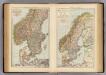
S. Scandinavia, Norway, Sweden.
1 : 4000000 Andree, Richard; Times (London, England)
Allgemeine Postkarte von Schweden und Norwegen zur Uebersicht
Norsko Ponheimer, Kilian im von Reillyschen Landkarten und Kunstwerke Verschleiss Komptoir
Ice Chart, Baltic Sea, October.
U.S. Navy
Ice Chart, Baltic Sea, June.
U.S. Navy
Ice Chart, Baltic Sea, March.
U.S. Navy
Ice Chart, Baltic Sea, April.
U.S. Navy
Norway.
1 : 4170000 Hughes, William
Scandanavie Flle. S.
1 : 2500000 Vivien St Martin, L.
Statistikk 3 Kart over upplæringsmålet i folkeskulen
1 : 1000000 Peder Hovdan Noregs Mållag
Ice Chart, Baltic Sea, January.
U.S. Navy
Ice Chart, Baltic Sea, February.
U.S. Navy
Ice Chart, Baltic Sea, May.
U.S. Navy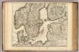
Courones du Nord (sud)
1 : 2600000 L'Isle, Guillaume de, 1675-1726
Karte von dem Königreiche Norwegen
1 : 1470000 Norsko Reilly, Franz Johann Josef von Stöber, Joseph von Franz Ioh. Ios. von Reilly
Ice Chart, Baltic Sea, December.
U.S. Navy
Ice Chart, Baltic Sea, November.
U.S. Navy
Geological Map of the Pre-Quaternary Systems of Sweden
1 : 1500000 Švédsko Törnebohm, A. E. The Geological Survey of Sweden
Norgesavdelingen 156: Noregr - Det gamle Norge før Aar 1500
1 : 1500000 Gerhard Munthe
Regni Norvegiæ accvrata tabvla
1 Karte : Kupferdruck ; 57 x 48 cm Homann Johann Baptist Homann