Maps of Turkey
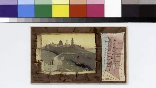
Palestine.
From [Series of advertising cards issued by Arbuckle Bros. Coffee Company, each consisting of a map of a country of the world with related illustrations.]

L'Empire Grec en 1190 et l'Hellenisme pendant l'occupation latine de Constantinople [Nebenkarte]
Byzantinisches Reich Lateinisches Kaiserreich Konstantinopel Hellenismus Kümmerly & Frey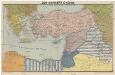
Der vordere Orient
1 : 2750000 Blízký východ List & von Bressensdorf
[Klein-Asien & Syrien, Nebst den Westlichen Theilen von Armenien, Kurdistan & Mesopotamien]
Handatlas über alle Theile der Erde und über das Weltgebäude Stieler, Adolf Justus Perthes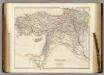
Turkey in Asia.
1 : 3484800 Arrowsmith, John
88-89. Turchia, Siria, Palestina.
1 : 3000000 Touring club italiano
Die asiatische Türkey
Schul-Atlas in 36 Karten Völter, Daniel Verlag der J.M. Dannheimer'schen Buchhandlung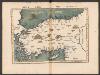
Tabula Nova Asie Minoris [Karte], in: Claudii Ptolemei viri Alexandrini mathematice discipline philosophi doctissimi geographie opus [...], S. 269.
1 Karte aus Atlas Waldseemüller, Martin [und Ptolemaeus, Claudius] Übelin, Georg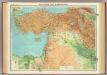
Asia Minor, Syria & Mesopotamia.
1 : 4000000 John Bartholomew and Son
Klein Asien.
1 : 5670000 Radefeld, Carl Christian Franz, 1788-1874
Egypte, Syrie Phoenicie et Asie Mineure.
1 : 5400000 Monin, C.V.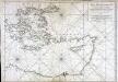
Carte de la mer Mediterranée, 3
1 Blatt : 51 x 74 cm s.n.
Egypte, Syrie, Asie Mineure.
Andriveau-Goujon, J.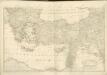
Dritter Theil der Karte von Europa welcher das südliche Russland Polen und Ungarn die europæische, und beinahe die ganze asiatische Türkei enthælt, 2
1 Blatt : 54 x 84 cm F.A. Schrämbl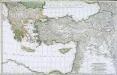
Troisième partie de la carte d'Europe contenant le midi de la Russie, la Pologne et la Hongrie, la Turquie y compris celle d'Asie presqu'entière, 2
1 Blatt : 53 x 84 cm chez l'auteur
Karte von Klein Asien
Grosser Hand-Atlas über alle Theile der Erde in 170 Karten Meyer, J. Verlag des Bibliographischen Instituts
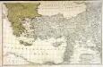
Klein-Asien & Syrien nebst den westlichen Theilen von Armenien, Kurdistan & Mesopotamien
Hand-Atlas über alle Theile der Erde und über das Weltgebäude Stieler, Adolf Justus Perthes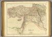
Turkey in Asia.
1 : 3440000 Arrowsmith, John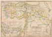
Empire Ottoman : division administrative
1 : 1500000 Huber, R F. Loeffler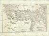
[Balkán a Malá Asie]
1 : 2850000 Balkánský poloostrov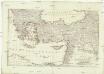
[Balkán a Malá Asie]
1 : 2850000 Balkánský poloostrov
Klein-Asien & Syrien Nebst Den Westlichen Theilen Von Armenien, Kurdistan & Mesopotamien.
1 : 3700000 Petermann, A.
Colonia romana, Tabula geographica provinciarum et urbium.
1 : 5000000 L'Isle, Guillaume de, 1675-1726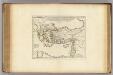
Colonia Romana, Tabula Geographica Provinciarum et Urbium.
1 : 5000000 L'Isle, Guillaume de, 1675-1726
Turkey in Asia.
1 : 5800000 Mitchell, Samuel Augustus
Turkey in Asia.
1 : 5800000 Mitchell, Samuel Augustus
Turkey in Asia.
1 : 6000000 Tanner, Henry S.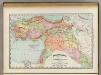
Turkey in Asia.
1 : 7603200 Rand McNally and Company
Turkey In Asia.
1 : 5900000 Mitchell, Samuel Augustus
Turkey In Asia.
1 : 6000000 Tanner, Henry S.