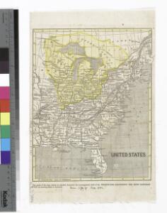
Maps of Central Lowland

United States.
from Whole
United States / drawn & engraved by J. Rapkin ; illustrations by J. Marchant & engraved by J. Rogers.
from Whole
United States of America.
from Charts and maps
Wyld's Military Map Of The United States.
1 : 4500000 Wyld, James, 1812-1887
United States or Fredon / H.G. Spafford, del. ; G. Fairman sc.
from General geography, and rudiments of useful knowledge. In nine sections ... Illustrated with an elegant improved plate of the solar system ... a map of the world ... of the United States ... and several engravings on wood. Digested on a new plan, and designed for the use of schools. By H. G. Spafford.
Accurata delineatio celeberrimae Regionis Ludovicianae vel Gallice Louisiane
1 : 12000000 Rogg, Gottfried, 1669-1742
A new map of ye north parts of America claimed by France : under ye names of Louisiana, Mississipi, Canada & New France with the adjoyning territories of England & Spain / By H. Moll, geographer.
from Charts and maps
A general map of North America : from the latest observations / J. Lodge sculp.
from The Constitutions of the several independent states of America; the Declaration of independence; the Articles of confederation between the said states; the treaties between His Most Christian Majesty and the United States of America. With an appendix, containing an authentic copy of the treaty concluded between Their High Mightinesses the States-General and the United States of America, and the provisional treaty. Pub. by order of Congress. Philadelphia printed. London reprinted, with an advertisement by J.L. de Lolme.
Map of the United States and Texas / engraved by C. Copley, New York.
from Whole

The course of the River St. Laurence : from Lake Ontario, to Manicouagan Point ; United States of America.
from St. Lawrence River
The United States of North America : with the British territories and those of Spain, according to the treaty of 1784 / engrav'd by Wm. Faden.
from John H. Levine Collection
Accurata delineatio celeberrimae regionis Ludovicianae vel Gallice Louisiane ot. Canadae et Floridae adpellatione in Septemtrionali America: descriptae quae hodie nomine fluminis Mississippi vel St. Louis per colonias et navigationes Gallorum ob immensas opes et adfluentiam magis magisque inclarescit ex fide digniss.
from John H. Levine Collection s.n.: [Augspurg]; Rogg, Gottfried; Seutter, Matthaeus,
Map of the United States and Canada : shewing Captn. Hall's route through those countries in 1827 & 1828 / engraved on steel by W.H. Lizars.
from Parts
Map of the United States : drawn from the most approved surveys.
from Whole

Etats Unis.
1 : 10000000 Vivien St Martin, L.
Carte générale de l'Amérique séptentrionale: avec les posséssions Angloises dans cette partie du nouveau monde / dressée sur la carte de Pople [sic], publiée à Londres en 20 feuilles, pour servir à l'intelligence de la guerre présente.
from Whole Henry Popple,
A map of the British Empire in America: with the French, Spanish and Hollandish settlements adjacent thereto / by Henry Popple; I. Condet s.
from John H. Levine Collection Henry Popple; I. Condet s.,
Amerique septentrionale: suivant la carte de Pople faite à Londres en 20 feuilles.
from Charts and maps Par et chez le Sr. le Rouge ...: Paris; Lawson, Oscar A.; Le Rouge, Georges-Louis,
America Septentrionalis A Map of the British Empire in America.
1 : 11000000 Popple, Henry
Composite: British Empire in America.
1 : 2000000 Popple, Henry
America Septentrionalis. A Map of the British Empire in America.
1 : 11000000 Popple, Henry
United States / Geo. Boynton, sc., Boston.
from Whole
American Continent: United States, British Possessons, West Indies, Mexico, Central America
1 : 4435200 Rosa, R.
Verein-Staaten Von Nord-America, Mexico, Yucatan U. A.
1 : 13400000 Stulpnagel, F.v.
Map of the United States of North America / compiled from the latest and most authentic information by David H. Vance ; engraved by J.H. Young.
from Whole
A map of the United States including Louisiana / by Wm. Darby ; engraved by Jas. D. Stout.
from Whole
United States with the contiguous British & Spanish Possessions.
1 : 3801600 Melish, John
Composite: United States with the contiguous British & Spanish Possessions.
1 : 3801600 Melish, John