Maps of South America

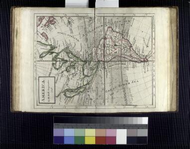
America / by H. Moll, geographer, 1726.; A set of thirty-two new and correct maps of the principal parts of Europe, &c.: with the great or post-roads, and principal cross-roads, done in the year 1725, 1726 and 1727: all except four, viz. England, Scotland, Ireland, and a general map of Turky in Europe, which have been done and printed before ... / all done according to the latest observations, by Herman Moll, geographer.
from A set of thirty-two new and correct maps of the principal parts of Europe, &c. : with the great or post-roads, and principal cross-roads, done in the year 1725, 1726 and 1727 : all except four, viz. England, Scotland, Ireland, and a general map of Turky in Europe, which have been done and printed before ... / all done according to the latest observations, by Herman Moll, geographer. Moll, Herman,
America.
1 : 75000000 Moll, Herman, d. 1732
La America
1 Karte : Kupferdruck ; 45 x 51 cm s.n.
America
Amerika Verlage des Kunst und Industrie Comptoirs
Tableau général de l'Amérique
1 Karte : Kupferdruck ; 35 x 44 cm, Gesamtgrösse 52 x 72 cm Brion de la Tour; Le Père; Avaulez chez le Pere et Avaulez m.ds d'estampes rue St. Jaque à la ville de Rouen
Amerique
1 Karte : Kupferdruck ; 51 x 63 cm Crépy chez chez Crepy rue St. Jacques a St. Jacques
Carte nouvelle d'Amerique
1 Karte : Kupferdruck ; 26 x 36 cm Philippe de Prétot; Moithey; Vallet Nyon
L'Amerique
1 Karte auf 2 Blatt : Kupferdruck ; 70 x 98 cm Bonne; Lattré chez Lattré grav. ord. du roi de M. le duc d'Orléans et de la ville rue St. Jacques
Recentissima novi orbis sive Americæ septentrionalis et meridionalis tabula
1 Karte : Kupferdruck ; 48 x 57 cm Wit; Ottens; Ottens ex officina R. et I. Ottens
Novissima et accuratissima septentrionalis ac meridionalis Americæ
1 Karte : Kupferdruck ; 42 x 53 cm Wit ex officina I. Cóvens et C. Mortier
Novissima et accuratissima septentrionalis ac meridionalis Americæ
1 Karte : Kupferdruck ; 48 x 56 cm Wit F. de Wit excudit
Novissima et accuratissima totius Americæ descriptio
1 Karte : Kupferdruck ; 48 x 56 cm Danckerts Justus Danckerts
Novissima et accuratissima totius Americæ descriptio
1 Karte : Kupferdruck ; 48 x 56 cm Wit F. de Wit excudit
America
1 Karte : Kupferdruck ; 48 x 59 cm Valck; Valck G. und L. Valck
Amerika Historisch, Physisch und Politisch vom Jahr 1828
Historisch-genealogisch-geographischer Atlas von Le Sage Las Cases, Emmanuel Auguste Dieudonné Marius Joseph de Johann Velten, Kunsthändler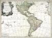
L'Amerique divisée en ses principaux etats
1 Karte : Kupferdruck ; 46 x 64 cm Janvier; Lattré; Choffard chés Lattré graveur rue St. Jacques au coin de celle de la parcheminerie à la ville de Bordeaux
Americae mappa generalis
1 Karte : Kupferdruck ; 45 x 51 cm Haas; Böhme Homännische Erben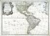
L'Amerique divisée en ses principaux etats
1 Karte : Kupferdruck ; 45 x 62 cm Janvier; Santini; Remondini chez Mr. Remondini
Amérique ou Indes occidentales
1 Karte : Kupferdruck ; 49 x 51 cm, Gesamtgrösse 50 x 65 cm Robert de Vaugondy; Delahaye; Delamarche; Groux chez le Sr. Delamarche géographe rue du Foin St. Jacques au collège de M.tre Gervais
L'Amérique septentrionale et meridionale
1 Karte : Kupferdruck ; 48 x 51 cm, Bildgrösse 48 x 64 cm Robert de Vaugondy; Delahaye; Gobin; Sanson; Sanson Gilles Robert de Vaugondy quay de l'Horloge proche le Pont-neuf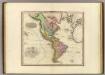
America.
Tanner, Henry S.
Carte d'Amerique
Amerika Delisle, Guillaume Condet, Johannes Covens & Mortier & Covens junior
Continent Américan carte physique
Vidal de La Blache, Paul
America
Hand-Atlas über alle Theile der Erde nach dem neuesten Zustande und über das Weltgebäude Stieler, Adolf bei Justus Perthes
America
Hand-Atlas über alle Theile der Erde nach dem neuesten Zustande und über das Weltgebäude Stieler, Adolf bei Justus Perthes
America
1 : 25000000 Amerika Schmidt, Johann Marius Friedrich Franz Simon Schropp
The World on Mercator's projection, western part.
1 : 40000000 Pinkerton, John, 1758-1826
L'Amerique
1 Karte : Kupferdruck ; 48 x 62 cm Charlevoix; Le Rouge; La Condamine chez Le Rouge rue des gr.s Augustins
L'Amerique
1 Karte : Kupferdruck ; 48 x 62 cm Charlevoix; Crépy; La Condamine; Crépy chez Crepy rue S. Jacque à S. Pierre près la rue de la parcheminerie