Maps of New York

New York.
1 : 2787840 Morse, Jedidiah
A map of the state of New York / J. Roper, sc.
J. Roper,
A chorographical map of the province of New-York in North America, divided into counties, manors, patents and townships : exhibiting likewise all the private grants of land made and located in that Province / compiled from actual surveys deposited in the
from Whole
The provinces of New York, and New Jersey : with part of Pensilvania and the province of Quebec / drawn by Major Holland, Surveyor General of the Northern District in America ; corrected and improved, from the original materials, by Governr. Pownall, Mem
from Charts and maps
State of New York with part of the adjacent States.
1 : 633600 Eddy, John H.
A map of the state of New York : compiled from the latest authorities, including the turnpike roads now granted as also the principal common roads connected therewith
1 : 1350000 McCalpin, William
A map of the State of New York
1 : 950000 De Witt, Simeon
Rome, Watertown and Ogdensburg Railroad.
1 : 5514850 Rome, Watertown & Ogdensburg Railroad Company
Map of the state of New York : compiled from the latest authorities.
from Whole
New York, Vermont, New Hampshire, Rhode Island, Massachusetts & Connecticut.
1 : 1570000 Black, Adam & Charles
Map of the meetings constituting New York Yearly Meeting of Friends.
from Whole
New York / by H.S. Tanner.
from Whole Henry S. Tanner,
The Empire State, New York: with its counties, towns, cities, villages, internal improvements &c. / drawn & engraved by J. H. Young.
from Whole J. H. Young,
Map of the state of New York: showing the boundaries of counties & townships, the location of cities, towns and villages, the courses of rail roads, canals & stage roads / by J. Calvin Smith; engraved on steel by Sherman & Smith.
from Whole J. Calvin Smith; Sherman & Smith,
Map of the state of New York: showing the boundaries of counties & townships, the location of cities, towns and villages, the courses of rail roads, canals & stage roads / by J. Calvin Smith; engraved on steel by Sherman & Smith.
from Whole J. Calvin Smith; Sherman & Smith,
New York / by H.S. Tanner; engraved ... by H.S. Tanner.
from Whole Henry S. Tanner,
The state of New York from the most recent surveys.
from Whole Published by E. Huntington: Hartford, Conn.; Huntington, Eleazar,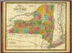
State of New York.
1 : 1330560 Mitchell, Samuel Augustus
The tourist's map of the state of New York: compiled from the latest authorities in the Surveyor General's office / engraved by Balch, Stiles & Co., N. York.
from Whole Balch, Stiles & Co.,,
Map of the state of New-York with part of the states of Pennsylvania, New-Jersey, &c. / compiled, corrected & published from the most recent authorities and accurate surveys by Amos Lay, 1817.
from Parts Amos Lay,
New York.
1 : 2700000 Lewis, Samuel
A map of the State of New York / by Simeon De Witt, Surveyor General.
from Charts and maps Simeon De Witt,
The state of New York : with part of the adjacent states / by John H. Eddy, geographer, New York, 1818 ; engraved by Tanner, Vallance, Kearny & Co., Philadelphia.
from Whole
Neueste Karte von New York mit seinen Canaelen, Strassen, Eisenbahnen, Entfernungen der Hauptpunkte und Routen für Dampfschiffe
Grosser Hand-Atlas über alle Theile der Erde in 170 Karten Meyer, J. Verlag des Bibliographischen Instituts
[Map of part of New York State between Albany and Buffalo : showing Erie Canal and other transportation routes] / D.W. Wilson, sc. Albany.
from (A-Z)
Map of the state of New York : showing the boundaries of counties & townships, the location of cities, towns and villages, the courses of rail roads, canals & stage roads / by J. Calvin Smith ; engraved on steel by Sherman & Smith.
from Whole
New York / W. Barker, sculp.; Carey's American pocket atlas; containing nineteen maps... with a brief description of each state.
from Carey's American pocket atlas; containing nineteen maps... with a brief description of each state. Carey, Mathew; Sweitzer, Henry,
Map of the state of New York / by Simeon De Witt, surveyor general ; engraved by G. Fairman.
from Whole
The state of New York with part of the adjacent states
1 : 633600 Eddy, John Hartshorne James Eastburn & Co.