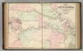
Maps of Dorchester County

A map of Virginia : formed from actual surveys, and the latest as well as most accurate observations / by James Madison, D.D., president of Wm. & Mary College. ; drawn by Wm. Davis ; engraved by Fred. Bossler, Richmd.
From Charts and maps
A map of Virginia : formed from actual surveys and the latest as well as the most accurate observations / by James Madison ; drawn by Wm. Davis ; with extensive additions and corrections to the year 1818.
from Charts and maps
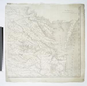
Map of part of Virginia, Maryland and Delaware from the best authorities
1 : 400000 Heyne, Charles E. & G.W. Blunt (Firm)
Strategic War Points of the United States no.3: the country round the Chesapeake and the Potomac to Washington
Strategic War points of the United States no.3: the country round the Chesapeake and the Potomac to Washington J. Wyld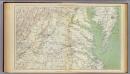
Gen. map II.
1 : 633600 United States. War Department
A map of Virginia and Maryland
1 : 1150000 Speed, John Basset, Thomas
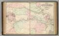
Der amerikanische Kriegsschauplatz zwischen Washington und Richmond
1 : 1000000 Richmond (Virginie) Petermann, August Debes, Ernst Justus Perthes
Seat of War in America
Seat of War in America. Published by Bacon & Co. in London, Seat of the War in America shows the region between Baltimore and Petersburg and the placement of troops and fortifications along the border between the Confederacy and the Union. It is notable how many batteries are placed around the Confederate capital of Richmond, as well as marking out the railway lines that connected the region. At the top of the map are publishing adverts for Colton productions, as well as a list of the Union and Confederate generals and a table detailing export amounts in 1860, with cotton being the largest figure. Bacon & Co.
A Chart of the Chesapeake And Delaware Bays
1 : 354816 Lucas, Fielding Jr.
Maryland.
1 : 1774080 Scott, Joseph
A Chart of the Chesapeake And Delaware Bays.
1 : 354816 Lucas, Fielding Jr.
A map and chart of those parts of the Bay of Chesapeak, York and James rivers which are at present the seat of war / Jno. Lodge, sc.
from Revolutionary War, 1775-1783
Bird's-eye view of the Seat of War
Bird's-eye view of the Seat of War, arranged after the latest Surveys. This Bird’s Eye View of the Seat of War, published by Prang, displays the region around the Chesapeake Bay and Potomac River, showing Washington, D.C., Baltimore, Harper’s Ferry, Richmond, Manassas Junction (Bull Run), Fort Monroe and Norfolk Harbour. The map also details railroad lines. It is possible to see a drawing of the Capitol building where Washington, D.C. is labelled. L. Prang & Co.
A draught of Virginia from the Capes to York in York River ....
from English pilot. The fourth book.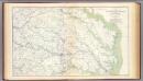
SE Virginia, Ft. Monroe.
1 : 316800 U.S. War Department, Topographical Engineers
(Seat of the Civil War - Virginia).
1 : 412000 Schonberg & Co.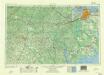
Norfolk
1 : 250000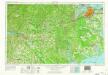
Norfolk
1 : 250000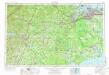
Norfolk
1 : 250000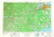
Norfolk
1 : 250000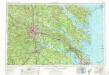
Richmond
1 : 250000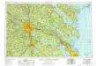
Richmond
1 : 250000
Richmond
1 : 250000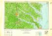
Richmond
1 : 250000
Richmond
1 : 250000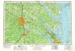
Richmond
1 : 250000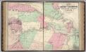
Vicinity of Richmond, and Peninsular Campaign in Virginia (American Civil War).
1 : 189000 Johnson, A.J.
Map of the seat of war. Published by T.A. Burke
1 : 800000 Howell, R. H.
Übersichts-Karte zum Feldzuge 1864 und 1865 in Virginien
Vicinity of Richmond.
1 : 180000 Johnson, A.J.