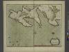
Maps of Argentia
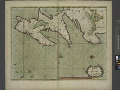
A new chart of the trading part of NEW FOUND LAND
from The sea-atlas : containing an hydrographical description of most of the sea-coasts of the known parts of the world.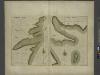
HARBOR GRACE part of new found land; BAY BULLS part of new found land
from The sea-atlas : containing an hydrographical description of most of the sea-coasts of the known parts of the world.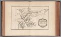
Carte des bayes, rades, et port de Plaisance dans l'isle de Terre-Neuve
1 : 61392 Bellin, Jacques Nicolas, 1703-1772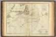
A Chart Of The Banks Of Newfoundland
1 : 2200000 Jefferys, Thomas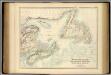
British North America. Sheet I, East.
1 : 2407680 Fullarton, A. & Co.
Limits under fishery treaties, 1818 and 1888
1 : 2800000 Roberts, A. C., cartographe 18..-.... [Washington, D.C.] : Hydrographic Office, Navy Department, USA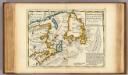
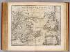
New Found Land, St. Laurence Bay, Acadia, New Scotland.
1 : 4800000 Moll, Herman, d. 1732
A new & correct map of the Isles of New Foundland, Cape Breton &c. with the provinces of Nova Scotia / J. Gibson sculp.
1 : 4000000 Annotatie: Uit: The American gazetteer ... - London : A. Millar ; [etc.], 1762 Gibson, John (fl. 1762) [London : A. Millar] [etc.]
Newfoundland.
1 : 1204000 Rand McNally and Company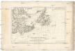
Isle et banc de Terre-Neuve, Isle Royale et Isle St. Jean, avec l'Acadie ou la Nouvelle Ecosse
1 : 5560000 Akádie Bonne, Rigobert André
Newfoundland.
1 : 1584000 Stanford, Edward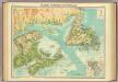
Maritime Provinces & Newfoundland.
1 : 2500000 John Bartholomew & Co.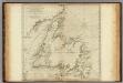
A General Chart Of The Island Of Newfoundland.
1 : 1280000 Jefferys, Thomas
Southeast Canada.
1 : 1550000 Colton, G.W.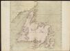
A general chart of the island of Newfoundland with the rocks & soundings
1 : 1280000
Map of Newfoundland.
1 : 3900000 Morse, Jedidiah
Le Isole di Terra Nuova e Capo Breton Di Nuova Projezione.
1 : 2100000 Zatta, Antonio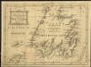
A new map of the only useful and frequented part of New Found Land
1 : 2800000
Nova Scotia And Newfoundland.
1 : 4300000 Tallis, J. & F.
New Brunswick, Nova Scotia, Newfoundland, and Prince Edward Id.
1 : 3484800 Colton, G.W.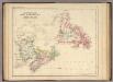
Newfoundland, New Brunswick, Nova Scotia, Cape Breton & Prince Edward Is.
1 : 3453120 Rogers, Henry Darwin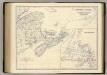
Canada E.
1 : 2065500 Johnston, Alexander Keith, 1804-1871
New Brunswick, Nova Scotia, Newfoundland. and Prince Edward Id.
1 : 3294720 Johnson, A.J.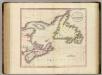
Nova Scotia, Newfoundland, &c.
1 : 2350000 Cary, John, ca. 1754-1835
New Brunswick, Nova Scotia, Newfoundland, and Prince Edward Island.
1 : 3301000 Colton, G. Woolworth
New Brunswick, Nova Scotia, Newfoundland. Prince Edward Island.
1 : 3300000 Colton, G.W.
A Map of the British Empire in America. (Sheet 4).
1 : 2000000 Popple, Henry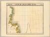
Partie, Ile de Terre Neuve. Amer. Sep. 37.
1 : 1641836 Vandermaelen, Philippe, 1795-1869
A Map of the British Empire in America. (Sheet 8).
1 : 2000000 Popple, Henry