Maps of Portugal
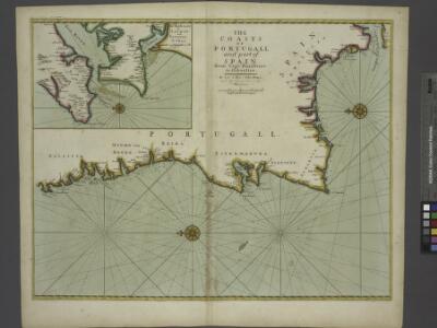
The coasts of PORTUGALL and part of SPAIN from cape finifterre to Gibralter
from The sea-atlas : containing an hydrographical description of most of the sea-coasts of the known parts of the world.
Spain & Portugal - western section.
1 : 2000000 John Bartholomew and Son
Le Portugal et ses rontieres avec l'Espagne / par ordre de M. le duc de Choiseul par le Sr. Bellin
1 Mapa, b/n. Datació aproximada. Bellin, Jacques Nicolas Dépôt de la Marine
Hispaniæ, et Portugalliæ maritimi tractus, à S. Andero, ad Malagam
1 Karte : Kupferdruck ; 47 x 56 cm Renard Louis Renard
Carte de la Peninsule Hispanique.
1 : 2750000 Vivien de St Martin, L.
Carte réduite des costes d'Espagne et de Portugal
1 Karte : Kupferdruck ; 87 x 54 cm Bellin s.n.
Carte nouvelle et curieuse du royaume d'Espagne / C. Inselin, 1
1 Blatt : Inselin
[132][135] Hispaniae, et Portugalliae Maritimi tractus, uit: Atlas sive Descriptio terrarum orbis
Annotatie: Gedigitaliseerde versie. Amsterdam. Heiloo : Picturae (vervaardiger), 2015. tiff-bestand. Gedigitaliseerd: 07-01-2015; Origineel: Universiteitsbibliotheek Vrije Universiteit (XL.05127.-) ; Netherlands; Titelpagina ontbreekt Wit, Frederik de Amsterdam : Frederick de Wit
Neueste Karte von Portugal
Grosser Hand-Atlas über alle Theile der Erde in 170 Karten Meyer, J. Verlag des Bibliographischen Instituts
Portugall.
from A new systeme of the mathematicks: containing I. Arithmetick, as well natural and decimal, as in species, or the principles of algebra. II. Practical geometry, together with the first six books of Euclid's Elements, as also the eleventh and twelfth, symbo
Mapa dos reynos de Portugal e Algarve
1 Karte : Kupferdruck ; 58 x 41 cm Lattré; Rizzi-Zannoni; Marillier; Berthault en casa de M. Lattré
Les frontieres d'Espagne et de Portugal
1 Karte : Kupferdruck ; 57 x 42 cm Fer; Starckman chez l'auteur dans l'isle du Palais sur le quay de l'orloge a la sphere royale
Portugalliae et Algarbiae regna
1 : 1740000 Algarve (Portugalsko) Seutter, Matthäus cura et studio Matthaei Seutteri
Portugal, Algarve.
1 : 1250000 Robert Laurie & James Whittle
Spanien westliche Hälfte
Grosser Hand-Atlas über alle Theile der Erde in 170 Karten Meyer, J. Verlag des Bibliographischen Instituts
Portugallia et Algarbia quae olim Lusitania. [Karte], in: Le théâtre du monde, ou, Nouvel atlas contenant les chartes et descriptions de tous les païs de la terre, Bd. 2, S. 219.
1 Karte aus Atlas Blaeu, Willem Janszoon und Blaeu, Joan Blaeu, Willem Janszoon
Portugalliæ et Algarbiæ regna
1 Karte : Kupferdruck ; 48 x 56 cm Seutter Matthäus Seutter
Portugalliæ et Algarbiæ cum finitimis Hispanniæ regnis
1 Karte : Kupferdruck ; 48 x 54 cm Homann Johann Baptist Homann
Spanien west.
1 : 2350000 Radefeld, Carl Christian Franz, 1788-1874
Portugalliæ et Algarbiæ regna
1 Karte : Kupferdruck ; 45 x 55 cm Visscher Nicolaes Visscher
El reyno de Portugal subdividido en muchas provincias
1 Karte : Kupferdruck ; 67 x 50 cm Longchamps en casa del autor, en casa del Barthelmy
Portugalliae et Algarbiae Regna / per Nicolaum Visscher
1 : 1500000 Annotatie: Cum privilegio ordinum Hollandiæ et West-Frisiæ; Origineel is Blad 6 in atlas factice; Annotatie geografische gegevens: Met 3 schaalstokken; Legenda Nicolaes Jansz. Visscher jr. 1649-1702 [Amsterdam : Nicolaes Visscher]
39-40. Spagna, Portogallo ouest.
1 : 1500000 Touring club italiano
Nova regni Portugalliæ et Algarbiæ descriptio
1 Karte : Kupferdruck ; 49 x 58 cm La Feuille; Ottens; Ottens apud Jaco.m de la Feuille
Portugalliae et Algarbiae Regna
1 : 1500000 per Nicolaum Visscher [Amsterdam] : nunc apud Petrum Schenk Junior
Royaume de Portugal
1 Karte : Kupferdruck ; 32 x 42 cm Mentelle; Tardieu E. Mentelle
Karte von den Königreichen Portugal und Algarbien
1 Karte : Kupferdruck ; 48 x 33 cm Sotzmann; López; Ramberg; Rizzi-Zannoni; Büsching; Jefferys s.n.
Portugallia et Algarbia quae olim Lusitania. [Karte], in: Novus Atlas, das ist, Weltbeschreibung, Bd. 2, S. 228.
1 Karte aus Atlas Blaeu, Joan Blaeu, Willem Janszoon
Portugal.
1 : 915000 Pinkerton, John, 1758-1826
(Portugal)
1 : 7500000 Bruyset, Jean-Marie; Schneider, J. H.