Maps of Nassau County
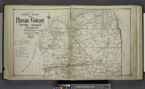
Upper section Index Map of Nassau County Long Island Published by E. Belcher Hype. 97 Liberty St. Brooklyn, 5 Beekman St. Manhattan. 1914.
from Atlas of Nassau County, Long Island, N.Y. Complete in one volume. Historical, statistical. Based upon maps on file at the county seat in Mineola and upon private plans and surveys furnished by surveyors and individual owners. Supplemented by careful measurements & field observations by our own corps of engineers.
Birds Eye View Map Of New York And Vicinity.
1 : 80033 Hammond, C.S.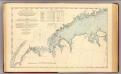
N.Y.-Norwalk Is.
1 : 80000 United States Coast Survey
Plate 32: Town of Oyster Bay.
from Atlas of Queens Co., Long Island, New York / compiled from official records, private plans & actual surveys by and under the direction of Chester Wolverton.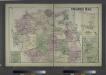
Oyster Bay, Queens Co. - Lattingtown, Town of Oyster Bay. - East Norwich, Town of Oyster Bay. - Oyster Bay Harbor, Town of Oyster Bay.
from Atlas of Long Island, New York. From recent and actual surveys and records.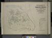
Index map to Vol. 3; Atlas of the Borough of Queens Third Ward city of New York. Published by E. Belcher Hyde; 97 Liberty St., Brooklyn Borough. 1904.
from Third ward: Flushing.
Plate 24: Northern part of Town of Yonkers, adjacent to the River.
from Atlas of New York and vicinity : from actual surveys / by and under the direction of F. W. Beers, assisted by A. B. Prindle & others
Oyster Bay
1 : 62500
Oyster Bay
1 : 62500
Oyster Bay
1 : 62500
Oyster Bay
1 : 62500
Oyster Bay
1 : 62500
Oyster Bay
1 : 62500
Oyster Bay
1 : 62500
Oyster Bay
1 : 62500
Oyster Bay
1 : 62500
Oyster Bay
1 : 62500
Oyster Bay
1 : 62500
Oyster Bay
1 : 62500
Oyster Bay
1 : 62500
Oyster Bay
1 : 62500
Oyster Bay
1 : 62500
Oyster Bay
1 : 62500
Oyster Bay
1 : 62500
General map of the city of New York, consisting of boroughs of Manhattan, Brooklyn, Bronx, Queens and Richmond : consolidated into one municipality by act of the legislature of the state of New York (Chapter 378 of the laws of 1897) : showing in addition
from Whole
Index to the Topographical survey sheets of the borough of the Bronx easterly of the Bronx River.
from Topographical survey and new street system of the borough of the Bronx, easterly of the Bronx River
Map of Queens Borough, City of New York.
From Queens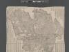
Street Indexed map of the Borough of Queens, also showing the Congressional Districts.
From Queens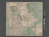
New Map of the Borough of the Bronx, City of New York . . . Circular stickers mark Carnegie Library sites.
From Bronx