Maps of Argentina
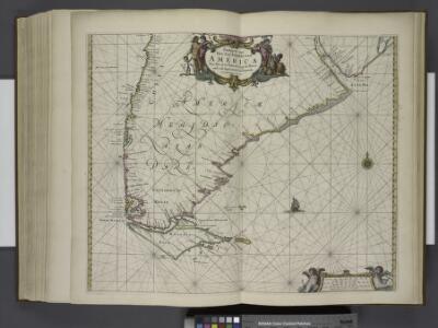
Paskaarte van het zuydelijckste van America, van Rio de la Plata tot Caap de Hoorn, ende inde Zuyd Zee, tot B. de Koquimbo.
from De zee-atlas ofte water-wereld : waer in vertoont werden alle de zee-kusten van het bekende des aerd-bodems : seer dienstigh voor alle heeren en kooplieden, als oock voor alle schippers en stuurlieden / by Pieter Goos.
Map of Chili, Patagonia, La Plata, part of Brasil.
1 : 18000000 Moll, Herman, d. 1732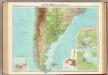
South America - southern section.
1 : 10000000 John Bartholomew and Son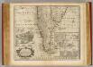
Chile, Terra del Fuego &c.
1 : 11000000 Bowen, Emanuel
Carte du Paraguay, du Chili, du Detroit de Magellan &c.
1 : 93442
United Provinces, Chili & Patagonia.
1 : 16473600 Burr, David H., 1803-1875
United Provinces, Chili, Patagonia.
1 : 18000000 Grigg, John
Patagonie, Detroit de Magellan, Terres Australes.
1 : 6000000 Garnier, F. A., 1803-1863
Typus Geographicus Chili & Paraguay
1 : 9000000 Esta es una adaptación de la empresa Homann Heirs (también es conocida como Homann Erben, o herederos de Homann, en castellano) de diversos mapas del cono sur de América publicados en Francia a principios del siglo XVIII. Incluye un plano de la ciudad de Santiago de Chile. La empresa Homann Heirs fue creada tras la muerte de Johann Baptiste Homann (1664-1724), famoso Geógrafo del Sacro Imperio Romano Germánico. A mediados del siglo XVIII la empresa estaba dirigida por el geógrafo Johann Michael Franz y por el grabador Johann Georg Ebersberg hijastro de Johann Baptiste Homann. La empresa funcionó en Núremberg hasta 1848 produciendo múltiples obras de geografía, atlas y mapas. Homann Erben (Empresa) L'Isle, Guillaume de (1675-1726)
Mapa de la Republica Argentina
1 : 8500000 Oficina meteorologica nacional. Buenos Aires [Buenos Aires] : Tall. de la Officina Meteorologica
Buenos Ayres, Chili & Patagonia.
1 : 14000000 Greenleaf, Jeremiah
United Provinces, Chili & Patagonia.
1 : 14000000 Greenleaf, Jeremiah
South America (southern sheet).
1 : 8989200 Johnston, W. & A.K.
South America (southern sheet).
1 : 8989200 Johnston, Alexander Keith
A map of Chili, Patagonia, La Plata and ye south part of Brasil
1 : 18000000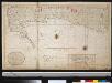
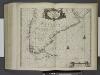
Het zuijdelijkste gedeelte van Brazilia van Rio de La Plata tot Caap de Hoorn of door de Straat van Magalanüs
Argentina Gerard van Keulen
Carte du Paraguay, du Chili, du Detroit de Magellan &c.
1 : 9300000 dressée sur les descriptions des P.P. Alfonse d'Ovalle, et Nicolas Techo [...] par Guillaume de l'Isle [...] A Amsteldam : chez Iean Cóvens et Corneille Mortier, Geographes
South America [South]
A new general atlas of modern geography, consisting of a complete collection of maps of the four quarters of the globe Wyld, James James Wyld
Süd-America in zwei Blättern
Hand-Atlas über alle Theile der Erde nach dem neuesten Zustande und über das Weltgebäude Stieler, Adolf bei Justus Perthes
Carte du Paraguay, du Chili, Détroit de Magellan, & Terre de Feu: dans l'Amérique méridionale
1 : 4600000 [Amsterdam] : par la veuve de Nicolas Visscher

Chili, Plata, et Patagonie.
1 : 15000000 Malte-Brun, Conrad, 1775-1826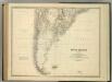
South America (southern sheet).
1 : 8989200 Johnston, Alexander Keith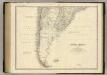
South America S.
1 : 8989200 Johnston, Alexander Keith, 1804-1871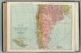
Chile, Bolivia, Peru, Ecuador, Uruguay, Paraguay, Argentine Republic. (southern half).
1 : 5020000 Rand McNally and Company
Typus Geographicus, CHILI PARAGUAY FRETI MAGELLANICI &c
1 : 1480000 Chile Delisle, Guillaume Beauchesne-Gouin de Homannianis Heredibus
Mapa orohidrografico de la Republica Argentina.
1 : 8500000 Paz Soldan, Mariano Felipe, 1821-1886
Mapa general de la Republica Argentina.
1 : 8500000 Paz Soldan, Mariano Felipe, 1821-1886
230-231. South America, South. The World Atlas.
1 : 7500000 USSR (Union of Soviet Socialist Republics).